Lewes in East Sussex, England, United Kingdom — Northwestern Europe (the British Isles)
What Happened Where?
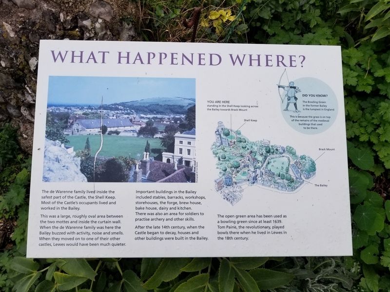
This was a large, roughly oval area between the two mottes and inside the curtain wall. When the de Warenne family was here the Bailey buzzed with activity, noise and smells. When they moved on to one of their other castles, Lewes would have been much quieter.
Important buildings in the Bailey included stables, barracks, workshops, storehouses, the forge, brew house, bake house, dairy and kitchen. There was also an area for soldiers to practise archery and other skills.
After the late 14th century, when the Castle began to decay, houses and other buildings were built in the Bailey.
( photo caption )
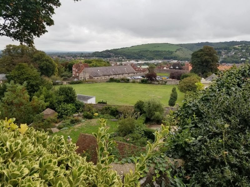
The open green area has been used as a bowling green since at least 1639. Tom Paine, the revolutionary, played bowls there when he lived in Lewes in the 18th century.
Did You Know?
The Bowling Green in the former Bailey is the lumpiest in England. This is because the grass is on top of the remains of the medieval buildings that used to be there.
Topics. This historical marker is listed in this topic list: Forts and Castles. A significant historical year for this entry is 1639.
Location. 50° 52.376′ N, 0° 0.462′ E. Marker is in Lewes, England, in East Sussex. Marker can be reached from the intersection of High Street and Castle Gate, on the left when traveling east. Located in Lewes Castle. Touch for map. Marker is in this post office area: Lewes, England BN7 1XH, United Kingdom. Touch for directions.
Other nearby markers. At least 8 other markers are within walking distance of this marker. The Battle of Lewes, 1264 (here, next to this marker); Brack Mount (a few steps from this marker); Fireplace (a few steps from this marker); The Norman Gatehouse and the Barbican (a few steps from this marker); The Wealds (a few steps from this marker); Protestant Martyrs (a few steps from this marker); Lewes Racecourse (a few steps from this marker); Mount Caburn (a few steps from this marker). Touch for a list and map of all markers in Lewes.
Also see . . .
1. Sussex Archaeological Society Lewes Castle & Museum. (Submitted on February 8, 2019, by Michael Herrick of Southbury, Connecticut.)
2. Lewes Castle on Wikipedia. (Submitted on February 8, 2019, by Michael Herrick of Southbury, Connecticut.)
Credits. This page was last revised on January 27, 2022. It was originally submitted on February 8, 2019, by Michael Herrick of Southbury, Connecticut. This page has been viewed 131 times since then and 7 times this year. Photos: 1, 2, 3. submitted on February 8, 2019, by Michael Herrick of Southbury, Connecticut.


