
Studio City in Los Angeles in Los Angeles County, California — The American West (Pacific Coastal)
Universal City Overlook
Photographed by Craig Baker, February 12, 2019
1. Universal City Overlook Marker
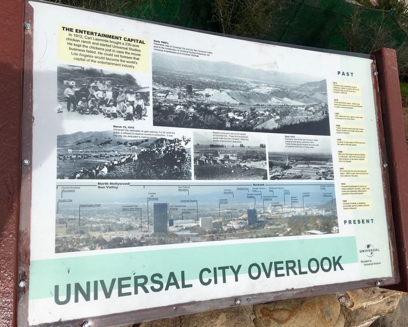
The Entertainment Capital
In 1912, Carl Laemmle bought a 230-acre chicken ranch and started Universal Studios. He kept the chickens just in case the movie business failed. He could not foresee that Los Angeles would become the world's capital of the entertainment industry.
Past / Present
1911
The first movie companies come to California. Within 10 years, 90% of all American films would come from Southern California.
1915
Universal Studios opens. Visitors pay twenty-five cents to sit in the grandstands to watch movie productions.
1927
NBC makes the first coast-to-coast radio broadcast of the Rose Bowl.
1928
'Talkie" movies come to the "big" screen. Warner Brothers and Walt Disney build studios in Burbank.
1932
Al Jarvis of radio station KFWB becomes the nation's first disc jockey.
1938
NBC and CBS build broadcast facilities in Hollywood. Half of the most popular radio programs in the nation originate from Los Angeles.
1947
KTLA becomes the city's first television station. Within a year, there would be six more stations in the area.
1972
Universal
this page online
1993
Universal CityWalk, a pedestrian promenade opened outside Universal Studios Hollywood.
Photo Captions:
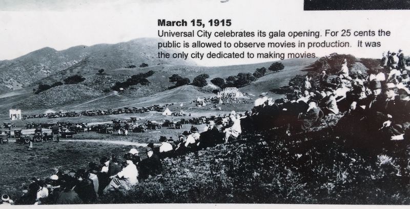
March 15, 1915 - Universal City celebrates its gala opening. For 25 cents the public is allowed to observe movies in production. It was the only city dedicated to making movies.
Western production site on the backlot of Universal City. These first productions would make the San Fernando Valley the world’s entertainment destination.
Early 1916 - Panoramic view of the San Fernando Valley orange groves along Lankershim Blvd. These orange groves became the future site of Lakeside Golf Club in Toluca Lake.
Early 1960's - Panoramic view of Universal City and the San Fernando Valley prior to the construction of Universal Studios Hollywood, the Universal Amphitheatre and Universal CityWalk.
Erected by Universal Studios.
Topics and series. This historical marker is listed in these topic lists: Arts, Letters, Music • Entertainment • Industry & Commerce.
Photographed by Craig Baker, February 12, 2019
2. Universal City Overlook and Marker
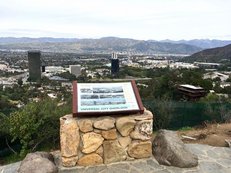
Location. 34° 7.736′ N, 118° 21.915′ W. Marker is in Los Angeles, California, in Los Angeles County. It is in Studio City. It is on Mulholland Drive 1.3 miles east of Laurel Canyon Boulevard, on the left when traveling east. Touch for map. Marker is at or near this postal address: 7701 Mulholland Dr, Los Angeles CA 90046, United States of America. Touch for directions.

Regionally, this marker is in California’s Transverse Ranges. It is also on the American Pacific Coast. Globally, it is in North America, on the Ring of Fire, in the Pacific Rim, in the Western Hemisphere, in the Western World, and in the Anglosphere. Historically, it finds itself in what was once New Spain and also Mexico’s Alta California.
Other nearby markers. At least 8 other markers are within walking distance of this marker: Lankershim Monument (about 400 feet away, measured in a direct line); Kallis House (approx. 0.2 miles away); The Basin Residence (approx. 0.4 miles away); Shulman House (approx. 0.4 miles away);
3. Marker Detail
Additional keywords. Santa Monica Mountains, Chemosphere, Los Angeles Historic Cultural Monument No. 785
4. Marker Detail
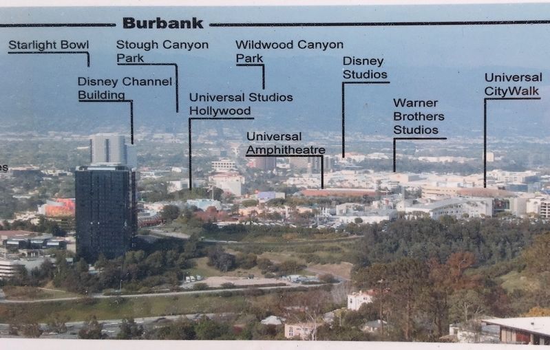
The Universal Amphitheater was demolished in 2013.
Photographed by Adam Margolis, August 21, 2020
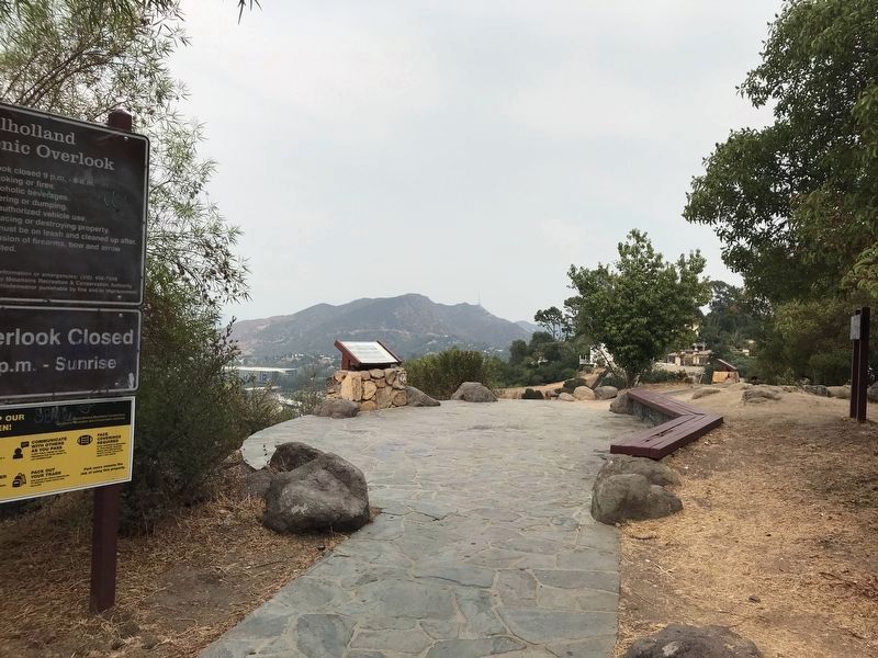
5. Universal City Overlook Marker
Photographed by Craig Baker, February 12, 2019
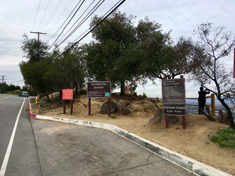
6. Universal City Overlook
Photographed by Craig Baker (CC0), February 12, 2019
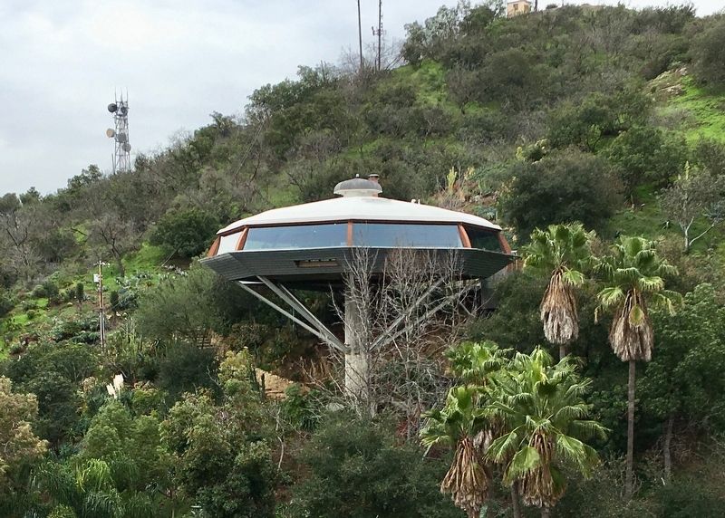
7. Chemosphere
Historic house located nearby, designed by John Lautner in 1960, Los Angeles Historic-Cultural Monument No. 785.
Credits. This page was last revised on January 30, 2023. It was originally submitted on February 13, 2019, by Craig Baker of Sylmar, California. This page has been viewed 1,360 times since then and 89 times this year. Photos: 1, 2, 3, 4. submitted on February 13, 2019, by Craig Baker of Sylmar, California. 5. submitted on November 10, 2021, by Adam Margolis of Mission Viejo, California. 6, 7. submitted on February 13, 2019, by Craig Baker of Sylmar, California. • Andrew Ruppenstein was the editor who published this page.
