Upper Arlington in Franklin County, Ohio — The American Midwest (Great Lakes)
The Upper Arlington Historic District
Inscription.
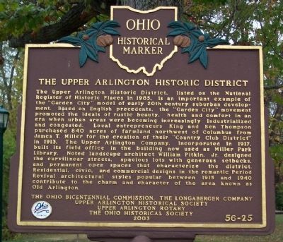
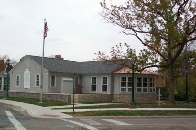
The Upper Arlington Historic District, listed on the National Register of Historic Places in 1985, is an important example of the "Garden City" model of early 20th century suburban development. Based on English precedents, the "Garden City" movement promoted the ideals of rustic beauty, health and comfort in an era when urban areas were becoming increasingly industrialized and congested. Local entrepreneurs King and Ben Thompson purchased 840 acres of farmland northwest of Columbus from James T. Miller for the creation of their "Country Club District" in 1913. The Upper Arlington Company, incorporated in 1917, built its field office in the building now used as Miller Park Library. Noted landscape architect William Pitkin, Jr. designed the curvilinear streets, spacious lots with generous setbacks, and permanent open spaces that characterize the district. Residential, civic, and commercial designs in the romantic Period Revival architectural styles popular between 1915 and 1940 contribute to the charm and character of the area known as Old Arlington.
Erected 2003 by The Ohio Bicentennial Commission, The Longaberger Company, Upper Arlington Historical Society, and The Ohio Historical Society. (Marker Number 56-25.)
Topics and series. This historical marker is listed in these topic lists: Architecture • Settlements & Settlers. In addition, it is included in the Ohio Historical Society / The Ohio History Connection series list. A significant historical year for this entry is 1985.
Location. 39° 59.712′ N, 83° 3.649′ W. Marker is in Upper Arlington, Ohio, in Franklin County. Marker is at the intersection of Arlington Avenue and Tremont Road, on the right when traveling south on Arlington Avenue. Marker is next to the Miller Park Branch of the Upper Arlington Library. Touch for map. Marker is at or near this postal address: 1901 Arlington Ave, Columbus OH 43212, United States of America. Touch for directions.
Other nearby markers. At least 8 other markers are within 2 miles of this marker, measured as the crow flies. Campbell Memorial Park / The Adena Culture (approx. 1.1 miles away); The Shrum Mound / James E. Campbell Memorial Park (approx. 1.1 miles away); Shrum Indian Mound (approx. 1.1 miles away); The Bank Block (approx. 1.2 miles away); Our Mascot: The Golden Bear (approx. 1.3 miles away); Our Physical Growth (approx. 1.3 miles away); Our Community Spirit (approx. 1.3 miles away); Guiding Our Young Community (approx. 1.3 miles away). Touch for a list and map of all markers in Upper Arlington.
Credits. This page was last revised on January 21, 2020. It was originally submitted on October 27, 2008, by William Fischer, Jr. of Scranton, Pennsylvania. This page has been viewed 1,183 times since then and 21 times this year. Photos: 1, 2. submitted on October 27, 2008, by William Fischer, Jr. of Scranton, Pennsylvania. • Kevin W. was the editor who published this page.

