Baldwinsville in Onondaga County, New York — The American Northeast (Mid-Atlantic)
World War II
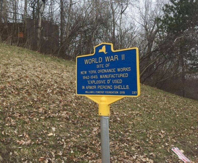
1. World War II Marker
Erected 2015 by William G. Pomeroy Foundation. (Marker Number 237.)
Topics and series. This historical marker is listed in these topic lists: Industry & Commerce • War, World II. In addition, it is included in the William G. Pomeroy Foundation series list.
Location. 43° 10.113′ N, 76° 18.023′ W. Marker is in Baldwinsville, New York, in Onondaga County. It is at the intersection of Loop Road and New York State Route 31 on Loop Road. Touch for map. Marker is at or near this postal address: 8233 NY-631, Baldwinsville NY 13027, United States of America. Touch for directions.

Regionally, this marker is in Upstate New York, specifically in Central New York, and in the Syracuse Metropolitan Area. It is also in the American Northeast and in the Mid-Atlantic. Globally, it is in North America, on the Great Lakes, in the Western Hemisphere, in the Western World, and in the Anglosphere. Historically, it finds itself in what was once the Haudenosaunee (Iroquois)
this page online
Other nearby markers. At least 8 other markers are within 2 miles of this marker, measured as the crow flies: On This Hill (approx. 0.7 miles away); Willett Tract (approx. 1.1 miles away); Grace Episcopal Church (approx. 1.7 miles away); First Presbyterian (approx. 1.7 miles away); Site of Baldwin Power and Navigation Canal (approx. 1.7 miles away); The Sun Never Sets On A Morris Pump (approx. 1.8 miles away); Baldwinsville 4 Corners Mural Project (approx. 1.8 miles away); New York State Barge Canal Lock 24 (approx. 1.8 miles away). Touch for a list and map of all markers in Baldwinsville.
Regarding World War II. As the United States mobilized for the Second World War, military production increased significantly. Factories sprung up across the nation and workers produced uniforms, ammunition, weapons, and vehicles. At this site in the Town of Lysander once stood the New York Ordnance Works. From 1942 to 1945, this munitions plant produced ammonium picrate or Dunnite aka "Explosive D” which was used in armor piercing shells during WWII. After the war the Ordnance Works ceased production and was abandoned; little by little it was dismantled. Today there is only a small remnant that still exists.
Credits. This page was last revised on May 1, 2019. It was originally submitted on April 30, 2019, by Deryn Pomeroy of Syracuse, New York. This page has been viewed 828 times since then and 69 times this year. Photo 1. submitted on April 30, 2019, by Deryn Pomeroy of Syracuse, New York. • Andrew Ruppenstein was the editor who published this page.
Editor’s want-list for this marker. Wide shot of marker and its surroundings. • Can you help?
