St. Charles in St. Charles County, Missouri — The American Midwest (Upper Plains)
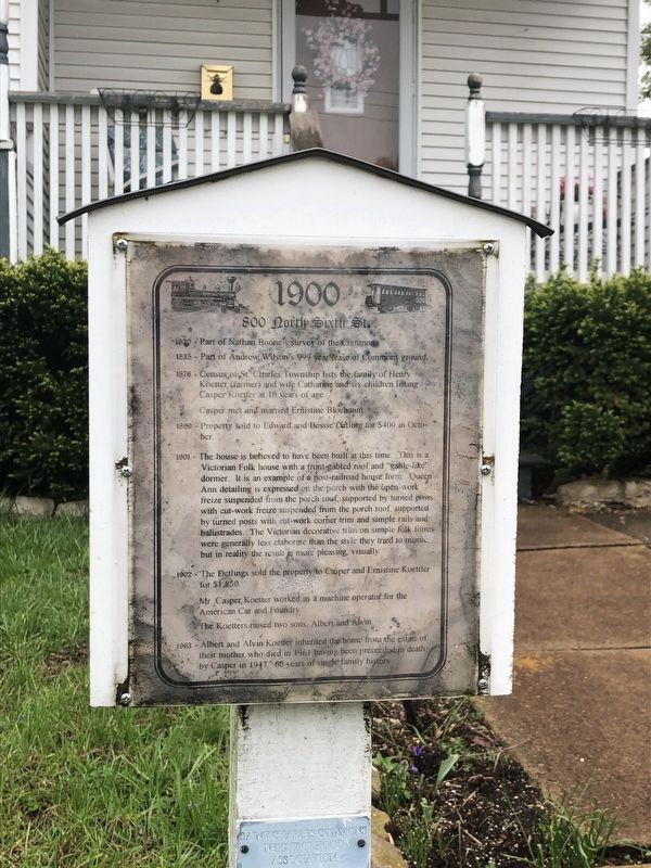
1900
800 North Sixth St.
— Saint Charles Commons Neighborhood Association —
1830 - Part of Nathan Boone's survey of the Commons.
1835 - Part of Andrew Wilson's 999 year lease of the Commons ground.
1876 - Census of St. CHarles Township lists the family of Henry Kroetter (farmer) and wife Catharine and six children listing Caspar Koetter at 10 years of age.
Casper met and married Ernistine Bloebaum
1899 - Prosperity sold to Edward and Bessie Detling for $400 in October.
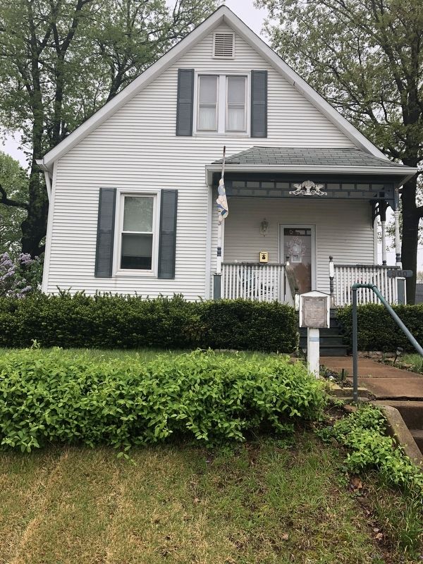
1901 - The house is believed to have been built at this time. This is a Victorian Folk house with a front-gabled roof and "gable-like" dormer. It is an example of a post-railroad house form. Queen Ann detailing is expressed on the porch with the open-work freize suspended from the porch roof, supported by turned posts with cut-work freize suspended from the porch roof, supported by turned posts with cut-work corner trim and simple rails and balustrades. The Victorian decorative trim on simple folk forms were generally less elaborate than the style they tried to mimic but in reality the result is more pleasing visually.
1902 - The Detlings sold the property to Casper and Ernestine Koettler for $1,850.
Mr. Casper Koetter worked as a machine operator for the American Car and Foundry.
The Koetters raised two sons, Albert and Alvin.
1963 - Albert and Alvin Koetter inherited the home from the estate of their mother who died in 1961 having been preceeded in death by Casper in 1947. 60 years of single family history.
Erected by Saint Charles Commons Neighborhood Association.
Topics. This historical marker is listed in these topic lists: Architecture • Industry & Commerce • Railroads & Streetcars • Settlements & Settlers. A significant historical year for this entry is 1830.
Location. 38° 47.39′ N, 90° 29.096′ W. Marker is in St. Charles, Missouri, in St. Charles County. Marker is at the intersection of North 6th Street and Franklin Street, on the right when traveling north on North 6th Street. Touch for map. Marker is at or near this postal address: 800 North 6th Street, Saint Charles MO 63301, United States of America. Touch for directions.
Other nearby markers. At least 8 other markers are within walking distance of this marker. 1902 (a few steps from this marker); Circa 1939 (a few steps from this marker); Circa 1906 (within shouting distance of this marker); Circa 1904 (within shouting distance of this marker); Circa 1894 (within shouting distance of this marker); Circa 1940 (about 600 feet away, measured in a direct line); 612 North Sixth Street (about 600 feet away); 1889 (about 600 feet away). Touch for a list and map of all markers in St. Charles.
Credits. This page was last revised on May 1, 2019. It was originally submitted on May 1, 2019, by Devry Becker Jones of Washington, District of Columbia. This page has been viewed 190 times since then and 9 times this year. Photos: 1, 2. submitted on May 1, 2019, by Devry Becker Jones of Washington, District of Columbia.

