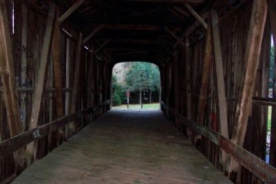
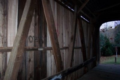
Near Norwich in Muskingum County, Ohio — The American Midwest (Great Lakes)
Salt Creek Bridge/Timber Covered Bridges
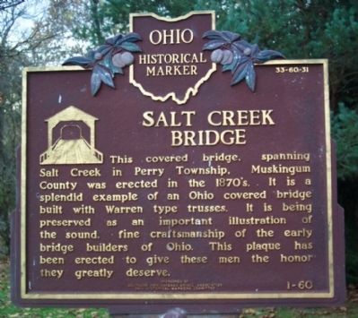
Salt Creek Bridge
This covered bridge, spanning Salt Creek in Perry Township, Muskingum County was erected in the 1870s. It is a splendid example of an Ohio covered bridge built with Warren type trusses. It is being preserved as an important illustration of the sound, fine craftsmanship of the early bridge builders of Ohio. This plaque has been erected to give these men the honor they greatly deserve.
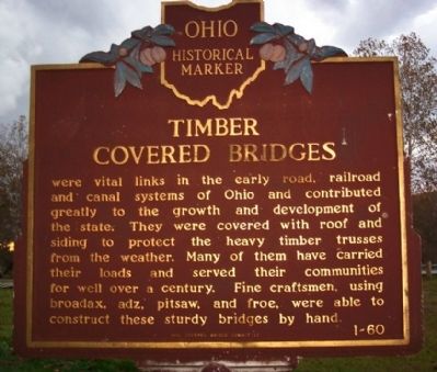
Timber Covered Bridges
Timber covered bridges were vital lines in the early road, railroad and canal systems of Ohio and contributed greatly to the growth and development of the state. They were covered with roof and siding to protect the heavy timber trusses from the weather. Many of them have carried their loads well over a century. Fine craftsmen, using broadax, pitsaw and froe, were able to construct these sturdy bridges by hand.
Erected 1963 by Ohio Covered Bridge Committee, Southern Ohio Covered Bridge Association, The Ohio Historical Society. (Marker Number 1-60.)
Topics and series. This historical marker is listed in this topic list: Bridges & Viaducts. In addition, it is included in the Covered Bridges , and the Ohio Historical Society / The Ohio History Connection series lists.
Location. 39° 59.937′ N, 81° 50.379′ W. Marker is near Norwich, Ohio, in Muskingum County. Marker is at the intersection of Arch Hill Road and Murphy Hill Road, on the right when traveling east on Arch Hill Road. Touch for map. Marker is in this post office area: Norwich OH 43767, United States of America. Touch for directions.
Other nearby markers. At least 8 other markers are within 2 miles of this marker, measured as the crow flies. Motels (approx. 1.8 miles away); Tomb Of The Unknown Soldier (approx. 1.8 miles away); Mile Markers (approx. 1.9 miles away); The Historic National Road (approx. 1.9 miles away); The Historic National Road in Ohio (approx. 1.9 miles away); Zane’s Trace Bridge (approx. 1.9 miles away); Warren Pony Truss Bridge (approx. 1.9 miles away); Eisenhower Interstate System (approx. 2 miles away). Touch for a list and map of all markers in Norwich.
Regarding Salt Creek Bridge/Timber Covered Bridges. Another marker, "Restoration of the Salt Creek Covered Bridge," is found inside the bridge but is heavily marked with graffiti. It notes the corporate and individual donors who made possible the 1997/1998 restoration.
Photographed By William Fischer, Jr., October 26, 2008
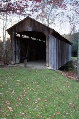
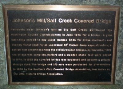
3. Johnson's Mill/Salt Creek Covered Bridge - west end of bridge
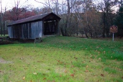
Residents near Johnson's Mill on Big Salt Creek petitioned the Muskingum County Commissioners in June 1875 for a bridge. A year later, they agreed to pay Jesse Romine $445 for stone abutments and Thomas Fisher $646 for an uncovered 80' Warren truss superstructure, a design now uncommon among the state's wooden bridges. By November 1876 the bridge was complete. Rafters and a wooden shake roof were added in 1879. In 1953 the covered bridge was bypassed and became a private storage shed. The bridge and 2/3 acre were purchased for preservation in 1960 by the Southern Ohio Covered Bridge Association, now known as the Ohio Historic Bridge Association.
Credits. This page was last revised on June 16, 2016. It was originally submitted on November 6, 2008, by William Fischer, Jr. of Scranton, Pennsylvania. This page has been viewed 1,666 times since then and 15 times this year. Photos: 1, 2, 3, 4, 5, 6, 7. submitted on November 6, 2008, by William Fischer, Jr. of Scranton, Pennsylvania. • Bill Pfingsten was the editor who published this page.
