Bacalar, Quintana Roo, Mexico — The Yucatan Peninsula (The Southeast)
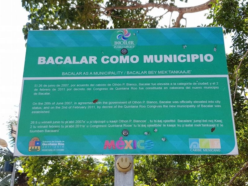
Bacalar as a Municipality
El 26 de junio de 2007, por acuerdo del cabildo de Othón P. Blanco, Bacalar fue elevada a la categoria de ciudad, y el 2 de febrero de 2011 por decreto del Congreso de Quintana Roo fue constituida en cabecera del nuevo municipio de Bacalar.
Bacalar as a Municipality
On the 26th of June 2007, in agreement with the government of Othón P. Blanco, Bacalar was officially elevated into city status; and on the 2nd of February 2011, by decree of the Quintana Roo Congress the new municipality of Bacalar was established.
Bacalar bey Mek’tankaaje’
26 ti u wiinalil junio tu ja'abil 2007e' u jo'olpóopil u kaajil Othon P. Blancoe', tu ts'áaj ojéeltbil Bacalare' jump'éel noj Kaaj; 2 tu winalil febrero tu ja'abil 2011e' u Congresoil Quintana Rooe' tu ts'aaj ojéeltbile' le kaaja' ku p'áatal mek tankaajil ti le túumben Bacalaro’.
Erected by Gobierno del Estado de Quintana Roo 2011-2016.
Topics. This historical marker is listed in these topic lists: Government & Politics • Political Subdivisions. A significant historical date for this entry is February 2, 2011.
Location. 18° 40.655′ N, 88° 23.308′ W. Marker is in Bacalar, Quintana Roo. Marker is on Avenida 3 just north of Calle 22, on the right when traveling north. Touch for map. Marker is in this post office area: Bacalar QR 77930, Mexico. Touch for directions.
Other nearby markers. At least 8 other markers are within walking distance of this marker. San Felipe Fort (a few steps from this marker); Fort of San Felipe (within shouting distance of this marker); Bridge of the Fort of San Felipe (within shouting distance of this marker); Moat of the Fort of San Felipe (within shouting distance of this marker); Miguel Hidalgo y Costilla (about 150 meters away, measured in a direct line); Creation of the Municipality of Bacalar (approx. 0.2 kilometers away); Church of San Joaquín (approx. 0.3 kilometers away); Bacalar (approx. 0.3 kilometers away). Touch for a list and map of all markers in Bacalar.
Credits. This page was last revised on May 21, 2019. It was originally submitted on May 21, 2019, by J. Makali Bruton of Accra, Ghana. This page has been viewed 96 times since then and 6 times this year. Photos: 1, 2. submitted on May 21, 2019, by J. Makali Bruton of Accra, Ghana.

