Innenstadt I in Frankfurt am Main, Hesse, Germany — Central Europe
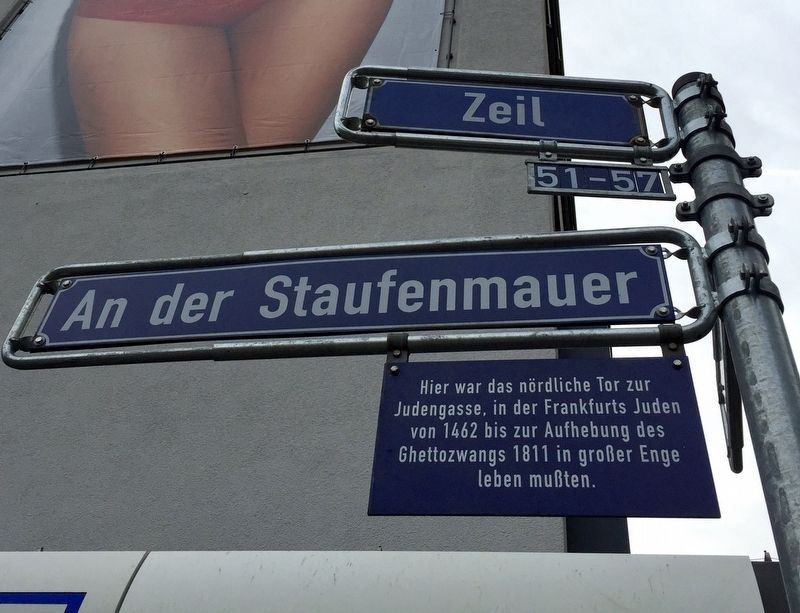
Jewish Ghetto Gate
Photographed by Andrew Ruppenstein, November 22, 2016
1. Jewish Ghetto Gate Marker
Inscription. Hier war das nördliche Tor zur
Judengasse, in der Frankfurts Juden
von 1462 bis zur Aufhebung des
Ghettozwangs 1811 in großer Enge
leben mußten.
-
Here was located the northern gate to "Jew's Lane", in which Frankfurt's Jews were required to live in tight quarters from 1462 until the lifting of "Compulsory Ghetto-ization" in 1811.
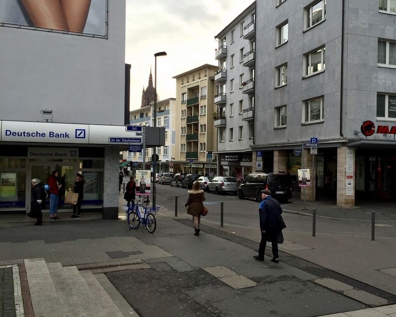
Location. 50° 6.847′ N, 8° 41.184′ E. Marker is in Frankfurt am Main, Hessen (Hesse). It is in Innenstadt I. It is at the intersection of Zeil and Fahrgasse, on the right when traveling west on Zeil. Touch for map. Marker is at or near this postal address: Zeil 57, Frankfurt am Main HE 60311, Germany. Touch for directions.
Regionally, it is in Europe, the European Union, Atlantic Europe, Central Europe, the Schengen Area, Western Europe, and the Western World. Historically, it finds itself in what was once the Holy Roman Empire.
Other nearby markers. At least 8 other markers are within walking
More about this marker. The marker hangs off of the street sign at the intersection of Zeil and Fahrgasse, in front of the Deutsche Bank.
Also see . . . 1. Frankfurter Judengasse (Wikipedia). "The Frankfurter Judengasse ("Jews' Lane" in German) was the Jewish ghetto of Frankfurt and one of the earliest ghettos in Germany. It existed from 1462 until 1811 and was home to Germany's largest Jewish community in early modern times....At the end of the 19th century, most of the buildings in the Judengasse were
Photographed by Andrew Ruppenstein, November 22, 2016
2. Jewish Ghetto Gate Marker - wide view
demolished. The area suffered major destruction during World War II and reconstruction left no visible signs of the ghetto in today's townscape of Frankfurt....The ghetto was located outside the city walls east of the medieval city wall (Staufenmauer).... The street was about 330 meters long, three to four meters wide, and had three town gates. The gates were locked at night as well as on Sundays and Christian holidays. Due to the narrow street and the limited access, the Judengasse was destroyed three times by fire in the 18th century alone, in 1711, 1721 and 1796....Initially, some 15 families with about 110 members lived in Frankfurt's Judengasse when they were forcibly removed from the city and relocated to the ghetto by decree of Frederick III in 1462. By the 16th century, the number of inhabitants rose to over 3,000, living in 195 houses. The ghetto had one of the highest population densities in Europe. Contemporary documents described it as narrow, oppressive and dirty." (Submitted on June 19, 2019.)
Credits. This page was last revised on January 28, 2022. It was originally submitted on June 19, 2019, by Andrew Ruppenstein of Lamorinda, California. This page has been viewed 489 times since then and 49 times this year. Photos:1, 2. submitted on June 19, 2019, by Andrew Ruppenstein of Lamorinda, California.