Elizabethton in Carter County, Tennessee — The American South (East South Central)
Bemberg Station
⎯⎯⎯
Port Rayon
Photographed by Cosmos Mariner, May 13, 2019
1. Bemberg Station / Port Rayon Marker
this page online
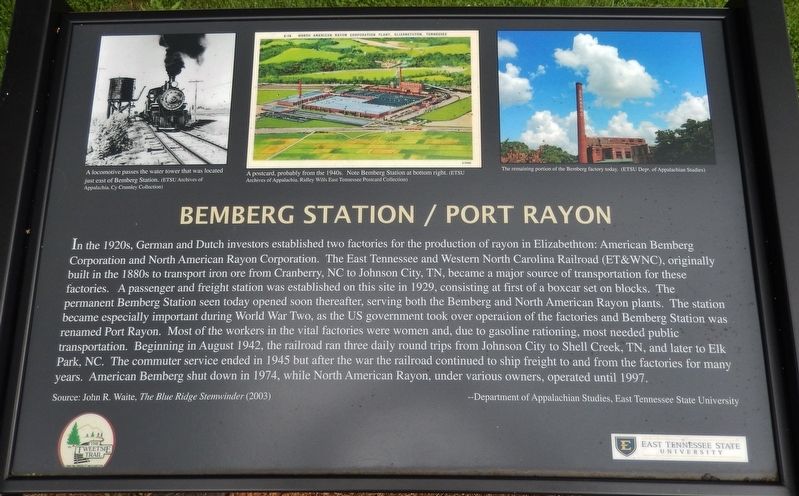
Source: John R. Waite, The Blue Ridge Stemwinder (2003)
--Department of Appalachian Studies, East Tennessee State University
(photo captions)
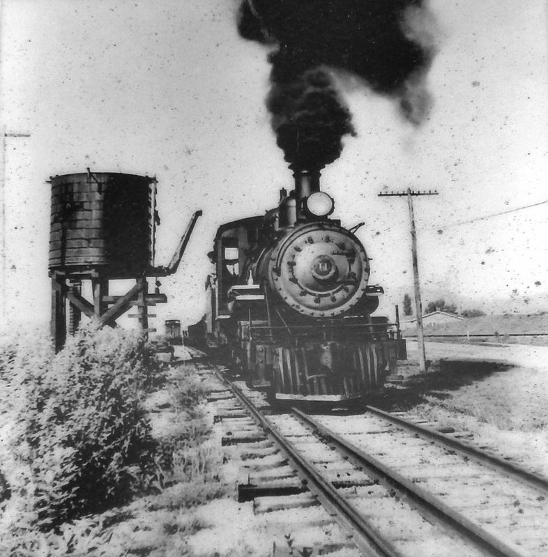
• A locomotive passes the water tower that was located just east of Bemberg Station. (ETSU Archives of Appalachia, Cy Crumley Collection)
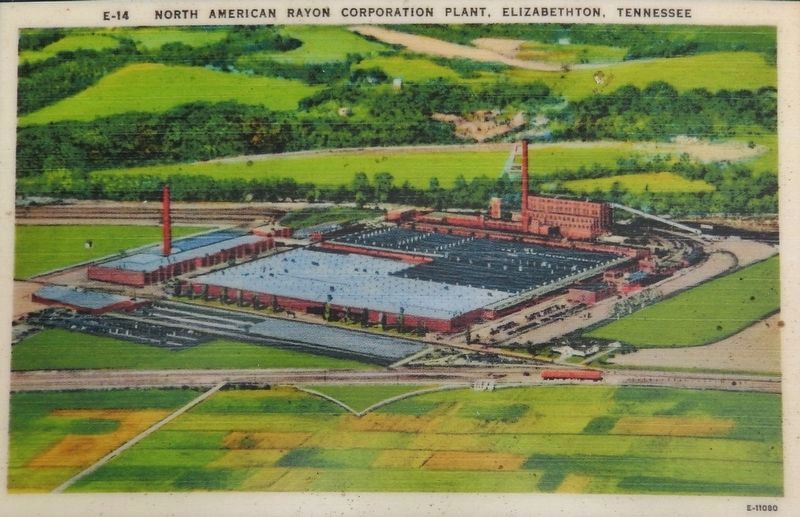
• A postcard, probably from the 1940s. Note Bemberg Station at bottom right. (ETSU Archives of Appalachia, Ridley Wills East Tennessee Postcard Collection)
• The remaining portion of the Bemberg factory today. (ETSU Dept. of Appalachian Studies)
Erected by The Tweetsie Trail and East Tennessee State University.
Topics. This historical marker is listed in these topic lists: Industry & Commerce • Railroads & Streetcars • War, World II.
Location. 36° 20.891′ N, 82° 14.488′ W. Marker is in Elizabethton, Tennessee, in Carter County. It is on West Elk Avenue (U.S. 321) 0.1 miles east of Hudson Drive, on the right when traveling east. Marker
ETSU Archives of Appalachia, Cy Crumley Collection
2. Marker detail: Locomotive passes the water tower that was located just east of Bemberg Station

Regionally, this marker is in East Tennessee and in the Tri-Cities Area. It is also in the American South, specifically in the Upper South, in Appalachia, and specifically in Southern Appalachia. Globally, it is in North America, the Western Hemisphere, the Western World, and the Anglosphere. Historically, it finds itself in what was once the original Cherokee Nation, the territory of the Mississippian Culture, one of the Confederate States of America, the State of Franklin, and the Antebellum South.
Other nearby markers. At least 8 other markers are within walking distance of this marker: Bemberg Water Tower (about 500 feet away, measured in a direct line); Green Hill Cemetery (approx. half a mile away); Revolutionary War Patriots (approx. 0.6 miles away); Sycamore Shoals of the Watauga (approx. 0.6 miles away); Watauga Purchase (approx. 0.6 miles away); Transylvania Purchase
ETSU Archives of Appalachia, Ridley Wills East Tennessee Postcard Collection
3. Marker detail: Postcard of American Rayon Corporation, circa 1940s
Related markers. Click here for a list of markers that are related to this marker. Bemberg Station, Elizabethton, Tennessee
Also see . . .
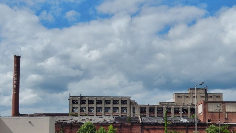
1. Bemberg and North American Rayon Corporation. The northern skyline along West Elk Avenue in Elizabethton is outlined with the smoke stack and empty shell that represents Carter County's largest employer ever. The decision to build a manufacturing facility in Elizabethton was finalized sometime around 1925. In October of 1926, American Bemberg began the manufacture of what was called "artificial silk," which was also known as rayon. (Submitted on June 21, 2019, by Cosmos Mariner of Cape Canaveral, Florida.)
2. North American Rayon Corporation and American Bemberg Corporation. Throughout the Great Depression the plants remained operational and, overall, continued to profit. The number of workers employed bottomed out at 2,491 in 1932 and peaked at 4,500 in 1939.
Photographed by Cosmos Mariner, May 13, 2019
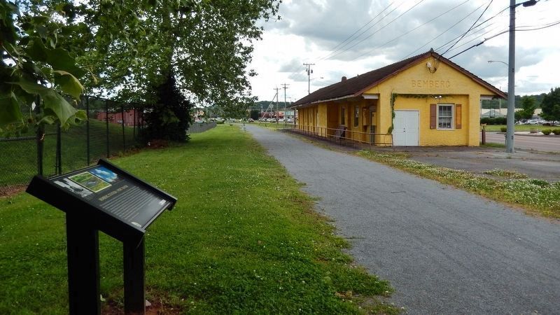
4. Bemberg Station / Port Rayon Marker
(wide view • Bemberg Station in background)
(wide view • Bemberg Station in background)
Photographed by Cosmos Mariner, May 13, 2019
5. Bemberg Factory Ruins
(view north from parking lot northwest of marker)
(view north from parking lot northwest of marker)
Photographed by Cosmos Mariner, May 13, 2019
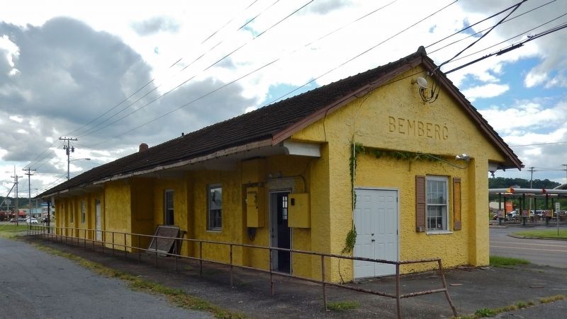
6. Bemberg Station (west side • view from near marker • Tweetsie Trail on left)
Credits. This page was last revised on June 21, 2019. It was originally submitted on June 19, 2019, by Cosmos Mariner of Cape Canaveral, Florida. This page has been viewed 2,007 times since then and 176 times this year. Photos: 1, 2, 3, 4, 5, 6. submitted on June 21, 2019, by Cosmos Mariner of Cape Canaveral, Florida.
