St. Michaels in Talbot County, Maryland — The American Northeast (Mid-Atlantic)
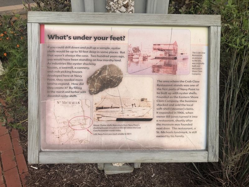
What's under your feet?
If you could drill down and pull up a sample, oyster shells would be up to 10 feet deep in some places. But that wasn't always the case. Two hundred years ago you would have been standing on low marshy land. As industries like oyster shucking houses, a sawmill, a cannery, and crab picking houses developed here at Navy Point, they needed more land to expand. How did they create it? By filling in the marsh and harbor with discarded oyster shells.
The area where the Crab Claw Restaurant stands was one of the first parts of Navy Point to be built up with oyster shells. Founded as the Eastern Shore Crab Company, the business shucked and sold the local soft-shell (steamer) clams. It expanded in 1966, when owner Bill Jones turned it into a restaurant, shortly after the museum was founded next door. The restaurant, a St. Michaels landmark, is still owned by the family.
[Captions:]
The Crab Claw Restaurant, as pictured to the left, was originally built over the Eastern Shore Clam Company.
Above: Oyster shells, byproducts from Navy Point's shucking houses, are piled on the site where the Crab Claw Restaurant stands today.
Left: Navy Point was much smaller in 1877.
Erected by Chesapeake Bay Maritime Museum.
Topics. This historical marker is listed in these topic lists: Animals • Industry & Commerce. A significant historical year for this entry is 1966.
Location. 38° 47.235′ N, 76° 13.237′ W. Marker is in St. Michaels, Maryland, in Talbot County. Marker is at the intersection of Mill Street and Burns Street, on the right when traveling west on Mill Street. Touch for map. Marker is at or near this postal address: 304 Mill Street, Saint Michaels MD 21663, United States of America. Touch for directions.
Other nearby markers. At least 8 other markers are within walking distance of this marker. Freedom's Figurehead (here, next to this marker); Deflecting the Enemy (here, next to this marker); War in the Chesapeake (here, next to this marker); Oystering on the Chesapeake (here, next to this marker); Navy Point Historic Houses (a few steps from this marker); Lost Overboard (within shouting distance of this marker); A Mighty Pull (within shouting distance of this marker); Skipjack Centerboard (within shouting distance of this marker). Touch for a list and map of all markers in St. Michaels.
Credits. This page was last revised on September 29, 2020. It was originally submitted on August 25, 2019, by Devry Becker Jones of Washington, District of Columbia. This page has been viewed 98 times since then and 4 times this year. Photos: 1, 2. submitted on August 25, 2019, by Devry Becker Jones of Washington, District of Columbia.

