Athol in Worcester County, Massachusetts — The American Northeast (New England)
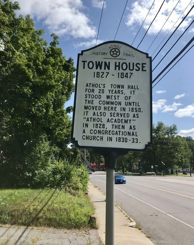
Town House
1827-1847
Topics. This historical marker is listed in this topic list: Notable Buildings.
Location. 42° 35.425′ N, 72° 12.968′ W. Marker is in Athol, Massachusetts, in Worcester County. Marker is on Main Street (Massachusetts Route 2A), on the right when traveling west. Touch for map. Marker is at or near this postal address: 1476 Main Street, Athol MA 01331, United States of America. Touch for directions.
Other nearby markers. At least 8 other markers are within walking distance of this marker. A different marker also named Town House (within shouting distance of this marker); Stagecoach Stop (about 300 feet away, measured in a direct line); World War l Memorial (about 300 feet away); Uptown Common and 3rd Meetinghouse (about 400 feet away); Hiding Place for Slaves (about 500 feet away); 4th Meetinghouse (approx. 0.2 miles away); Old Toll Gate (approx. 0.2 miles away); Town Pound (approx. 0.2 miles away). Touch for a list and map of all markers in Athol.
Credits. This page was last revised on September 7, 2019. It was originally submitted on September 5, 2019, by Darren Brosseau of Fitchburg, Massachusetts. This page has been viewed 145 times since then and 11 times this year. Photo 1. submitted on September 7, 2019, by Darren Brosseau of Fitchburg, Massachusetts. • Andrew Ruppenstein was the editor who published this page.
