Bowling Green in Warren County, Kentucky — The American South (East South Central)
An African American Neighborhood
Photographed by Shane Oliver, June 5, 2021
1. An African American Neighborhood Marker
Inscription.
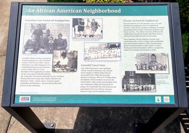
An African American Neighborhood. . Generations Lived, Worked and Worshipped Here , A sizeable African American population lived for generations in this immediate vicinity. Until the late 1960s, African Americans were often relegated to live in predetermined areas and sometimes even to certain sides of a street. Residents of this neighborhood worked for the Louisville and Nashville Railroad, the Turner Day Woolworth Axehandle Factory, the Kister Planing Mill, and in many other nearby industries and businesses. Some – nurses, clerics, insurance agents, undertakers, and attorneys – also provided professional services to the community.
Kuykendall Funeral Home , One of Bowling Green’s most significant African American businesses was a funeral home founded in 1900 by James Elwood Kuykendall (1874-1960). He moved the business in February 1905 to 637 College Street. He adapted a former residence to serve as the funeral parlor, while a large stone building to the rear warehoused coffins and functioned as a garage. Mr. Kuykendall also sold insurance and participated in the local African American Masonic Lodge and the Republican Party.
Churches Anchored the Neighborhood , The local churches were the spiritual, social, civic, and entertainment headquarters for most neighborhood activities. At the church, residents worshipped, socialized, and attended political rallies, educations programs, and leisure activities. The African American children in the neighborhood attended the nearby Street School, which provided additional activities for youth.
Three important African American churches were established nearby: Taylor’s Chapel African Methodist Episcopal Church (founded in 1866); Seventh Street Baptist Church (founded in 1892); and St. Cecilia’s Presbyterian Church (founded in 1865, it occupied the former First Christian Church built in 1842).
Left to right: Nancy and John Brown and their daughter, Mary Williams, ca. 1960. The Browns were long time residents of the neighborhood.
An unidentified family ca. 1890.
School children urge others to purchase War Savings Stamps during World War I.
Mary McFadden, left, and Carolyn South, ca 1960.
Above, members pose outside of Taylor’s Chapel Methodist Episcopal Church ca. 1945.
Left, members of the congregation in front of Seventh Street Baptist Church ca. 1972.
Generations Lived, Worked and Worshipped Here
A sizeable African American population lived for generations in this immediate vicinity. Until the late 1960s, African Americans were often relegated to live in predetermined areas and sometimes even to certain sides of a street. Residents of this neighborhood worked for the Louisville & Nashville Railroad, the Turner Day Woolworth Axehandle Factory, the Kister Planing Mill, and in many other nearby industries and businesses. Some – nurses, clerics, insurance agents, undertakers, and attorneys – also provided professional services to the community.
Kuykendall Funeral Home
One of Bowling Green’s most significant African American businesses was a funeral home founded in 1900 by James Elwood Kuykendall (1874-1960). He moved the business in February 1905 to 637 College Street. He adapted a former residence to serve as the funeral parlor, while a large stone building to the rear warehoused coffins and functioned as a garage. Mr. Kuykendall also sold insurance and participated in the local African American Masonic Lodge and the Republican Party.
Churches Anchored the Neighborhood
The local churches were the spiritual, social, civic, and entertainment headquarters for most neighborhood activities. At the church, residents worshipped, socialized, and attended political rallies, educations programs, and leisure activities. The African American children in the neighborhood attended the nearby Street School, which provided additional activities for youth.
Three important African American churches were established nearby: Taylor’s Chapel African Methodist Episcopal Church (founded in 1866); Seventh Street Baptist Church (founded in 1892); and St. Cecilia’s Presbyterian Church (founded in 1865, it occupied the former First Christian Church built in 1842).
Left to right: Nancy and John Brown and their daughter, Mary Williams, ca. 1960. The Browns were long time residents of the neighborhood.
An unidentified family ca. 1890.
School children urge others to purchase War Savings Stamps during World War I.
Mary McFadden, left, and Carolyn South, ca 1960.
Above, members pose outside of Taylor’s Chapel Methodist Episcopal Church ca. 1945.
Left, members of the congregation in front of Seventh Street Baptist Church ca. 1972.
Location. 36° 59.771′ N, 86° 26.298′ W. Marker is in Bowling Green, Kentucky, in Warren County. It is at the intersection of College Street and East 6th Street, on the left when traveling east on College Street. Touch for map. Marker is at or near this postal address: 601 College Street, Bowling Green KY 42101, United States of America. Touch for directions.
Regionally, this marker is in Kentucky’s Pennyroyal Region. It is also in the American Midwest, in the South, and specifically in the Upper South. Globally, it is in North America, the Western Hemisphere, the Western World, and the Anglosphere. Historically, it finds itself in what was once the territory of the Mississippian Culture and also the Antebellum South.
Other nearby markers. At least 8 other markers are within walking distance of this marker: Residential Architecture (here, next
Photographed by Tom Bosse, July 5, 2019
2. An African American Neighborhood Marker
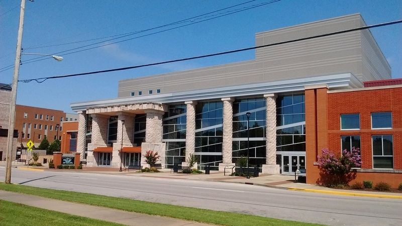
Of the three visible markers, this marker is in the center.
Credits. This page was last revised on June 11, 2021. It was originally submitted on September 11, 2019, by Tom Bosse of Jefferson City, Tennessee. This page has been viewed 493 times since then and 19 times this year. Photos:1. submitted on June 10, 2021, by Shane Oliver of Richmond, Virginia. 2. submitted on September 11, 2019, by Tom Bosse of Jefferson City, Tennessee. • Andrew Ruppenstein was the editor who published this page.