Barnesville near Dickerson in Montgomery County, Maryland — The American Northeast (Mid-Atlantic)
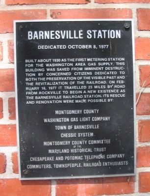
Barnesville Station
Dedicated October 8, 1977
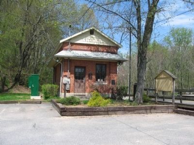
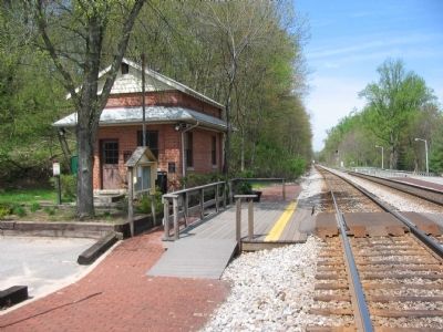
Built about 1930 as the first metering station for the Washington area gas supply, this building was saved from imminent destruction by concerned citizens dedicated to both the preservation of the visible past and revitalization of the railroad. On February 16, 1977 it travelled 23 miles by road from Rockville to begin a new existence as the Barnesville railroad station. Its rescue and renovation were made possible by:
Washington Gas Light Company
Town of Barnesville
Chessie System
Montgomery County Committee
of the
Maryland Historical Trust
Chesapeake and Potomac Telephone Company
Commuters, Townspeople, Railroad Enthusiasts
Topics. This historical marker is listed in this topic list: Railroads & Streetcars. A significant historical month for this entry is February 1826.
Location. 39° 12.58′ N, 77° 22.956′ W. Marker is near Dickerson, Maryland, in Montgomery County. It is in Barnesville. Marker is on Beallsville Road (State Highway 109) just south of Hillrise Lane, on the right when traveling south. Located at the east bound Barnesville MARC Station. Touch for map. Marker is at or near this postal address: 21550 Beallsville Rd, Dickerson MD 20842, United States of America. Touch for directions.
Other nearby markers. At least 8 other markers are within 3 miles of this marker, measured as the crow flies. Barnesville (approx. 0.8 miles away); a different marker also named Barnesville (approx. 0.8 miles away); Historic Site (approx. 2.2 miles away); African American Soldiers from Montgomery County (approx. 2.3 miles away); Equestrian Heritage (approx. 2.4 miles away); Brewer Farmstead (approx. 2.4 miles away); Chesapeake and Ohio Aqueduct (approx. 2.6 miles away); Washington's Farm (approx. 2.6 miles away). Touch for a list and map of all markers in Dickerson.
Credits. This page was last revised on February 21, 2023. It was originally submitted on April 27, 2009, by Craig Swain of Leesburg, Virginia. This page has been viewed 1,102 times since then and 34 times this year. Last updated on September 17, 2019, by Allen C. Browne of Silver Spring, Maryland. Photos: 1, 2, 3. submitted on April 27, 2009, by Craig Swain of Leesburg, Virginia. • Bill Pfingsten was the editor who published this page.


