Mackinaw City in Cheboygan County, Michigan — The American Midwest (Great Lakes)
The Lumbering Era
| — | Mackinaw City Historical Pathway | — |
Photographed by Joel Seewald, August 19, 2019
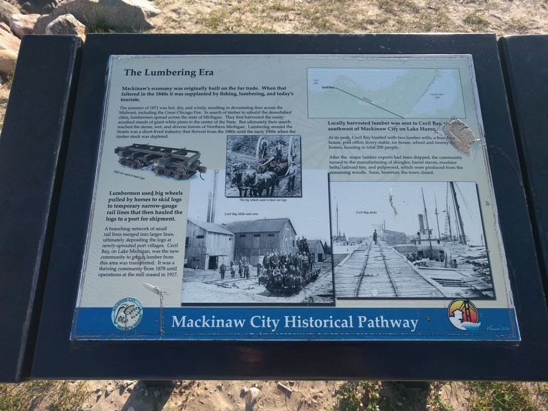
1. The Lumbering Era Marker
Mackinaw's economy was originally built on the fur trade. When that faltered in the 1840s it was supplanted by fising, lumbering, and today's tourism.
The summer of 1871 was hot, dry, and windy, resulting in devastating fires across the Midwest, including the Great Chicago Fire. In search of timber to rebuild the demolished cities, lumbermen spread across the state of Michigan. They first harvested the easily-accessed stands of giant white pines in the center of the State. But ultimately their search reached the dense, wet, and diverse forests of Northern Michigan. Lumbering around the Straits was a short-lived industry that thrived from the 1880s until the early 1900s when the timber stock was depleted.
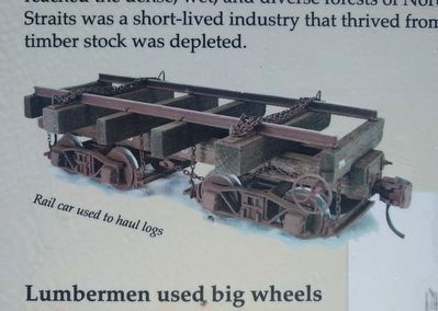
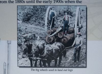
Lumbermen used big wheels pulled by horses to skid logs to temporary narrow-gauge rail lines that then hauled the logs to a port for shipment.
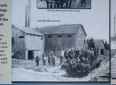
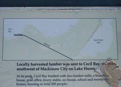
A branching network of small rail lines merged into larger lines, ultimately depositing the logs at newly-sprouted port villages. Cecil Bay, on Lake Michigan, was the new community to which lumber from this area was transported. It was a thriving community from 1878 until
this page online
Locally harvested lumber was sent to Cecil Bay, six miles southwest of Mackinaw City on Lake Huron [sic].
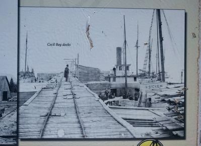
At its peak, Cecil Bay bustled with two lumber mills, a boarding house, post office, livery stable, ice house, school and twenty-five homes, housing in total 200 people.
After the major lumber exports had been shipped, the community turned to the manufacturing of shingles, barrel staves, excelsior bolts, railroad ties, and pulpwood, which were produced from the remaining woods. Soon, however, the town closed.
Erected 2014. (Marker Number 20.)
Topics. This historical marker is listed in these topic lists: Disasters • Industry & Commerce • Railroads & Streetcars. A significant historical year for this entry is 1871.
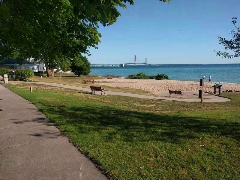
Location. This marker has been replaced by another marker nearby. It was located near 45° 47.084′ N, 84° 43.49′ W. Marker was in Mackinaw City, Michigan, in Cheboygan County. It was at the intersection of North Huron Avenue and East Sinclair Street, on the right when traveling north on North Huron Avenue. Marker is in Gary R. Williams Memorial Park. Touch for map.
2. The Lumbering Era Marker - left image
Rail car used to haul logs

Regionally, this marker was in Northern Michigan Lower Peninsula, on the Straits of Mackinac, and in one of the Lake Huron Shore counties. It was also in the American Midwest. Globally, it was in North America, in the Great North Woods, on the Great Lakes, in the Western Hemisphere, in the Western World, and in the Anglosphere. Historically, it found itself in what was once the Northwest Territory.
Other nearby markers. At least 8 other markers are within walking distance of this location: A different marker also named The Lumbering Era (here, next to this marker); “Merizon Barn” (about 400 feet away, measured in a direct line); Anchor (about 500 feet away); Chief Wawatam (about 500 feet away); a different marker also named Chief Wawatam (about 500 feet away); Marine and Weather Reporter (about 500 feet away); A Bridge for Mackinac (about 600 feet away); Where are the Clouds? The Snow? (about 600 feet away). Touch for a list and map of all markers in Mackinaw City.
Other markers no longer nearby. Anchors and their retrieval
3. The Lumbering Era Marker - upper middle image
The big wheels used to haul out logs
4. The Lumbering Era Marker - lower middle image
Cecil Bay Mills and crew
5. The Lumbering Era Marker - upper right image
6. The Lumbering Era Marker - lower right image
Cecil Bay docks
Photographed by Joel Seewald, August 19, 2019
7. The Lumbering Era Marker
View looking toward the northwest and the Mackinaw Bridge. The marker is at the right, at the end of the sidewalk into the small park.
Photographed by Joel Seewald, August 19, 2019
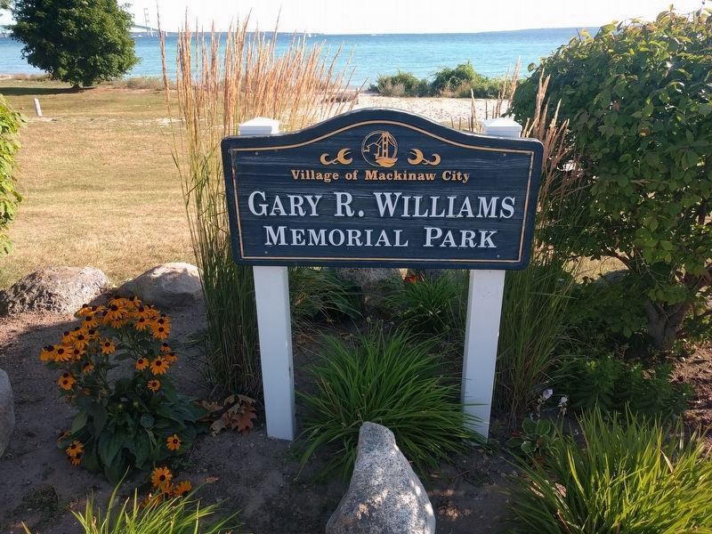
8. Gary R. Williams Memorial Park sign
The marker may not be visible from the street while driving because of the slope down to the beach, but the park sign can be seen from North Huron Avenue, the north end of Langlande Steet, and the east end of East Sinclair Street.
Credits. This page was last revised on August 24, 2024. It was originally submitted on October 11, 2019, by Joel Seewald of Madison Heights, Michigan. This page has been viewed 468 times since then and 28 times this year. Photos: 1, 2, 3, 4, 5, 6, 7, 8. submitted on October 11, 2019, by Joel Seewald of Madison Heights, Michigan.
