Winnemucca in Humboldt County, Nevada — The American Mountains (Southwest)
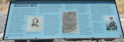
Explorers and Mountain Men

Photographed By Barry Swackhamer, August 26, 2019
1. Explorers and Mountain Men Marker
Captions: (bottom left) John C. Fremont, illustration from the book Life, Explorations, and Public Services of John Charles Fremont, ca. 1856.; Rock inscription in Humboldt County, possibly dating from 1807.; Joseph Walker, ca. 1860, by Mathew Brady.
The abundance of beaver in the Humboldt River drew the first non-native people, trappers (mountain men), to this area in the early 1800s. The popularity of felt hats was partially responsible for an increased demand for beaver pelts, but there was also political motivation. The British owned Canadian based Hudson's Bay Company (HBC) embarked on a "scorched earth" policy to trap all beavers in the region to make it less attractive to Americans. This policy led to the decimation of the Humboldt River beaver populations.
HBC's Peter Skene Ogden reached the Humboldt River at a point near present-day Winnemucca on November 9, 1828, and returned again in 1829. Although Ogden and his party were the first documented non-natives in this area, an intriguing inscription in Humboldt County indicates that others possibly were here as early as 1807.
The first Americans to travel along the Humboldt River were members of a trapping party lead by Joseph Walker in 1833. From 1833-1834 Walker explored the entire river. In 1845 he guided a contingent of John C. Fremont's Third Exploration Expedition along the Humboldt River to its terminus in the Humboldt Sink. Fremont named the river after the famed geographer Baron von Humboldt.
The main purpose of Fremont's expedition was to explore and map the area. Fremont determined that the region was a vast area of internal drainage that he named the "Great Basin" His findings put to rest rumors that there was a river that ran from the Rocky Mountains to the Pacific.
Major trapping efforts ended by the 1840s. Although trappers helped open the West and pioneered routes that would later be used by emigrants, they also caused long-lasting devastating effects to the river ecosystem and impacted Native Americans. Although early interactions with Ogden's exploration parties were friendly, it is clear that the Native peoples understood the damage that the trappers were causing as Ogden's party would sometimes find their beaver traps vandalized. In 1833, the Walker Party responded to trap thefts by killing several Shoshones. When a large group of Paiutes approached the Walker Party in the Humboldt Sink, wanting to greet them, the trappers misunderstood and fired on the the group tragically killing more than 30 Native Americans.
Subsequent use of the Humboldt River corridor by Euro-Americans exacerbated impacts to the river and to Native Americans.
Erected by Humboldt Museum, Bureau of Land Management.
Topics. This historical marker is listed in these topic lists: Animals • Exploration • Settlements & Settlers.
Location. 40° 58.618′ N, 117° 44.663′ W. Marker is in Winnemucca, Nevada, in Humboldt County. Marker is on Museum Avenue near Maple Avenue, on the left when traveling west. Touch for map. Marker is at or near this postal address: 175 Museum Avenue, Winnemucca NV 89445, United States of America. Touch for directions.
Other nearby markers. At least 8 other markers are within walking distance of this marker. The Victory Highway and Transcontinental Airway System (here, next to this marker); Railroads and Telegraphs (here, next to this marker); The California Trail (here, next to this marker); Winnemucca and the Humboldt River Corridor (here, next to this marker); The Humboldt River (here, next to this marker); Pioneer Memorial Park (approx. 0.2 miles away); Winneva Building (approx. 0.4 miles away); California Trail - Trading Post (approx. half a mile away). Touch for a list and map of all markers in Winnemucca.
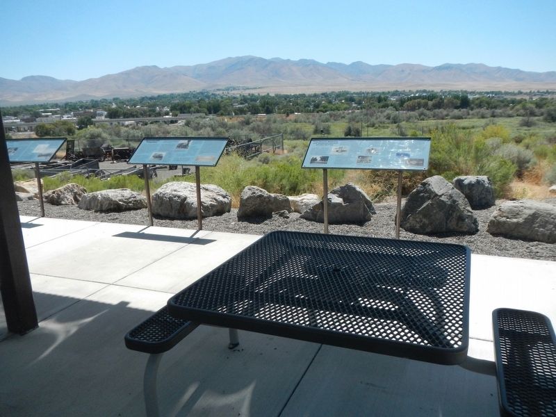
More about this marker. This marker is located at the overlook at the Humboldt Museum.
Credits. This page was last revised on October 17, 2022. It was originally submitted on October 22, 2019, by Barry Swackhamer of Brentwood, California. This page has been viewed 235 times since then and 22 times this year. Photos: 1, 2. submitted on October 22, 2019, by Barry Swackhamer of Brentwood, California.
