Central Oklahoma City in Oklahoma County, Oklahoma — The American South (West South Central)
Hell's Half Acre
| — | The ‘89er Trail | — |
Photographed by Mark Hilton, October 21, 2019
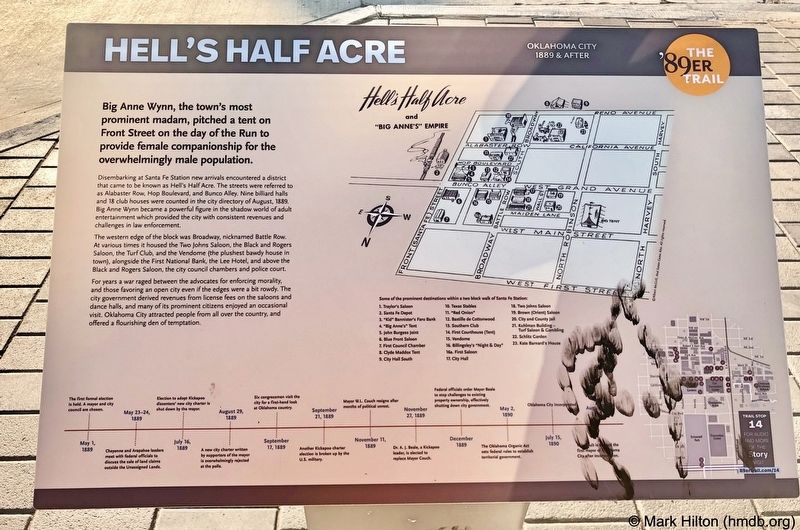
1. Hell's Half Acre Marker
Big Anne Wynn, the town's most prominent madam, pitched a tent on Front Street on the day of the Run to provide female companionship for the overwhelmingly male population.
Disembarking at Santa Fe Station new arrivals encountered a district that came to be known as Hell's Half Acre. The streets were referred to as Alabaster Row, Hop Boulevard, and Bunco Alley. Nine billiard halls and 18 club houses were counted in the city directory of August, 1889. Big Anne Wynn became a powerful figure in the shadow world of adult entertainment which provided the city with consistent revenues and challenges in law enforcement.
The western edge of the block was Broadway, nicknamed Battle Row. At various times it housed the Two Johns Saloon, the Black and Rogers Saloon, the Turf Club, and the Vendome (the plushest bawdy house in town), alongside the First National Bank, the Lee Hotel, and above the Black and Rogers Saloon, the city council chambers and police court.
For years a war raged between the advocates for enforcing morality, and those favoring an open city even if the edges were a bit rowdy. The city government derived
this page online
Erected 2018 by Oklahoma City Community Foundation, Wiggin Properties. (Marker Number 14.)
Topics and series. This historical marker is listed in these topic lists: Entertainment • Industry & Commerce • Women. In addition, it is included in the The '89er Trail series list. A significant historical month for this entry is August 1889.
Location. 35° 27.884′ N, 97° 30.781′ W. Marker is in Oklahoma City, Oklahoma, in Oklahoma County. It is in Central Oklahoma City. It is on South E.K. Gaylord Boulevard north of Reno Avenue, on the right when traveling north. Touch for map. Marker is at or near this postal address: 150 South E.K Gaylord Boulevard, Oklahoma City OK 73104, United States of America. Touch for directions.

Regionally, this marker is in Central Oklahoma—Frontier Country. It is also in the American South, specifically on the prairies, and on the Southern Plains. Globally, it is in North America,
Photographed by Mark Hilton, October 21, 2019
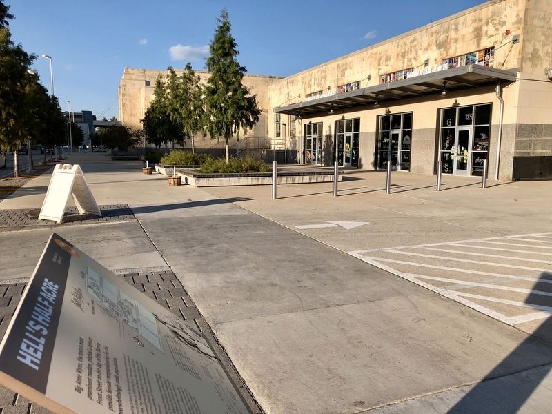
2. Hell's Half Acre Marker looking north towards the Amtrak station.
Other nearby markers. At least 8 other markers are within walking distance of this marker: The Land Run (within shouting distance of this marker); a different marker also named The Land Run (about 500 feet away, measured in a direct line); Ray Ackerman Dancing Fountains (about 600 feet away); The Building of Oklahoma City (about 600 feet away); The Rock Island Plow Building (about 700 feet away); City Hall by Forfeiture (about 700 feet away); A Summer of Political Unrest (about 800 feet away); Wells Fargo Livery Stable (approx. 0.2 miles away). Touch for a list and map of all markers in Oklahoma City.
Also see . . . OKC History on Hell's Half Acre. (Submitted on October 31, 2019, by Mark Hilton of Montgomery, Alabama.)
Credits. This page was last revised on January 1, 2025. It was originally submitted on October 31, 2019, by Mark Hilton of Montgomery, Alabama. This page has been viewed 3,216 times since then and 265 times this year. Photos: 1, 2. submitted on October 31, 2019, by Mark Hilton of Montgomery, Alabama.
