Near Midlothian in Chesterfield County, Virginia — The American South (Mid-Atlantic)
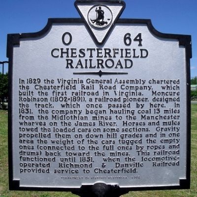
Chesterfield Railroad
Erected 2002 by Department of Historic Resources. (Marker Number O-64.)
Topics and series. This historical marker is listed in these topic lists: Industry & Commerce • Railroads & Streetcars. In addition, it is included in the Virginia Department of Historic Resources (DHR) series list. A significant historical year for this entry is 1829.
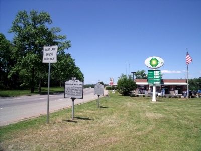
Location. Marker has been reported missing. It was located near 37° 30.371′ N, 77° 34.8′ W. Marker was near Midlothian, Virginia, in Chesterfield County. Marker was at the intersection of Midlothian Turnpike (U.S. 60) and Robious Road, on the right when traveling west on Midlothian Turnpike. Touch for map. Marker was in this post office area: Richmond VA 23235, United States of America. Touch for directions.
Other nearby markers. At least 8 other markers are within 4 miles of this location, measured as the crow flies. Bethlehem Baptist Church (approx. 0.4 miles away); First Railroad in Virginia (approx. half a mile away); Black Heath (approx. 1.9 miles away); Huguenot Settlement (approx. 2 miles away); Providence United Methodist Church (approx. 2.2 miles away); Trabue's Tavern (approx. 2.3 miles away); Mid-Lothian Mines and Rail Roads (approx. 3˝ miles away); The Bermuda Hundred Campaign (approx. 3˝ miles away). Touch for a list and map of all markers in Midlothian.
Also see . . . Mid-Lothian Mines & Rail Roads Foundation. (Submitted on May 17, 2009, by Bernard Fisher of Richmond, Virginia.)
Credits. This page was last revised on November 10, 2019. It was originally submitted on May 16, 2009, by Bernard Fisher of Richmond, Virginia. This page has been viewed 1,409 times since then and 49 times this year. Last updated on November 8, 2019, by H of Richmond, Virginia. Photos: 1, 2. submitted on May 16, 2009, by Bernard Fisher of Richmond, Virginia.

