Near Havre in Hill County, Montana — The American West (Mountains)
Fort Assinniboine
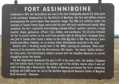
General John J. Pershing served here in the 1890s, earning his nickname "Black Jack" because of his association with the Afro-American 10th Cavalry - the famed "Buffalo Soldiers." For many years, Fort Assinniboine soldiers worked with the Canadian Mounties to control smuggling across the border.
The War Department abandoned the post in 1911. A few years later, the landless Chippewa and Cree Indians found a home on the southern part of the military reserve when it was set aside as Rocky Boy's Reservation. The State of Montana purchased the fort's remaining buildings and 2,000 acres for use as the Northern Agricultural Research Center of Montana State University - Bozeman.
Erected by Montana Department of Transportation.
Topics. This historical marker is listed in this topic list: Forts and Castles.
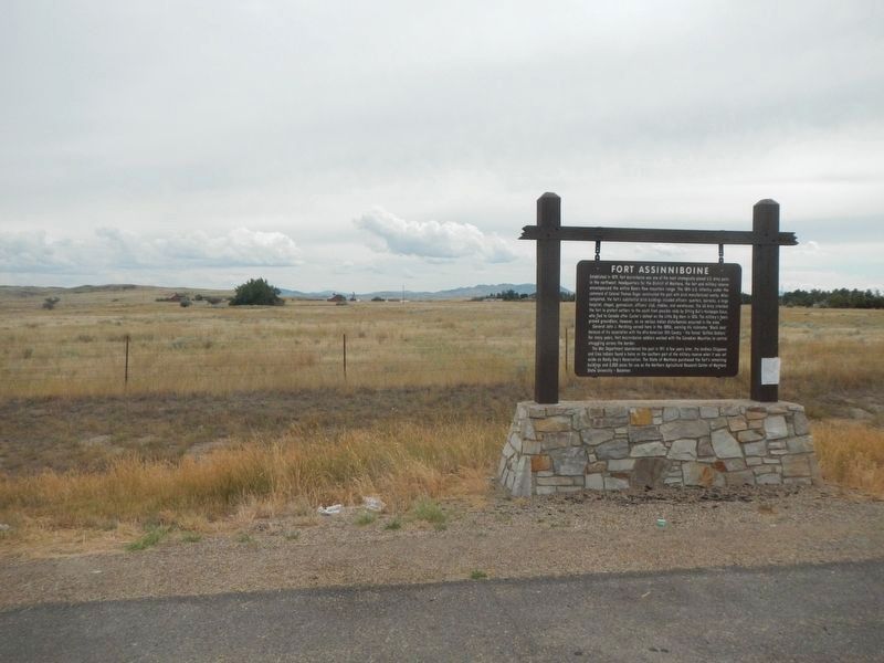
Location. 48° 30.448′ N, 109° 47.905′ W. Marker is near Havre, Montana, in Hill County. Marker is on U.S. 87 near 82nd Avenue West, on the right when traveling north. Touch for map. Marker is in this post office area: Havre MT 59501, United States of America. Touch for directions.
Other nearby markers. At least 8 other markers are within walking distance of this marker. Non-Commissioned Officers' Quarters (approx. half a mile away); John A. Burns (approx. 0.6 miles away); Fort Assiniboine (approx. 0.6 miles away); Guardhouse (approx. 0.6 miles away); The Buffalo Soldiers at Fort Assinniboine (approx. 0.6 miles away); a different marker also named Fort Assinniboine (approx. 0.6 miles away); a different marker also named Fort Assinniboine (approx. 0.6 miles away); Company Officer's Quarters (Duplexes) (approx. 0.6 miles away). Touch for a list and map of all markers in Havre.
Also see . . . Fort Assinniboine -- Fort Assinniboine Preservation Association. THE FORT, one of northern Montana’s earliest outposts, was a busy self contained city. Bakery, laundry, a barbershop and blacksmith facilities were in operation, as were a general store, post office, hotel, and restaurant. For recreation, the post band gave regular concerts, and the men engaged in such sport activities as baseball, track, and boxing. Other diversions offered included a library for reading, card playing, and checkers, plus an enlisted men’s amusement center housed in the regimental band barracks. The lifestyle was routine, with the men largely spared from battle activity. (Submitted on November 13, 2019, by Barry Swackhamer of Brentwood, California.)
Credits. This page was last revised on November 15, 2019. It was originally submitted on November 13, 2019, by Barry Swackhamer of Brentwood, California. This page has been viewed 162 times since then and 18 times this year. Photos: 1, 2. submitted on November 13, 2019, by Barry Swackhamer of Brentwood, California.

