Near Williston in Williams County, North Dakota — The American Midwest (Upper Plains)
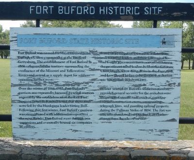
Fort Buford State Historic Site
Over the winter of 1866-1867, Fort Buford's garrison was repeatedly harassed by tribal warriors angered by the establishment of the fort. Post Surgeon James P. Kimball noted that these raids were led by the Hunkpapa leader Sitting Bull. Following that first winter, Fort Buford's garrison was strengthened with additional troops. Over the next decade, Fort Buford went through two expansions and eventually housed six companies of soldiers.
Fort Buford frequently served as a detention area for tribal leaders and their followers who had fought placement onto reservation. Among the prominent tribal leaders held at the fort were Chief Joseph, Crow King, Rain-in-the-Face, Gall and Low Dog. The last to be detained at the fort was Sitting Bull in July of 1881.
In later years, Fort Buford's soldiers not only provided general security for the area, but were also assigned specific tasks such as guarding railroad construction crews, constructing telegraph lines, and guarding railroad property during the Pullman Strike of 1894. The fort was officially abandoned on October 1, 1895 after almost three decades of service.
Topics. This historical marker is listed in this topic list: Forts and Castles. A significant historical date for this entry is October 1, 1895.
Location. 47° 59.13′ N, 104° 0.103′ W. Marker is near Williston, North Dakota, in Williams County. Marker is on 39th Lane Northwest near 153rd Avenue Northwest, on the left when traveling west. Touch for map. Marker is in this post office area: Williston ND 58801, United States of America. Touch for directions.
Other nearby markers. At least 8 other markers are within walking distance of this marker. Post Trader's Complex (within shouting distance of this marker); Fort Buford Historic Site (within shouting distance of this marker); Telegraph Office (about 400 feet away, measured in a direct line); Field Officers' Quarters (about 400 feet away); Infantry Barracks (about 500 feet away); Parade Ground (about 600 feet away); North Dakota Masonic Foundation (about 700 feet away); Cemetery (about 700 feet away). Touch for a list and map of all markers in Williston.
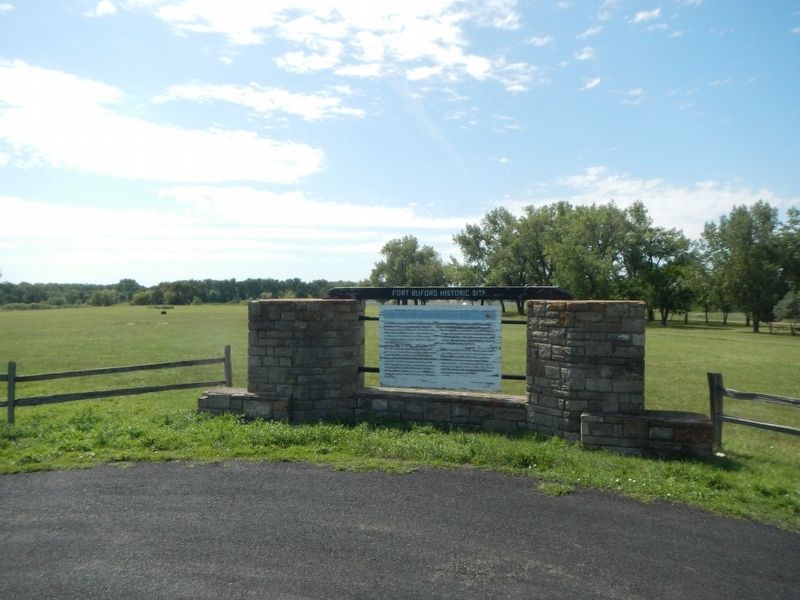
More about this marker. This marker is located at the west end of 39th Lane Northwest at the entrance to Historic Fort Buford.
Also see . . . Fort Buford State Historic Site - History -- State Historical Society of North Dakota. Although historically the Fort Buford region was claimed by the Hidatsa, the Sioux controlled the area after the Hidatsa population was decimated by smallpox. The Sioux, angered by the establishment of the fort, attacked a work party at the sawmill on December 21, 1866. Raids continued sporadically throughout the winter. (Submitted on November 30, 2019, by Barry Swackhamer of Brentwood, California.)
Credits. This page was last revised on November 30, 2019. It was originally submitted on November 30, 2019, by Barry Swackhamer of Brentwood, California. This page has been viewed 382 times since then and 17 times this year. Photos: 1, 2, 3, 4. submitted on November 30, 2019, by Barry Swackhamer of Brentwood, California.


