White Bluff in Dickson County, Tennessee — The American South (East South Central)
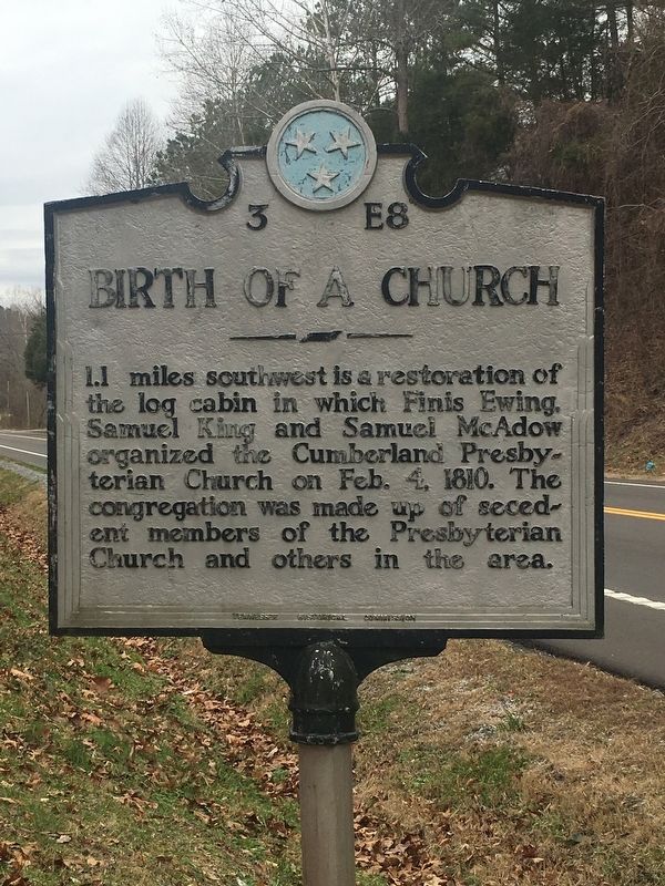
Birth of a Church
Erected by Tennessee Historical Commission. (Marker Number 3 E8.)
Topics and series. This historical marker is listed in this topic list: Churches & Religion. In addition, it is included in the Tennessee Historical Commission series list. A significant historical date for this entry is February 4, 1810.
Location. 36° 6.15′ N, 87° 17.008′ W. Marker is in White Bluff, Tennessee, in Dickson County. Marker is on Jackson Hill Road (U.S. 70) just south of U.S. 70, on the right when traveling south. Touch for map. Marker is in this post office area: White Bluff TN 37187, United States of America. Touch for directions.
Other nearby markers. At least 8 other markers are within 5 miles of this marker, measured as the crow flies. The Civilian Conservation Corps (about 600 feet away, measured in a direct line); The CCC at Montgomery Bell (about 600 feet away); The Old Log House (approx. 0.9 miles away); Cumberland Presbyterian Church Monument (approx. 0.9 miles away); The Civilian Conservation Corps and Montgomery Bell State Park (approx. 1.4 miles away); McNairy’s Attack (approx. 2.1 miles away); The Civil War in White Bluffs (approx. 3.3 miles away); "Lonesome" Cabin (approx. 4.1 miles away).
Credits. This page was last revised on December 26, 2019. It was originally submitted on December 26, 2019, by Tisha Coggin Clay of Nashville, Tennessee. This page has been viewed 211 times since then and 17 times this year. Photo 1. submitted on December 26, 2019, by Tisha Coggin Clay of Nashville, Tennessee. • Devry Becker Jones was the editor who published this page.
