Near Carlisle in Union County, South Carolina — The American South (South Atlantic)
Colonel William Farr
Photographed by Michael Sean Nix, December 13, 2008
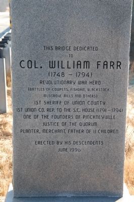
1. Colonel William Farr Marker
to
Col. William Farr
(1748-1794)
Revolutionary War hero
(Battles of Cowpens, Fishdam, Blackstock,
Musgrove Mills and others)
1st Sheriff of Union County
1st Union Co. Rep. to the S.C. House (1791-1794)
one of the founders of Pinckneyville
justice of the quorum
planter, merchant, father of 11 children
Erected 1996 by His Descendants.
Topics. This historical marker is listed in these topic lists: Bridges & Viaducts • War, US Revolutionary.
Location. 34° 35.729′ N, 81° 25.44′ W. Marker is near Carlisle, South Carolina, in Union County. It is on State Highway 215 0.1 miles east of Edwards Road, on the right when traveling east. Touch for map. Marker is in this post office area: Carlisle SC 29031, United States of America. Touch for directions.

Regionally, this marker is in Upstate and in the Olde English District. It is also in the American South, specifically in the Deep South, in Appalachia, and specifically in Southern Appalachia. Globally, it is in North America, the Western Hemisphere, the Western World, and the Anglosphere. Historically, it finds itself in what was once the original Cherokee Nation, the territory of the Mississippian Culture, one of the original Thirteen Colonies, one of the Confederate States of America, and the Antebellum South.
Other nearby markers. At least 8 other markers are within 10 miles of this marker, measured as the crow flies: Battle of Fishdam Ford (approx. 0.3 miles away); Fish Dam Battle Ground (approx. 0.4 miles away); St. Paul Baptist Church at Halsellville / Carter Colored School (approx. 6.7 miles away); Poplar Grove School (approx. 7.1 miles away); Old Zion A.M.E. Zion Church (approx. 7.1 miles away); Feasterville Female and Male Academy (approx. 7.4 miles
this page online
Photographed by Michael Sean Nix, December 13, 2008
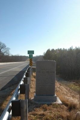
2. Colonel William Farr Marker
Photographed by Michael Sean Nix, December 13, 2008
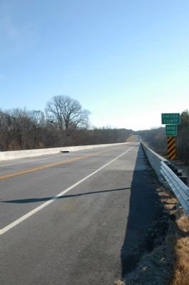
3. SC Hwy. 215 over Broad River
Credits. This page was last revised on December 15, 2019. It was originally submitted on December 13, 2008, by Michael Sean Nix of Spartanburg, South Carolina. This page has been viewed 4,362 times since then and 219 times this year. Photos: 1, 2, 3. submitted on December 13, 2008, by Michael Sean Nix of Spartanburg, South Carolina. • Bill Pfingsten was the editor who published this page.
