Port Morien in Cape Breton Region, Nova Scotia — The Atlantic Provinces (North America)
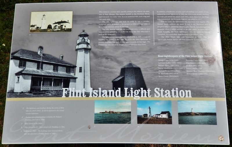
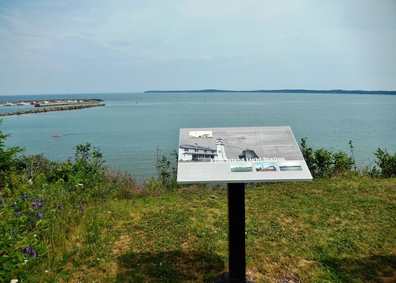
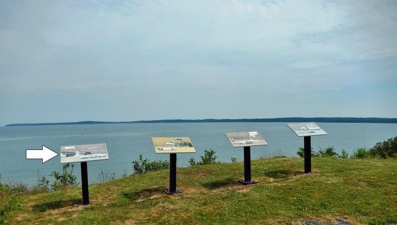
Flint Island Light Station
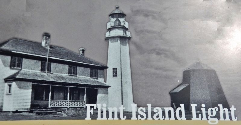
The first lighthouse was built in 1856. It was a wooden, octagonal tower. It burned to the ground in 1864 and was replaced by a similar structure about 42 feet high.
The only landing area was the northwest cove, a difficult spot because of the prevailing winds and the steep slip. One often had to land on the third wave.
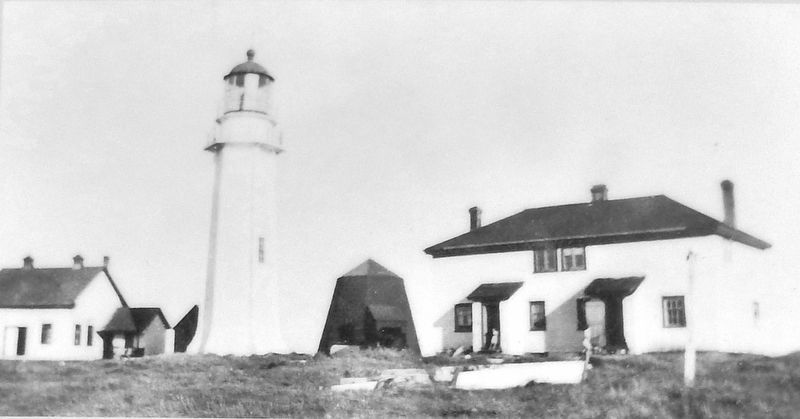
The light station was completely refurbished in 1909. A foghorn building was added at that time. In 1910, the third lighthouse, a cement structure, was built. It was approximately 60 feet high. The Fresnel lens was turned by weights wound up every four hours.
In addition, a boathouse, oil store and outbuildings were added. It was replaced by a new lighthouse in 1961. In 1912, a new double dwelling was built and served the island until 1961, when three new dwellings were constructed. An electronic foghorn was added in 1971.
Over the years, the lightstation was associated with tragedy. The Martell family suffered the most. It lost a son Raymond and daughter Ethel to drowning. Another son, Harold, died of a ruptured appendix when a valiant attempt to get him ashore in winter failed. Frank Langille, the head lightkeeper, and his assistant George Campbell, drowned while duck hunting in November, 1950.
The Flint Island light was automated in 1985. The last lightkeeper, Robert Spears, left Flint Island for Scaterie in 1983.
Head Lightkeepers of the Flint Island Light Station
• George Cann (1856-1880)
• Lawrence Laffan (1880-1883)
• William Helm (1883-1903)
• Daniel MacKenzie (1903-1904)
• Michael Brean (1904-1911)
• A. MacLeod (1911-1914)
• Avery Covey (1913-1925)
• Freeman Curry (1925-1927)
• John Martell (1927-1945)
• Joe Bell (1945-1950)
• Frank Langille 1950
• Brenton (Ben) Hopkins (1950-1968)
• Robert Spears (1968-1983)
(photo captions)
1. The lighthouse and dwellings during the tenure of John Martell (1927-1945). In the background is the second wooden lighthouse.
2. Another view of the buildings including the Foghorn Building, first built in 1909.
3. Flint Island in the 1960s.
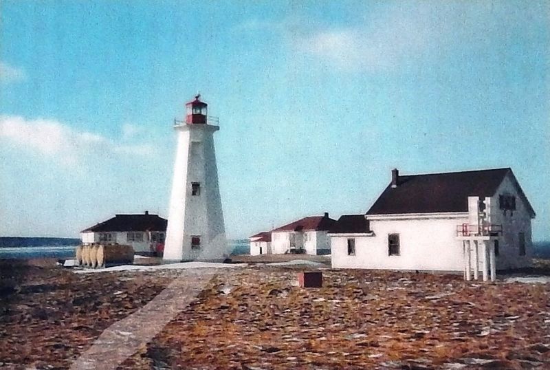
4. Flint Island 1960-1983 — Flint Island with Buildings in 1961.
5. Lighthouse 2004 — The buildings were removed shortly after the departure of Robert Spears in 1983.
Erected by Enterprise Cape Breton Corporation, Cape Breton County Economic Development Authority, and the Cape Breton Regional Municipality.
Topics and series. This historical marker is listed in this topic list: Notable Places. In addition, it is included in the Lighthouses series list.
Location. 46° 7.8′ N, 59° 52.55′ W. Marker is in Port Morien, Nova Scotia, in Cape Breton Region. Marker is on Marconi Trail (Nova Scotia Route 255) 0.2 kilometers south of Birch Grove Road, on the right when traveling north. Marker is located beside the highway on the south side of Morien Cliffs Municipal Park, overlooking Morien Bay. Touch for map. Marker is in this post office area: Port Morien NS B1B 1V9, Canada. Touch for directions.
Other nearby markers. At least 8 other markers are within walking distance of this marker. Gowrie and North Atlantic Collieries (here, next to this marker); The Fishery in Port Morien (here, next to this marker); Morien Bay (here, next to this marker); Morien's Legacy (approx. 0.4 kilometers away); Morien Institutions (approx. half a kilometer away); Morien Businesses of the Past (approx. half a kilometer away); First Boy Scout Troop in North America (approx. 1.1 kilometers away); The First Coal Workings in North America (approx. 1.1 kilometers away). Touch for a list and map of all markers in Port Morien.
Related markers. Click here for a list of markers that are related to this marker. Port Morien Interpretive Walking Tour
Also see . . . Flint Island Lighthouse. The island is actually made up of sandstone, not flint, and erosion has broken it into two pieces. Flint Island Lighthouse was the only one built by the Province of Nova Scotia in 1856, and Keeper George Cann placed the light in operation on November first of that year. As there was no well on the island, Keeper Cann had to catch rainwater in casks. Cann earned an annual salary of £60 and was given another £20 as a fuel allowance. Out of this money, he was forced to hire a man to help him as the station’s boat had to be hauled up the cliff at the island’s one landing place. (Submitted on January 3, 2020, by Cosmos Mariner of Cape Canaveral, Florida.)
Credits. This page was last revised on January 3, 2020. It was originally submitted on January 2, 2020, by Cosmos Mariner of Cape Canaveral, Florida. This page has been viewed 378 times since then and 61 times this year. Photos: 1. submitted on January 2, 2020, by Cosmos Mariner of Cape Canaveral, Florida. 2, 3, 4, 5, 6. submitted on January 3, 2020, by Cosmos Mariner of Cape Canaveral, Florida.
