Purcell in McClain County, Oklahoma — The American South (West South Central)
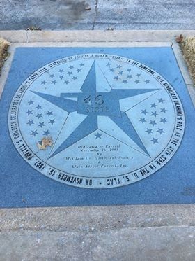
46th State
On November 16, 1907, Purcell’s children celebrated Oklahoma’s entry into statehood by forming a human “star” in the downtown. This symbolized Oklahoma’s role as the 46th star in the U. S. flag ★
Dedicated to Purcell November 16, 1995 by McClain Co. Historical Society & Main Street Purcell, Inc.
Erected 1995 by McClain Co. Historical Society & Main Street Purcell, Inc.
Topics. This historical marker is listed in these topic lists: Education • Patriots & Patriotism • Settlements & Settlers. A significant historical date for this entry is November 16, 1907.
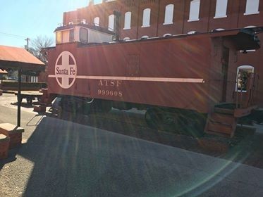
Location. 35° 0.726′ N, 97° 21.665′ W. Marker is in Purcell, Oklahoma, in McClain County. Marker is at the intersection of West Main Street and South Second Avenue, on the right when traveling east on West Main Street. The marker is found at the north entrance of downtown Purcell's Santa Fe Plaza. Touch for map. Marker is in this post office area: Purcell OK 73080, United States of America. Touch for directions.
Other nearby markers. At least 8 other markers are within 8 miles of this marker, measured as the crow flies. Confederate Memorial (a few steps from this marker); Desert Storm Honor Roll (a few steps from this marker); Hotel Love (within shouting distance of this marker); Purcell (about 500 feet away, measured in a direct line); Run of '89 South Boundary (approx. 1˝ miles away); Col. John L. Smith (approx. 1˝ miles away); Camp Holmes Treaty (approx. 1˝ miles away); California Trail (approx. 7.4 miles away). Touch for a list and map of all markers in Purcell.
Also see . . . Downtown Lucky 7 - Purcell, OK. The Long Description of this Waymark includes a description of the Santa Fe Plaza. (Submitted on January 20, 2020, by Jerome Walker of Moore, Oklahoma.)
Credits. This page was last revised on January 24, 2020. It was originally submitted on January 19, 2020, by Jerome Walker of Moore, Oklahoma. This page has been viewed 164 times since then and 12 times this year. Photos: 1. submitted on January 20, 2020, by Jerome Walker of Moore, Oklahoma. 2. submitted on January 22, 2020, by Jerome Walker of Moore, Oklahoma. • J. Makali Bruton was the editor who published this page.

