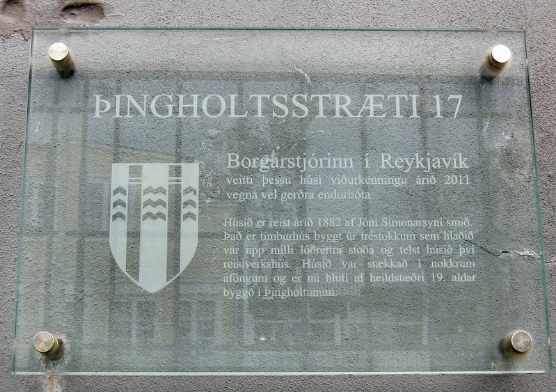
ŮingholtsstrŠti 17
H˙si er reist ßri 1882 af Jˇni Simonarsyni smi. Ůa er timburh˙s byggt ˙r trÚstokkum sem hlai var upp milli lˇrÚttra stoa og telst h˙si ■vÝ reisiverksh˙s. H˙si var stŠkka Ý nokkrum ßfongum og er nu hluti af heildstŠri 19. aldar bygg Ý Ůingholtunum.
-
This house was awarded recognition by the Mayor of Reykjavik in 2011 for the excellence of its improvements.
The house was built in 1882 by the carpenter Jˇni Simonarsyni. It is a wooden house built of logs set between vertical pillars, and the house was used as his workshop. The house was expanded in several stages and helps form part of the 19th century Thingholt neighborhood.
Topics. This historical marker is listed in this topic list: Notable Buildings. A significant historical year for this entry is 2011.
Location. 64° 8.727′ N, 21° 56.121′ W. Marker is in ReykjavÝk, Capital Region (H÷fuborgarsvŠi), in ReykjavÝkurborg. It is in Downtown. Marker is on ŮingholtsstrŠti
Other nearby markers. At least 8 other markers are within walking distance of this marker. Torfhildur Hˇlm (a few steps from this marker); ŮingholtsstrŠti 13 (within shouting distance of this marker); LandlŠknih˙si (about 90 meters away, measured in a direct line); Menntaskˇlinn Ý ReykjavÝk / High School in ReykjavÝk (about 120 meters away); Ůjˇfundurinn 1851 / The National Assembly of 1851 (about 120 meters away); Gimli (about 150 meters away); BankastrŠti 10 (about 150 meters away); The Mothers' Garden / MŠragarurinn (about 150 meters away). Touch for a list and map of all markers in ReykjavÝk.
Credits. This page was last revised on February 1, 2020. It was originally submitted on February 1, 2020, by Andrew Ruppenstein of Lamorinda, California. This page has been viewed 119 times since then and 14 times this year. Photos: 1, 2. submitted on February 1, 2020, by Andrew Ruppenstein of Lamorinda, California.

