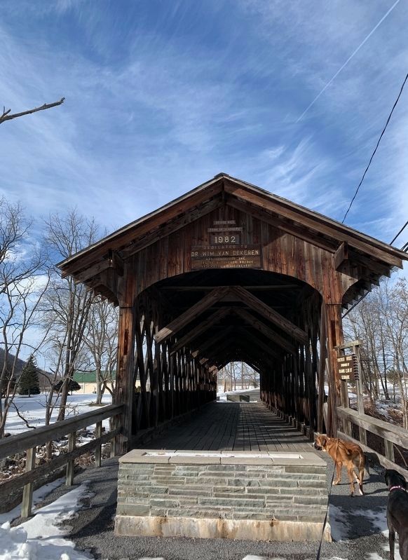
Schoharie in Schoharie County, New York — The American Northeast (Mid-Atlantic)
Bridge No. 1
Town of Schoharie
1982
Dedicated To
Dr. Wim Van Eekeren
Who Conceived The
Idea Of A Covered Bridge
And Made It A Reality
Erected 1982 by Town of Schoharie.
Topics and series. This historical marker is listed in this topic list: Bridges & Viaducts. In addition, it is included in the Covered Bridges series list. A significant historical year for this entry is 1982.
Location. 42° 40.765′ N, 74° 18.057′ W. Marker is in Schoharie, New York, in Schoharie County. Marker is on Fort Road north of N Main Street when traveling north. The foot bridge is at the end of Fort Road. Touch for map. Marker is in this post office area: Schoharie NY 12157, United States of America. Touch for directions.
Other nearby markers. At least 8 other markers are within walking distance of this marker. Stone Church Parsonage (within shouting distance of this marker); Col. Peter Vroman (about 500 feet away, measured in a direct line); George Mann Tory Tavern (about 700 feet away); David Williams Memorial (about 800 feet away); Colonel John Harper (approx. 0.2 miles away); David Ellerson (approx. 0.2 miles away); Revolution in the Mohawk Valley (approx. 0.2 miles away); War in Schoharie County (approx. 0.2 miles away). Touch for a list and map of all markers in Schoharie.
Credits. This page was last revised on February 18, 2020. It was originally submitted on February 15, 2020, by Steve Stoessel of Niskayuna, New York. This page has been viewed 301 times since then and 21 times this year. Photos: 1, 2. submitted on February 15, 2020, by Steve Stoessel of Niskayuna, New York. • Michael Herrick was the editor who published this page.

