Forest City in Rutherford County, North Carolina — The American South (South Atlantic)
First Baptist Church
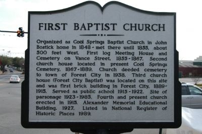
Photographed by Michael Sean Nix, December 21, 2008
1. First Baptist Church Marker
Topics. This historical marker is listed in this topic list: Religion & Religious Structures. A significant historical year for this entry is 1855.
Location. 35° 20.07′ N, 81° 52.104′ W. Marker is in Forest City, North Carolina, in Rutherford County. It is at the intersection of W. Main Street and S. Church Street, on the left when traveling west on W. Main Street. Touch for map. Marker is in this post office area: Forest City NC 28043, United States of America. Touch for directions.

Regionally, this
this page online
Other nearby markers. At least 8 other markers are within walking distance of this marker: Forest City (about 400 feet away, measured in a direct line); Town of Burnt Chimney (about 800 feet away); Forest City Confederate Memorial (approx. 0.2 miles away); Police Memorial (approx. ¼ mile away); Building the Community Connector (approx. ¼ mile away); Rutherford County Memorial (approx. ¼ mile away); Cool Springs High School (approx. 0.4 miles away); Elisha Baxter (approx. 0.4 miles away). Touch for a list and map of all markers in Forest City.

Photographed by Michael Sean Nix, December 21, 2008
2. First Baptist Church

Photographed by Michael Sean Nix, December 21, 2008
3. First Baptist Church
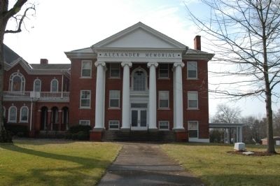
Photographed by Michael Sean Nix, December 21, 2008
4. Alexander Memorial
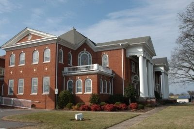
Photographed by Michael Sean Nix, December 21, 2008
5. First Baptist Church
Side view
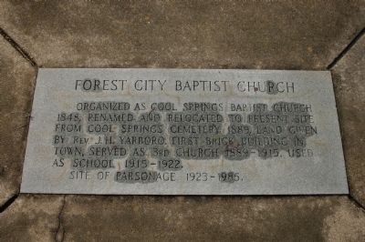
Photographed by Michael Sean Nix, December 21, 2008
6. First Baptist Church Marker
Credits. This page was last revised on June 16, 2016. It was originally submitted on December 21, 2008, by Michael Sean Nix of Spartanburg, South Carolina. This page has been viewed 1,354 times since then and 66 times this year. Photos: 1, 2, 3, 4, 5, 6. submitted on December 21, 2008, by Michael Sean Nix of Spartanburg, South Carolina. • Bill Pfingsten was the editor who published this page.
