Denham Springs in Livingston Parish, Louisiana — The American South (West South Central)
Historic Denham Springs
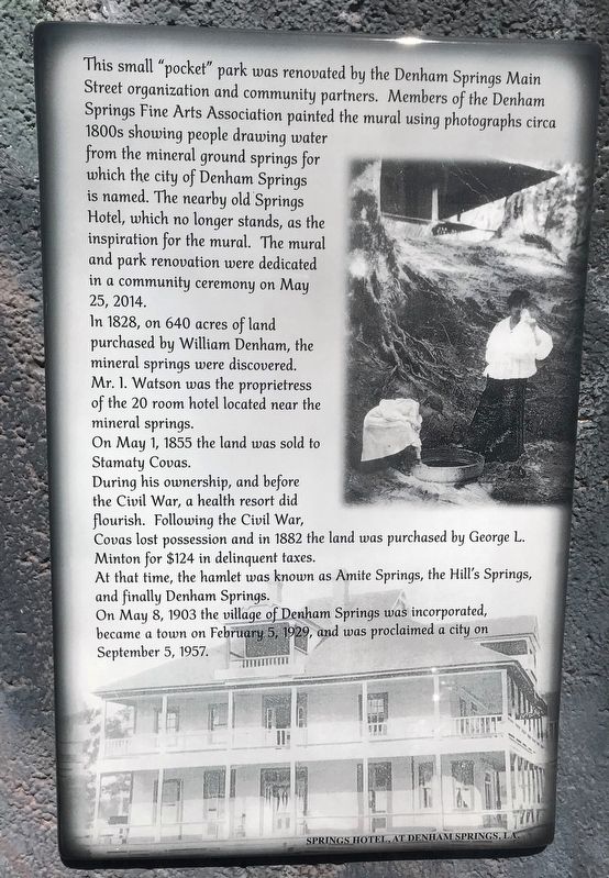
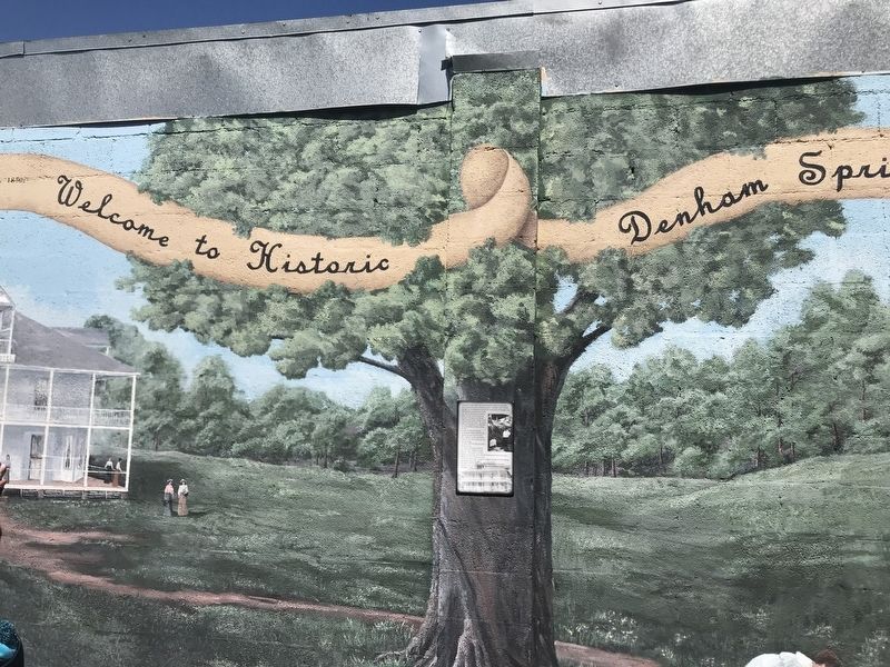
This small “pocket” park was renovated by the Denham Springs Main Street organization and community partners. Members of the Denham Springs Fine Arts Association painted the mural using photographs circa 1800s showing people drawing water from the mineral ground springs for which the city of Denham Springs is named. The nearby old Springs Hotel, which no longer stands, as the inspiration for the mural. The mural and park renovation were dedicated in a community ceremony on May 25, 2014.
In 1828, on 640 acres of land purchased by William Denham, the mineral springs were discovered. Mr. I. Watson was the proprietress of the 20 room hotel located near the mineral springs. On May 1, 1855 the land was sold to Stamaty Covas. During his ownership, and before the Civil War, a health resort did flourish. Following the Civil War, Covas lost possession and in 1882 the land was purchased by George L. Minton for $124 in delinquent taxes. At that time, the hamlet was known as Amite Springs, the Hill's Springs, and finally Denham Springs. On May 8, 1903 the village of Denham Springs was incorporated, became a town on February 5, 1929, and was proclaimed a city on September 5, 1957.
Erected 2014 by Denham Springs Main Street.
Topics. This historical marker is listed in this topic list: Settlements & Settlers.
Location. 30° 29.143′ N, 90° 57.361′ W. Marker is in Denham Springs, Louisiana, in Livingston Parish. Marker can be reached from North Range Avenue (State Highway 16) north of Centerville Street NW, on the left when traveling south. Touch for map. Marker is at or near this postal address: 212 North Range Avenue, Denham Springs LA 70726, United States of America. Touch for directions.
Other nearby markers. At least 8 other markers are within 7 miles of this marker, measured as the crow flies. Denham Springs Historic Site (approx. 0.4 miles away); Denham Springs (approx. half a mile away); Osgood Corner (approx. 2.9 miles away); Parish of St. Alphonsus Liguori (approx. 4.8 miles away); Hebron Baptist Church (approx. 5.4 miles away); Walker, Louisiana (approx. 5˝ miles away); Indians Along Amite River (approx. 6 miles away); Watson (approx. 6.3 miles away). Touch for a list and map of all markers in Denham Springs.
Credits. This page was last revised on February 29, 2020. It was originally submitted on February 29, 2020, by Cajun Scrambler of Assumption, Louisiana. This page has been viewed 938 times since then and 58 times this year. Photos: 1, 2. submitted on February 29, 2020, by Cajun Scrambler of Assumption, Louisiana.

