Near Henrieville in Garfield County, Utah — The American Mountains (Southwest)
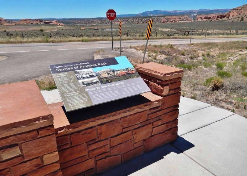
Stories of Promise Rock
Community Landmark
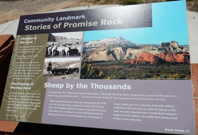
Sheep by the Thousands
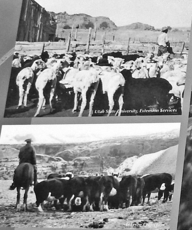
”I'd imagine there'd be 100,000 sheep sheared down there... I think they had about twenty sheep shearers — good, fast sheep shearers — and they was going all the time there..." —Jim Smith of Henrieville, recalling the sheep shearing operations near Promise Rock in the 1920s.
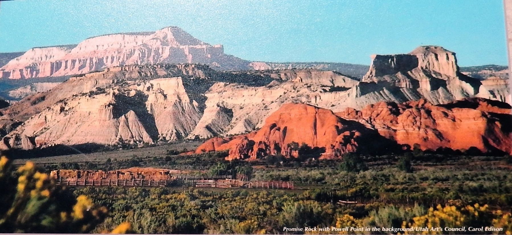
When sheep shearing time arrived each spring during the 1920s and '30s, this quiet valley erupted with activity. Near Promise Rock— the mounded sandstone formation rising out of the open range before you — a network of corrals held sheep bound for shearing pens where men hand-sheared tens of thousands of sheep. Caught up in the excitement, Henrieville children walked two miles from town to watch the shearers at their work. Even after shearing season, Promise Rock remained a magnet for local children, who walked there during school holidays to play and picnic.
Changes to the Land
”They had overgrazed the country at that time, and it was done before people realized what had happened…”
—Charlie Francisco of Henrieville, recalling Bryce Valley during the 1930s.
Before Franklin D. Roosevelt signed the Taylor Grazing Act of 1934, there were no limits on livestock grazing on public lands. Tens of thousands of cattle, sheep, and angora goats depleted local rangelands. The Taylor Grazing Act improved rangelands by authorizing grazing management.
The Promise of Promise Rock
According to local lore, a young couple were once picnicking on the rounded sandstone knob rock in the valley before you. The man asked his companion to marry him and threatened, if she refused, to push her over the edge (in jest, one hopes!). She promptly agreed, and the formation has since been called “Promise Rock.”
Topics. This historical marker is listed in these topic lists: Animals • Horticulture & Forestry.
Location. 37° 33.613′ N, 112° 1.468′ W. Marker is near Henrieville, Utah, in Garfield County. Marker is on Utah Route 12 at milepost 27, on the right when traveling west. Marker is located in a pull-out on the north side of the highway, about 2 miles west of Henrieville. Touch for map. Marker is in this post office area: Henrieville UT 84736, United States of America. Touch for directions.
Other nearby markers. At least 8 other markers are within 10 miles of this marker, measured as the crow flies. Minerals in the Mesas (here, next to this marker); Loseeville (approx. 4˝ miles away); Tropic Pioneers (approx. 5˝ miles away); Bryce Amphitheater (approx. 8.9 miles away); Streetscape (approx. 9.1 miles away);
Bryce Canyon Lodge (approx. 9.1 miles away); Post-War Service Station (approx. 9.1 miles away); Wheeling through the Years (approx. 9.1 miles away).
Also see . . . Taylor Grazing Act of 1934 (Wikipedia). During the administration of President Herbert Hoover, it became clear that federal regulation of public land use was needed to address the root causes of the Dust Bowl. Since vast portions were used for livestock grazing, the importance of range management loomed large. (Submitted on March 16, 2020, by Cosmos Mariner of Cape Canaveral, Florida.)
Credits. This page was last revised on March 16, 2020. It was originally submitted on March 15, 2020, by Cosmos Mariner of Cape Canaveral, Florida. This page has been viewed 517 times since then and 379 times this year. Photos: 1, 2, 3, 4. submitted on March 16, 2020, by Cosmos Mariner of Cape Canaveral, Florida.


