Canastota in Madison County, New York — The American Northeast (Mid-Atlantic)
Canastota's Lift Bridge
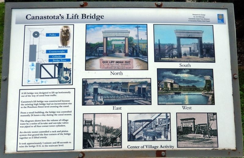
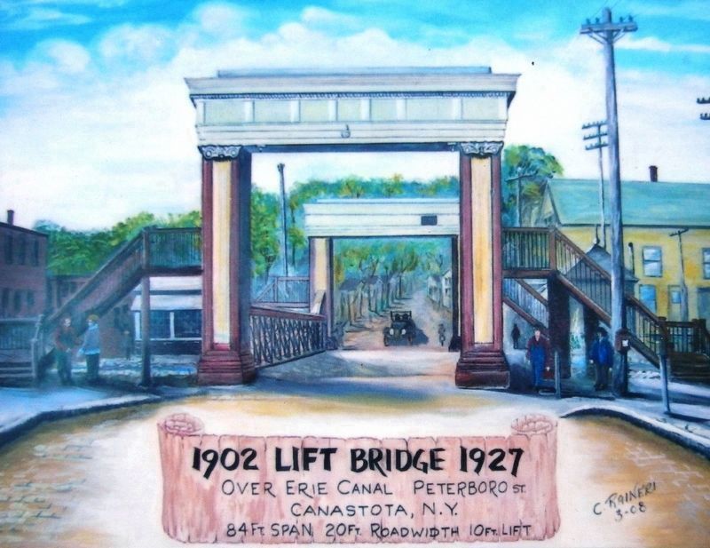
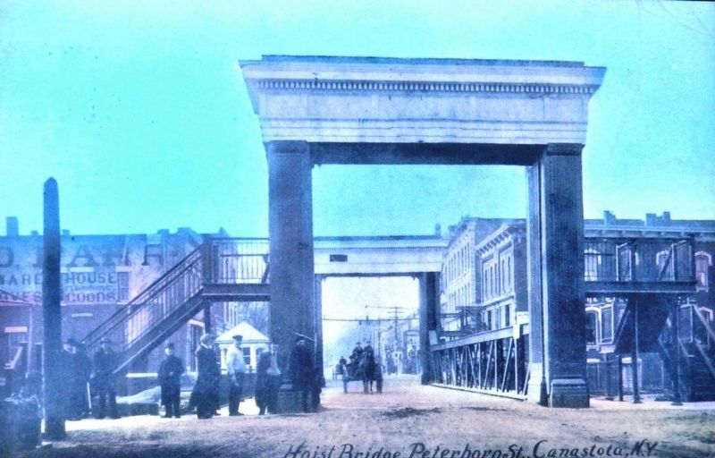
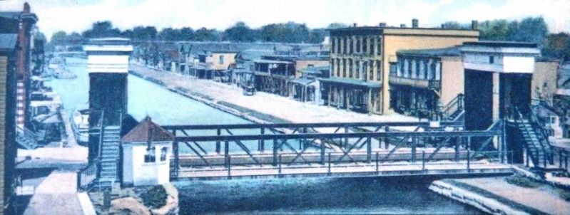
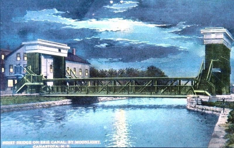
A lift bridge was designed to lift up horizontally out of the way of canal boat traffic.
Canastota's lift bridge was constructed because the existing high bridge had an inconvenient rise to the Peterboro Street level crossing the canal.
From a small building, the bridge was controlled manually 24 hours a day during the canal season.
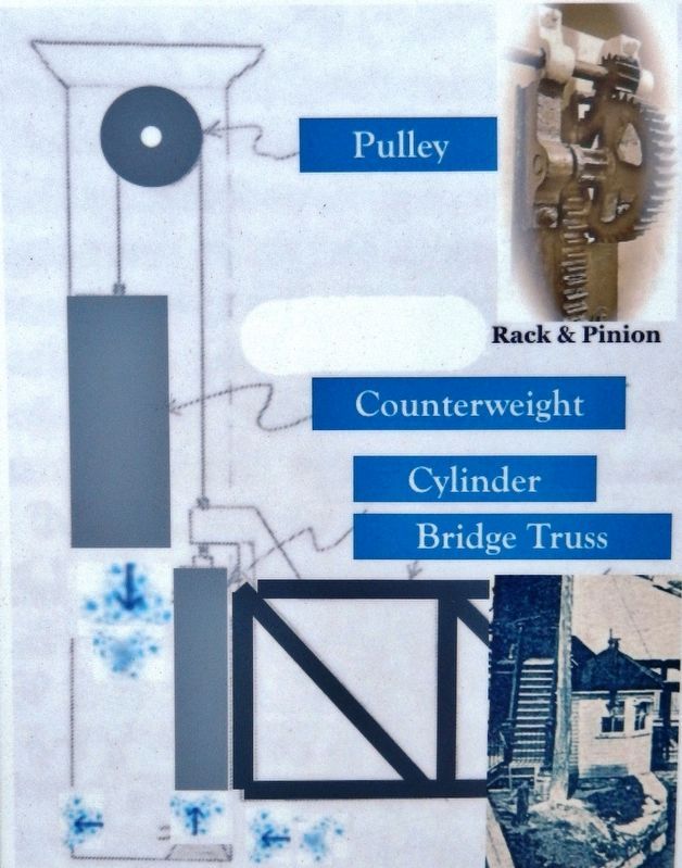
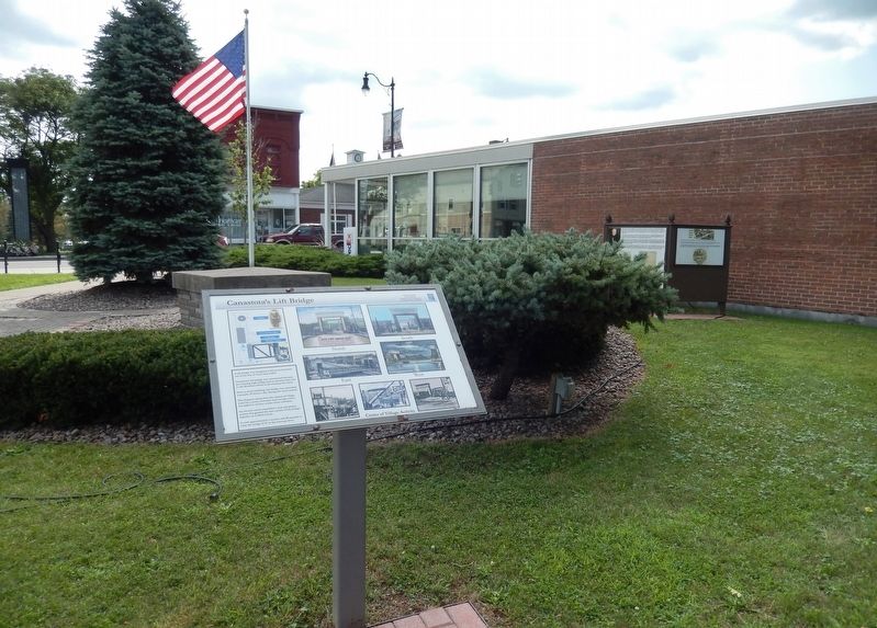
The diagram shows how the volume of village water by a series of in-take and out-take valves was piped to all four corner tower cylinders.
An electric motor controlled a rack and pinion system that geared the four corners of the bridge together so it lifted evenly.
It took approximately 1 minute and 40 seconds to raise the bridge 15 ft. to the staircase level.
Erected by Canastota Rotary Club.
Topics and series. This historical marker is listed in this topic list: Bridges & Viaducts. In addition, it is included in the Rotary International series list.
Location. 43° 4.759′ N, 75° 45.098′ W. Marker is in Canastota, New York, in Madison County. Marker is on Canal Street (County Route 76) west of South Peterboro Street (New York State Route 13), on the left when traveling west. Marker is located in an interpretive plaza on the south side of the street. Touch for map. Marker is in this post office area: Canastota NY 13032, United States of America. Touch for directions.
Other nearby markers. At least 8 other markers are within walking distance of this marker. Peterboro Street Lift Bridge (here, next to this marker); Canal Street (here, next to this marker); Canal Town (here, next to this marker); Reuben Perkins (a few steps from this marker); Canastota's Basin (within shouting distance of this marker); Enlarging the Erie Canal (within shouting distance of this marker); Industrial Growth / Canalway Trail (within shouting distance of this marker); Canastota's First Commercial Activity Occurred Along the Canal Basin of the Erie Canal (within shouting distance of this marker). Touch for a list and map of all markers in Canastota.
Credits. This page was last revised on March 23, 2020. It was originally submitted on March 21, 2020, by Cosmos Mariner of Cape Canaveral, Florida. This page has been viewed 224 times since then and 18 times this year. Photos: 1, 2, 3, 4, 5, 6, 7, 8. submitted on March 23, 2020, by Cosmos Mariner of Cape Canaveral, Florida.
