
Downtown in St. Louis, Missouri — The American Midwest (Upper Plains)
Site of the Democratic National Convention of 1876
Photographed by Jason Voigt, October 22, 2019
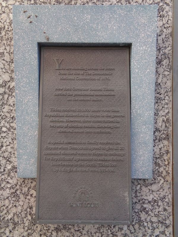
1. Site of the Democratic National Convention of 1876 Marker
You are standing across the street from the site of The Democratic National Convention of 1876.
New York Governor Samuel Tilden carried the presidential nomination on the second ballot.
Tilden received 250,000 more votes than Republican Rutherford B. Hayes in the general election. However, three states turned in two sets of election results, throwing the electoral count into confusion.
A special commission finally resolved the dispute when Democrats agreed to give all 20 contested electoral votes to Hayes in exchange for Republicans' agreement to reduce federal interference in the South. Tilden lost by a single electoral vote, 185-184.
Topics. This historical marker is listed in this topic list: Government & Politics. A significant historical year for this entry is 1876.
Location. 38° 37.595′ N, 90° 11.303′ W. Marker is in St. Louis, Missouri. It is in Downtown. It is at the intersection of North 4th Street and Pine Street, on the left when traveling north on North 4th Street. Touch for map. Marker is at or near this postal address: 100 N Broadway, Saint Louis MO 63102, United States of America. Touch for directions.

Regionally,
this page online
Other nearby markers. At least 8 other markers are within walking distance of this marker: The Mississippi Valley Trust Company (within shouting distance of this marker); Western Reach of the Revolution (about 300 feet away, measured in a direct line); Rue Quicapou (about 300 feet away); Merchant Laclede Building (about 300 feet away); La Rue Missouri (about 400 feet away); The Old Courthouse (about 400 feet away); William Clark died at this site (about 400 feet away); Dred and Harriet Scott (about 400 feet away). Touch for a list and map of all markers in St. Louis.
Other markers no longer nearby. Western Reach of the Revolution (was about 300 feet away but has been replaced with another marker now near it); Joseph Pulitzer (was about 400 feet away but
Photographed by Jason Voigt, October 22, 2019
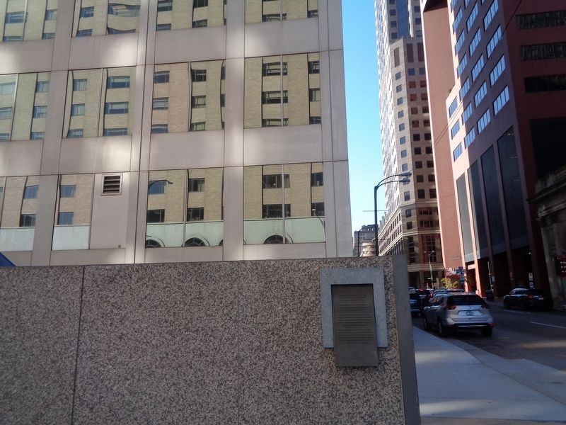
2. Site of the Democratic National Convention of 1876 Marker
Marker is at the northeastern corner of the Bank of America Tower grounds.
Also see . . .
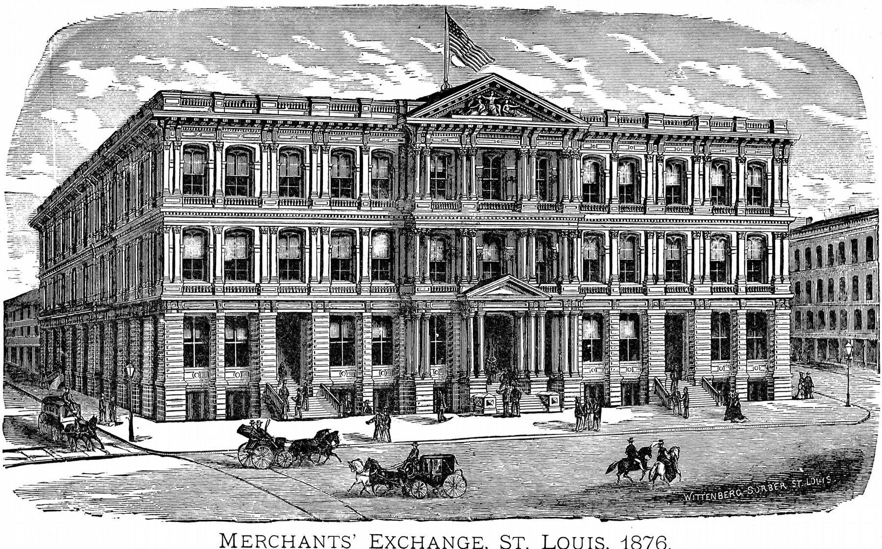
1. Merchants Exchange Building (St. Louis) on Wikipedia. This was the site of the Democratic National Convention in 1876, as mentioned on the marker. The building was known to be one of the largest indoor venues of its time. It was torn down in 1958. Hyatt Hotels now stands in its former place. (Submitted on April 5, 2020, by Jason Voigt of Glen Carbon, Illinois.)
2. Official proceedings of the National Democratic convention, St. Louis, Mo., 1876. From the Internet Archive, this is literature from the National Democratic Convention, held in St. Louis, Mo., June 27th, 28th and 29th, 1876. Contributed by the Library of Congress. (Submitted on April 5, 2020, by Jason Voigt of Glen Carbon, Illinois.)
Internet Archive
3. Merchant's Exchange. St. Louis, 1876.
From Official Proceedings of the National Democratic Convention, 1876.
Credits. This page was last revised on January 30, 2023. It was originally submitted on April 5, 2020, by Jason Voigt of Glen Carbon, Illinois. This page has been viewed 392 times since then and 22 times this year. Photos: 1, 2. submitted on April 5, 2020, by Jason Voigt of Glen Carbon, Illinois. 3. submitted on October 12, 2020, by Allen C. Browne of Silver Spring, Maryland. • Devry Becker Jones was the editor who published this page.
