Near North East in Cecil County, Maryland — The American Northeast (Mid-Atlantic)
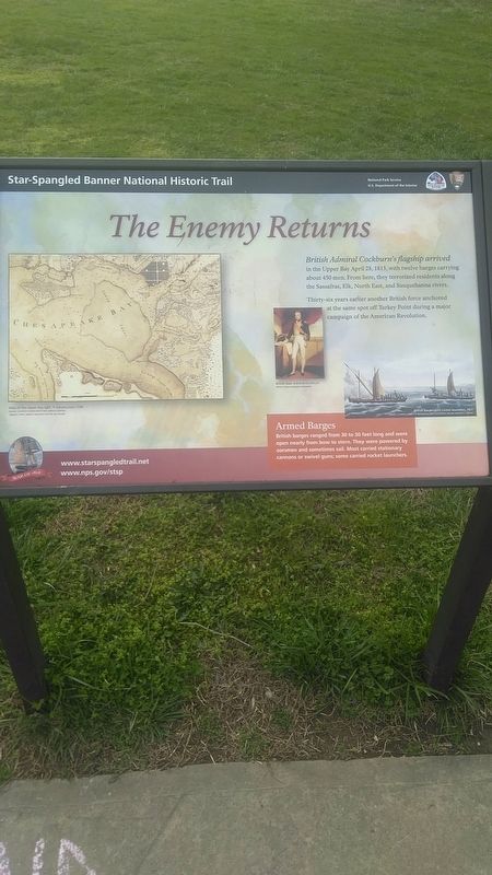
The Enemy Returns
Star Spangled Banner National Historic Trail
Thirty-six years earlier another British force anchored at the same spot off Turkey Point during a major campaign of the American Revolution.
Armed Barges
British barges ranged from 30 to 50 feet long and were open nearly from bow to stern. They were powered by oarsmen and sometimes sail. Most carried stationary cannons or swivel guns; some carried rocket launchers.
[caption at left]
Map of the Upper Bay by C. P. Hauducoeur, 1799
Image / Courtesy Enoch Pratt Free Library; Central
Library / State Library Resource Center, Baltimore
[caption at center]
British Rear Admiral Cockburn
Image / Royal Museums Greenwich
[caption at right; right justified]
British barges with rocket launchers, 1827
Image / Courtesy Anne S. K. Brown Military Collection, Brown University Library
Erected by National Park Service, U.S. Department of the Interior.
Topics. This historical marker is listed in these topic lists: War of 1812 • War, US Revolutionary. A significant historical date for this entry is April 28, 1813.
Location. 39° 26.998′ N, 76° 0.506′ W. Marker is near North East, Maryland, in Cecil County. Marker can be reached from Turkey Point Lighthouse Trail. This is at Turkey Point in Elk Neck State Park. To reach it takes a walk of more than a mile from the southern end of Route 272, where there is a parking lot and no permission to travel any further by car. Touch for map. Marker is in this post office area: North East MD 21901, United States of America. Touch for directions.
Other nearby markers. At least 8 other markers are within 5 miles of this marker, measured as the crow flies. Welcome to Turkey Point! (here, next to this marker); Sentinel on the Bay (approx. 0.7 miles away); Why Build a Lighthouse? (approx. 0.7 miles away); An Earthly Paradise (approx. 3.2 miles away); Bird’s Eye View (approx. 3.2 miles away); Hazelmore (approx. 3.7 miles away); Rose Hill (approx. 4.4 miles away); Cherry Grove (approx. 4˝ miles away). Touch for a list and map of all markers in North East.
Credits. This page was last revised on April 6, 2020. It was originally submitted on April 5, 2020, by Carl Gordon Moore Jr. of North East, Maryland. This page has been viewed 150 times since then and 12 times this year. Last updated on April 5, 2020, by Carl Gordon Moore Jr. of North East, Maryland. Photo 1. submitted on April 5, 2020, by Carl Gordon Moore Jr. of North East, Maryland. • Bill Pfingsten was the editor who published this page.
