Murray Harbour in Kings County, Prince Edward Island — The Atlantic Provinces (North America)
Getting the Train to the Track / L’Arrivée du Train sur la Voie Ferrée
Inscription.
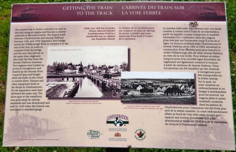
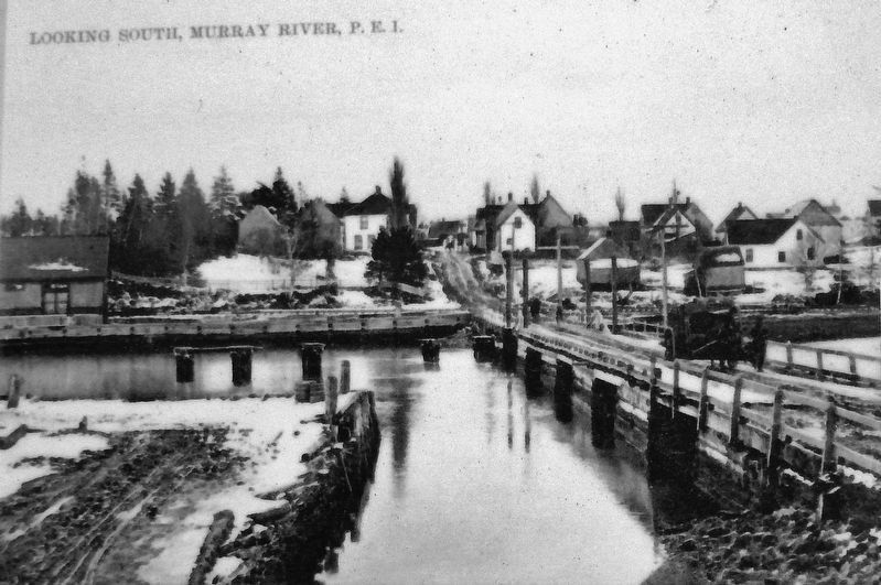
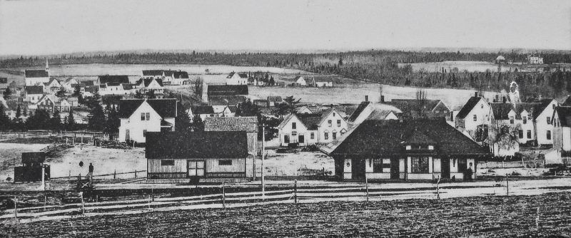
The normal way to build a railway is to start at one end using an engine and flatcars to deliver materials to the end-of-track. The branch built between Charlottetown and Murray Harbour between 1901 and 1904 required a new bridge across the Hillsborough River to connect it to the rest of the line. In order to complete both the bridge and the new line railway at the same time, engineers also built the line from the Murray Harbour terminus. Two engines were loaded on scows in Georgetown and hauled up the Murray River. A special spur and freight shed was built on the wharf to receive them. Flatcars and other equipment built at the shops in Charlottetown for the expansion were later delivered the same way. The short spur to the waterfront was quite steep by railway standards and was abandoned and sold in 1930 when the branch was converted to standard gauge.
With over 400 km of paths, Prince Edward Island's Confederation Trail is a wonderful way to explore our beautiful Island.
La manière habituelle de construire une voie ferrée consiste à commencer à l'une de ses extrémités à partir de laquelle on peut transporter le matériel nécessaire à la construction dans des wagons plats tirés par une locomotive jusqu'à la fin de la ligne. Le tronçon construit entre Charlottetown et Murray Harbour entre 1901 et 1904 nécessitait la construction d'un nouveau pont pour franchir la rivière Hillsborough afin de relier Murray Harbour au reste de la voie ferrée. Pour réaliser en même temps le pont et la nouvelle ligne ferroviaire, les ingénieurs ont également construit le tronçon à partir du terminus de Murray Harbour. Deux locomotives ont été installées sur des chalands à Georgetown pour être transportées sur la rivière Murray. Sur le quai, on avait construit un embranchement et un hangar à marchandises pour les recevoir. Les wagons plats et autres matériels construits dans les ateliers de' Charlottetown pour l'expansion ont été livrés plus tard de la même manière. Le court embranchement allant au bord de l'eau était assez escarpé par rapport aux normes ferroviaires et il a été abandonné et vendu en 1930 lors de la conversion du tronçon à l'écartement normal.
Le Sentier de la Confédération est composé de plus de 400 km de pistes cyclables qui vous mèneront d'un bout à l'autre de la province.
Erected by Prince Edward Island Museum & Heritage, Confederation Trail, and Trans Canada Trail.
Topics. This historical
marker is listed in this topic list: Railroads & Streetcars. A significant historical year for this entry is 1901.
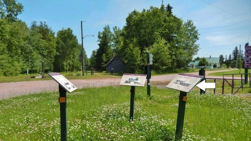
Location. 46° 0.307′ N, 62° 31.691′ W. Marker is in Murray Harbour, Prince Edward Island, in Kings County. Marker is on Station Lane just south of Cape Bear Road (Main Street) (Provincial Route 18), on the right when traveling south. Marker is located beside the Confederation Trail in Railhead Park. Touch for map. Marker is at or near this postal address: 19 Station Lane, Murray Harbour PE C0A 1V0, Canada. Touch for directions.
Other nearby markers. At least 8 other markers are within 21 kilometers of this marker, measured as the crow flies. The Fishery at Murray Harbour / La Pêche À Murray Harbour (here, next to this marker); Cape Bear Lighthouse / Phare de Cape Bear (here, next to this marker); The “Harbour” / Le « Harbour » (approx. 0.4 kilometers away); Murray Harbour War Memorial (approx. 0.7 kilometers away); Cape Bear (approx. 5.4 kilometers away); The Murray Harbour Branch / L’Embranchement Menant À Murray Harbour (approx. 6.3 kilometers away); Georgetown’s New Railway Station (approx. 19.5 kilometers away); Three Rivers (approx. 19.5 kilometers away). Touch for a list and map of all markers in Murray Harbour.
Also see . . .
1. Prince Edward Island Railway (Wikipedia). The Prince Edward Island Railway (PEIR) was a historic Canadian railway
on Prince Edward Island (PEI). The railway ran tip-to-tip on the island, from Tignish in the west to Elmira in the east, with major spurs serving Borden-Carleton's train ferry dock, the capital in Charlottetown, Montague and Georgetown and the original eastern terminus at Souris. A major spur from Charlottetown served Murray Harbour on the south coast. (Submitted on April 11, 2020, by Cosmos Mariner of Cape Canaveral, Florida.)
2. Prince Edward Island Railway Explained. The Murray Harbour Line started at the end of the mainline spur in Charlottetown, crossing the Hillsborough River Bridge (the original pilings can still be seen) before bending sharply to the northeast through Bunbury. (Submitted on April 11, 2020, by Cosmos Mariner of Cape Canaveral, Florida.)
Credits. This page was last revised on April 12, 2020. It was originally submitted on April 11, 2020, by Cosmos Mariner of Cape Canaveral, Florida. This page has been viewed 106 times since then and 13 times this year. Photos: 1, 2, 3, 4. submitted on April 11, 2020, by Cosmos Mariner of Cape Canaveral, Florida.


