Financial District in Manhattan in New York County, New York — The American Northeast (Mid-Atlantic)
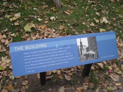
The Building
Photographed by Bill Coughlin, June 24, 2009
1. The Building Marker
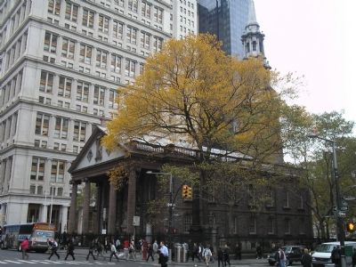
Andrew Gauthier built St. Paul’s Chapel in 1766 – a perfect example of Georgian Classic-Revival style architecture. Surrounded by farmland and orchard, this remote “country church” accommodated parishioners living on the outskirts of town. With the addition of the steeple in 1794, many considered St. Paul’s the most elegant and imposing church edifice in the city.
Topics. This historical marker is listed in this topic list: Religion & Religious Structures. A significant historical year for this entry is 1766.
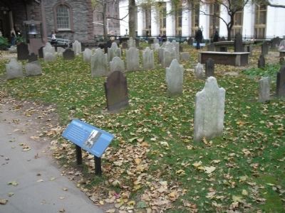
Location. 40° 42.691′ N, 74° 0.583′ W. Marker is in Manhattan, New York, in New York County. It is in the Financial District. It can be reached from Vesey Street, on the right when traveling east. Marker is located in the churchyard behind St. Paul’s Chapel. Touch for map. Marker is in this post office area: New York NY 10007, United States of America. Touch for directions.

Regionally, this marker is in New York City. It is also in the American Northeast, in the Mid-Atlantic, and on the Eastern Seaboard. Globally, it is in the North Atlantic Region, North America, the Western Hemisphere, the
this page online
Other nearby markers. At least 8 other markers are within walking distance of this marker: Lt. Col. E.M. Bechet, Sieur de Rochefontaine (here, next to this marker); St. Paul's Chapel - the Building (here, next to this marker); Majors Job Sumner and John Lucas (a few steps from this marker); Standing Against All Odds (a few steps from this marker); The Churchyard (a few steps from this marker); St. Paul’s and the World Trade Center (a few steps from this marker); a different marker also named Bell of Hope (a few steps from this marker); John Holt (a few steps from this marker). Touch for a list and map of all markers in Manhattan.
Another marker is no longer nearby. Bell of Hope (was a few steps from this marker but has been permanently removed).
More about this marker. The right side of the marker contains a photo of St. Paul’s Chapel.
Regarding The Building. The building is listed in the “American Institute of Architecture (AIA) Guide to New York City, Fifth Edition”.
Also see . . . The 1766 St. Paul's Chapel -- Broadway and Fulton Street.
Photographed by Bill Coughlin, June 24, 2009
2. Marker in St. Paul's Churchyard
The back side of the church can be seen on the left in the photo.
Photographed by Bill Coughlin, June 24, 2009
3. St. Paul's Chapel
Credits. This page was last revised on January 31, 2023. It was originally submitted on June 14, 2011, by Bill Coughlin of Woodland Park, New Jersey. This page has been viewed 673 times since then and 15 times this year. Last updated on April 12, 2020, by Larry Gertner of New York, New York. Photos: 1, 2, 3. submitted on June 14, 2011, by Bill Coughlin of Woodland Park, New Jersey. • Bill Pfingsten was the editor who published this page.
