Waterford in Saratoga County, New York — The American Northeast (Mid-Atlantic)
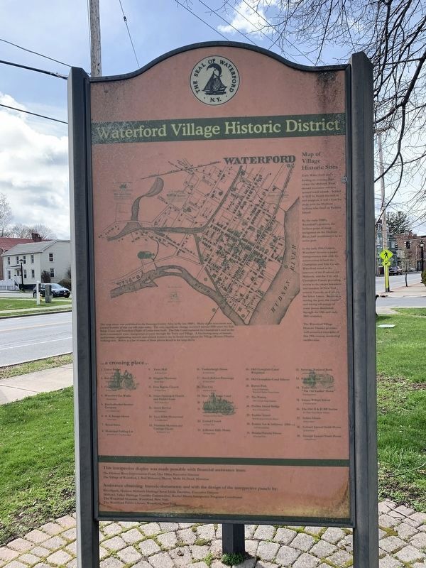
Waterford Village Historic District
Map of Village Historic Sites
Early Water Ford was a fording place or crossing place where the Mohawk River slowed to narrow streams around small islands. Settled in 1622 by Dutch fur traders and trappers. It was a base for trade with the Mahican Indians who lived on Peebles Island.
By the early 1700’s, Waterford’s position, the farthest point of sloop navigation on the Hudson River, had established it as an active port.
In the early 19th Century, Waterford became a major transportation hub with the construction of both the Champlain and Erie Canals. Waterford stood at the juncture of the Hudson and Mohawk, and the Erie and Champlain Canals providing access to the major resources and markets of New York, eastern Canada, and west to the Great Lakes. Businesses serving the port, the canals, and taking advantage of water power flourished through the 19th and early 20th centuries.
The Waterford Village Historical District provides well preserved examples of fine 19th century residential architecture.
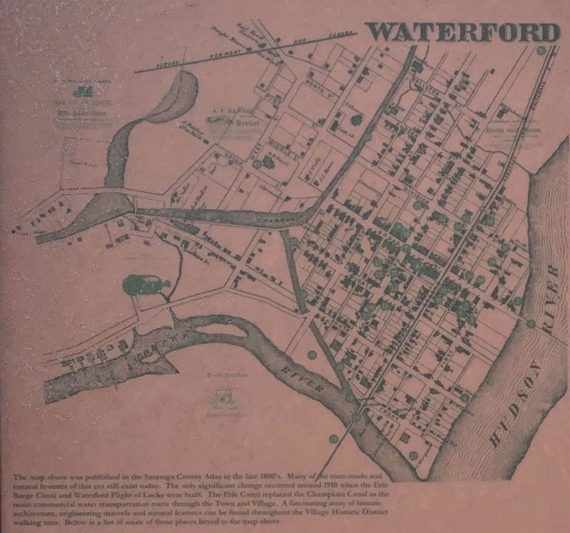
The map above was published in the Saratoga County Atlas in the late 1800's. Many of the man-made and natural features of this era still exist today. The only significant change occurred around 1910 when the Erie Barge Canal and Waterford Flight of Locks were built. The Erie Canal replaced the Champlain Canal as the main commercial water transportation route through the Town and Village. A fascinating array of historic architecture, engineering marvels and natural features can be found throughout the Village Historic District walking tour. Below is a list of some of those places keyed to the map above.
List of Map Locations
1. Union Bridge – foot of Broad Street
2. Knickerbocker Park – foot of Broad Street
3.Classic Hall – First Street
4. Waterford Gas Works -1 South Street
5. Knickerbocker Steamer Company - 1½ Pearl Street
6. R.A. Savage House – 3 Pearl Street
7. Broad Street
8. Municipal Parking Lot – Broad Street at Tug Boat Alley
9. Town Hall – 65 Broad Street
10. Higgins Pharmacy – Broad Street
11. First Baptist Church – 35 Third Street
12. Grace Episcopal Church and Parish House – 30-34 Third Street
13. Greek Revival – 24 Third Street
14. Issac Eddy Homestead - 27 Middle Street
15. Victorian Mansion and Carriage House - 36 Middle Street
16. Vandenbergh House – 22 Third Street
17. Dutch Reform Parsonage – 20 Third Street
18. Dial City – Mohawk Avenue
19. New York Barge Canal
20 Tow Path and Lock Park
21. Van Schoonhoven Stable and Carriage

Photographed By Steve Stoessel, April 10, 2020
2. Waterford Village Historic District Map
The map above was published in the Saratoga County Atlas in the late 1800's. Many of he man-made and
natural features of this era still exist today. The only significant change occurred around 1910 when the Erie
Barge Canal and Waterford Flight of Locks were built. The Erie Canal replaced the Champlain Canal as the
main commercial water transportation route through the Town and Village. A fascinating array of historic
architecture, engineering marvels and natural features can be found throughout the Village Historic District
walking tour. Below is a list of sorne of those places keyed to the map above.
22. United Church – 61 Third Street
23. Jefferson Eddy House – 60 Third Street
24. Old Champlain Canal Weightblock
25. Old Champlain Canal Sidecut
26. Button Park – Foot of Third Street
27. The Battery – 18th Century Sloop Terminal
28. Peebles Island Bridge – Foot of Second Street
29. Peebles Island
30. Former Inn & Infirmary (18th c.) 43-47 Second Street
31 Breslin-Ormsby House – 51 Second Street
32. Saratoga National Bank – 23 Broad
33. Raleigh Manor - 61 Second Street
34. Tudor Arms “The Old Ladies Home” – 70 Second Street
35. Emma Willard School – 77 Second Street
36. The Old D&H RR Station - 117 Third Street
37. Schine House - 68 First Street
38. Colonel Samuel Smith House - 64 First Street
39. General Samuel Stuart House – 15 Broad Street
This interpretative display was made possible with the financial assistance from:
The Hudson River Improvement Fund, Clay Hiles, Executive Director
The Village of Waterford, J. Ben Mahoney , Mayor , Merle H. Doud, Historian
Assistance obtaining historic documentation and with the design of the interpretative panels by:
RiverSpark, Hudson Mohawk Heritage Area, Linda Tremblay, Executive Director
Mohawk Valley Heritage Corridor Commission, Rachel D. Bliven, Interpretative Program Coordinator
The Waterford Museum, The Waterford Public Library - Waterford, New York
Topics. This historical marker is listed in this topic list: Settlements & Settlers. A significant historical year for this entry is 1910.
Location. 42° 47.362′ N, 73° 40.542′ W. Marker is in Waterford, New York, in Saratoga County. Marker is at the intersection of Broad Street (U.S. 4) and First Street on Broad Street. Touch for map. Marker is in this post office area: Waterford NY 12188, United States of America. Touch for directions.
Other nearby markers. At least 8 other markers are within walking distance of this marker. Village of Waterford (here, next to this marker); Troy - Waterford Bridge (here, next to this marker); Waterford (a few steps from this marker); Gen. Henry Knox Trail (within shouting distance of this marker); Birthplace of Howard Lindsay (within shouting distance of this marker); Waterford War Memorial (within shouting distance of this marker); Waterford N.Y. (within shouting distance of this marker); Waterford Bridges (within shouting distance of this marker). Touch for a list and map of all markers in Waterford.
Credits. This page was last revised on April 22, 2020. It was originally submitted on April 16, 2020, by Steve Stoessel of Niskayuna, New York. This page has been viewed 397 times since then and 47 times this year. Last updated on April 20, 2020, by Steve Stoessel of Niskayuna, New York. Photos: 1. submitted on April 20, 2020, by Steve Stoessel of Niskayuna, New York. 2. submitted on April 16, 2020, by Steve Stoessel of Niskayuna, New York. • Michael Herrick was the editor who published this page.
