Spokane in Spokane County, Washington — The American West (Northwest)
Symbol of Spokane
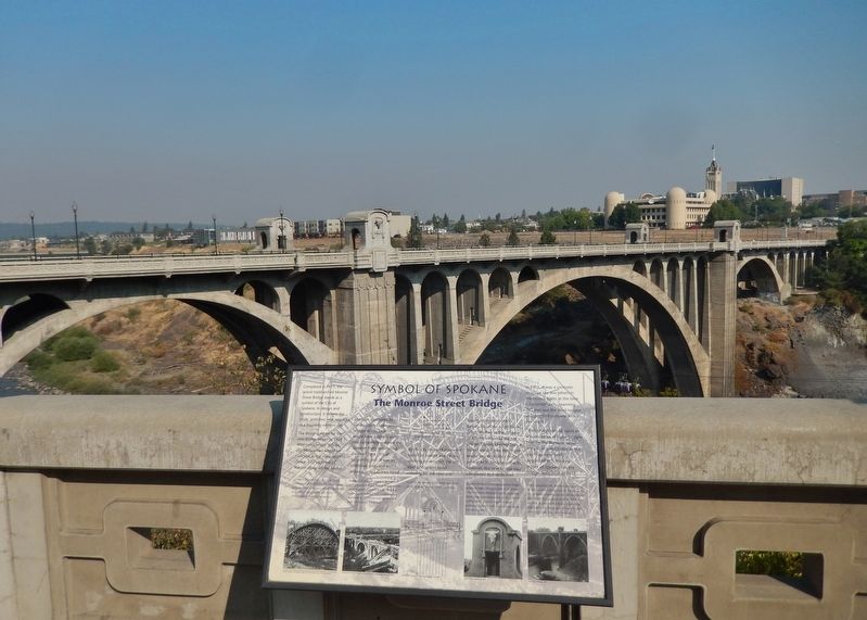
The Monroe Street Bridge
• Central arch span: 281 feet
• Side arch spans: 120 feet
• Height (at railing): 136 feet
• Cost: $535,000 (half went to labor)
Completed in 1911, the grand triple-arched Monroe Street Bridge stands as a symbol of the City of Spokane. In design and construction, it reflects the pride, ambition, and nostalgia of a booming western city.
The design process for the new bridge began in 1909. After considerable debate, city officials had settled on concrete as the material of choice. City engineer J.C. Ralston designed the bridge and later supervised its construction. Unlike previous bridges at this location, it would have a central arch that completely spanned the Spokane River, eliminating the need for a central supporting pier. It was an ambitious goal, and an arduous task. Laborers hired by the city dangled above the rapids on towers and cables, working to demolish the old steel bridge and build cribbing for the new one.
Shortly after demolition began, fill on the south bank failed, leading to the collapse of a large section of the old bridge. During construction, a violent wind-storm destroyed weeks' worth of labor on the central arch. Despite setbacks, however, the new bridge was completed and dedicated in 1911. It was a concrete structure like few others in the United States at the time — its central arch, spanning 281 feet was the third longest unsupported concrete arch in the world.
“This bridge should stand as long as some of those bridges built by the Romans, which are just as good today as the day they were built,” suggested W.J. Hindley, mayor of Spokane, at the bridge dedication in 1911.
Topics. This historical marker is listed in these topic lists: Architecture • Bridges & Viaducts. A significant historical year for this entry is 1911.
Location. 47° 39.591′ N, 117° 25.541′ W. Marker is in Spokane, Washington, in Spokane County. Marker is on West Spokane Falls Boulevard west of North Lincoln Street, on the right when traveling west. Marker is located beside the sidewalk, overlooking the subject Monroe Street Bridge. Touch for map. Marker is in this post office area: Spokane WA 99201, United States of America. Touch for directions.
Other nearby markers. At least 8 other markers are within walking distance of this marker. The First Bridges (a few steps from this marker); Monroe Street Bridge (a few steps from this marker); Spokane River (within shouting distance of this marker); Abraham Lincoln (about 300 feet away, measured in a direct line); Monroe Bridge (about 500 feet away); City Hall (about 500 feet away); John Robert Monaghan (about 500 feet away); Thomas S. Foley United States Courthouse (about 600 feet away). Touch for a list and map of all markers in Spokane.
Regarding Symbol of Spokane.
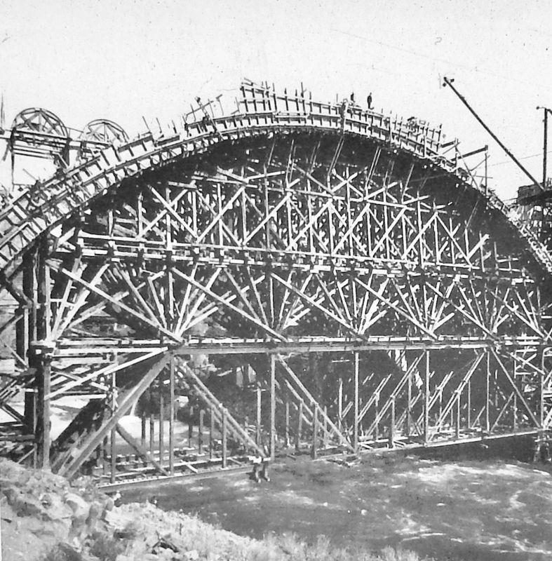
2. Marker detail: Bridge Construction Trestle
Courtesy of the Northwest Museum of Arts & Culture/Eastern Washington State Historical Society, Spokane, Washington, (L94-9.131) (This photo is also the marker background image).
Related markers. Click here for a list of markers that are related to this marker. Monroe Street Bridge
Also see . . . Monroe Street Bridge. Today’s Monroe Street Bridge is the third bridge on this site. The first Monroe Street Bridge was constructed of wood and built with horses and wagons in mind. A new Monroe Street Bridge constructed of steel was completed in 1890. It was immediately apparent that the bridge vibrated heavily, perhaps dangerously, with any sort of traffic. Today’s Monroe Street Bridge opened November 23, 1911 with over 3,000 Spokane citizens on hand to celebrate. It was the world’s largest concrete arch-bridge. (Submitted on April 21, 2020, by Cosmos Mariner of Cape Canaveral, Florida.)
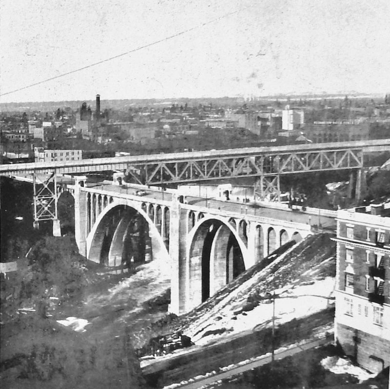
3. Marker detail: Union Pacific Railroad Trestle
Courtesy of the Teakle Collection, Northwest Room, Spokane Public Library (92.584)
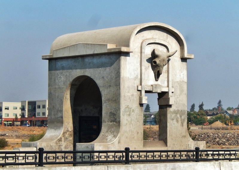
Photographed By Cosmos Mariner, August 2, 2015
5. Monroe Street Bridge detail
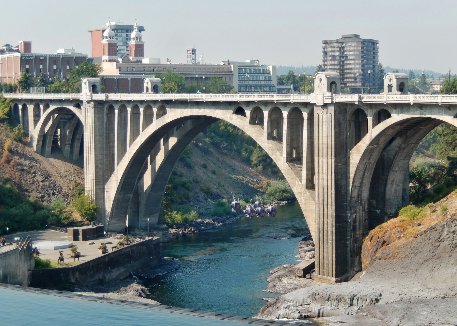
Photographed By Cosmos Mariner, August 2, 2015
6. Monroe Street Bridge
Credits. This page was last revised on April 21, 2020. It was originally submitted on April 20, 2020, by Cosmos Mariner of Cape Canaveral, Florida. This page has been viewed 245 times since then and 32 times this year. Photos: 1, 2, 3, 4, 5, 6. submitted on April 21, 2020, by Cosmos Mariner of Cape Canaveral, Florida.

