Amarillo in Potter County, Texas — The American South (West South Central)
St. Francis Catholic Church Community
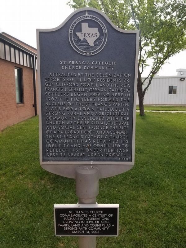
Attracted by the colonization efforts of Illinois residents Dr. Guy Clifford Powell and the Rev. Francis J. Oreilly, German Catholic settlers began moving here in 1907. The pioneers formed the nucleus of the St. Francis Parish. Plans for a town failed, but a strong rural and agricultural community developed with the church as the spiritual, cultural and social center. Once the site of a railroad depot and a school, the St. Francis Catholic Church community has retained its identity and has continued to reflect its pioneer heritage despite nearby urban growth.
Additional, smaller marker:
St. Francis Church commemorates a century of eucharistic celebrations growing in love of God, family, land and country as a strong faith community.
March 13, 2008
Erected 1983 by Texas Historical Commission. (Marker Number 5032.)
Topics. This historical marker is listed in this topic list: Churches & Religion.
Location. 35° 15.773′ N, 101° 37.662′ W. Marker is in Amarillo, Texas, in Potter County. Marker is on Klinke Road, on the right when traveling west. Touch for map. Marker is at or near this postal address: 5005 Klinke Road, Amarillo TX 79108, United States of America. Touch for directions.
Other nearby markers. At least 8 other markers are within 9 miles of this marker, measured as the crow flies . Liberty Cemetery (approx. 4˝ miles away); Gerald Holtom (approx. 4.8 miles away); Did You Know - Americans Killed During (approx. 4.8 miles away); First Transcontinental Air Service to Texas Panhandle, Amarillo Municipal Airport (approx. 5.6 miles away); Fort Smith-Santa Fe Trail (approx. 5.7 miles away); Town of Washburn (approx. 6.7 miles away); The Big Texan Steak Ranch, Amarillo, Texas (approx. 8.6 miles away); A Route 66 Legend (approx. 8.6 miles away). Touch for a list and map of all markers in Amarillo.
Credits. This page was last revised on May 7, 2020. It was originally submitted on May 6, 2020, by Allen Lowrey of Amarillo, Texas. This page has been viewed 146 times since then and 13 times this year. Photos: 1, 2, 3. submitted on May 6, 2020, by Allen Lowrey of Amarillo, Texas. • J. Makali Bruton was the editor who published this page.


