Spring Hill in Williamson County, Tennessee — The American South (East South Central)
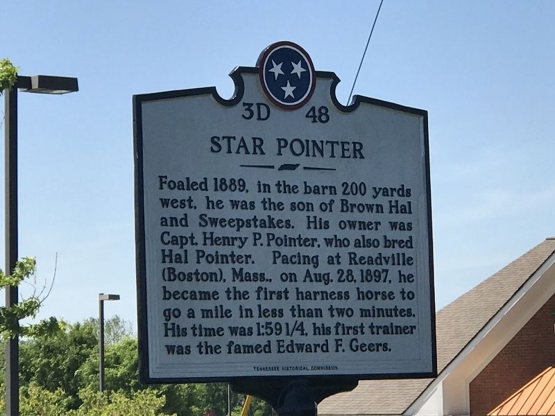
Star Pointer
Erected by Tennessee Historical Commission. (Marker Number 3D 48.)
Topics and series. This historical marker is listed in these topic lists: Animals • Sports. In addition, it is included in the Tennessee Historical Commission series list. A significant historical date for this entry is August 28, 1897.
Location. 35° 46.126′ N, 86° 55.108′ W. Marker is in Spring Hill, Tennessee, in Williamson County. Marker is on Columbia Pike (U.S. 31) 0.7 miles north of Belshire Way, on the right when traveling south. Touch for map. Marker is at or near this postal address: 3012 Belshire Village Drive, Spring Hill TN 37174, United States of America. Touch for directions.
Other nearby markers. At least 8 other markers are within 2 miles of this marker, measured as the crow flies. Hood and Schofield (approx. 0.6 miles away); William Banks Caperton (approx. 1.2 miles away); Grace Episcopal Church (approx. 1.3 miles away); Ritter-Morton Cottage (approx. 1.4 miles away); Spring Hill, Tennessee ~ November 29, 1864 (approx. 1.4 miles away); The Town of Spring Hill, Tennessee (approx. 1.4 miles away); Ewell Farm (approx. 1.4 miles away); Spring Hill Presbyterian Church (approx. 1.6 miles away). Touch for a list and map of all markers in Spring Hill.
Credits. This page was last revised on February 27, 2021. It was originally submitted on May 9, 2020, by Duane and Tracy Marsteller of Murfreesboro, Tennessee. This page has been viewed 302 times since then and 10 times this year. Photos: 1, 2. submitted on May 9, 2020, by Duane and Tracy Marsteller of Murfreesboro, Tennessee. • Devry Becker Jones was the editor who published this page.

