College Grove in Williamson County, Tennessee — The American South (East South Central)
College Grove, Tennessee
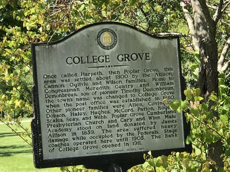
Once called Harpeth, then Poplar Grove, this area was settled about 1800 by the Allison, Cannon, Ogilvie and Wilson families. Home to Congressman Meredith Gentry and William Demonbreun, son of pioneer Timothy Demonbreun, the town's name was changed to College Grove when the post office was established in 1860. Other pioneer families were Allen, Covington, Dobson, Haley, Hughes, McCord, Patton, Rogers, Scales, Seay, and Webb. Poplar Grove Cumberland Presbyterian Church and Cary and Winn Male Academy stood on land donated by James Allison in 1859. The area suffered heavy damage while occupied by the Federals. Stage coaches operated here until 1905. The Bank of College Grove opened in 1911.
Erected 1997 by Williamson County Historical Society.
Topics and series. This historical marker is listed in this topic list: Settlements & Settlers. In addition, it is included in the Tennessee – Williamson County Historical Society series list. A significant historical year for this entry is 1800.
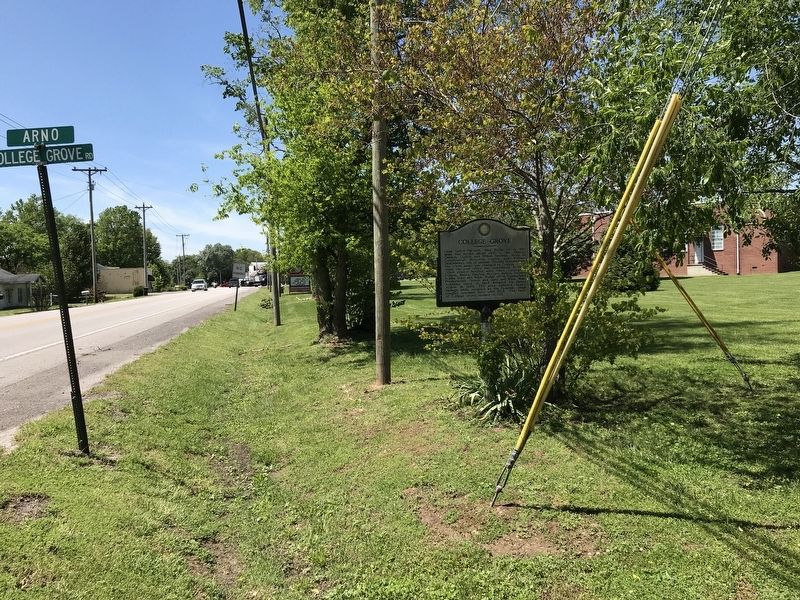
Location. 35° 47.251′ N, 86° 40.519′ W. Marker is in College Grove, Tennessee, in Williamson County. Marker is at the intersection of Horton Highway (Alternate U.S. 31) and Arno-College Grove Road, on the right when traveling south on Horton Highway. Touch for map. Marker is at or near this postal address: 8573 Horton Hwy, College Grove TN 37046, United States of America. Touch for directions.
Other nearby markers. At least 8 other markers are within 4 miles of this marker, measured as the crow flies. College Grove Methodist Church (about 300 feet away, measured in a direct line); Ogilvie Farm (approx. 1.1 miles away); Absalom Scales House (approx. 2.2 miles away); Newton Cannon (approx. 2.2 miles away); Owen Hill (approx. 2.3 miles away); Eagleville Baptist Church (approx. 3.4 miles away); The Cove (approx. 3.7 miles away); Rucker Cemetery (approx. 3.8 miles away). Touch for a list and map of all markers in College Grove.
Also see . . . History of College Grove. From the January, 2011 edition of The Eagleville Times. (Submitted on May 10, 2020, by Duane and Tracy Marsteller of Murfreesboro, Tennessee.)
Credits. This page was last revised on April 20, 2024. It was originally submitted on May 10, 2020, by Duane and Tracy Marsteller of Murfreesboro, Tennessee. This page has been viewed 915 times since then and 104 times this year. Photos: 1, 2. submitted on May 10, 2020, by Duane and Tracy Marsteller of Murfreesboro, Tennessee. • Devry Becker Jones was the editor who published this page.

