Near Vivian in Lyman County, South Dakota — The American Midwest (Upper Plains)
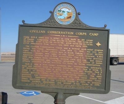
Civilian Conservation Corps Camp
The Civilian Conservation Corps was a federal work-relief program during the Great Depression. From 1933 to 1942, the CCC provided work for 31,097 jobless men in South Dakota—about 22,000 enrollees (single men aged 17-25), about 1,700 veterans, 4,554 American Indians and 2,834 supervisors. The U.S. Army provided 200-man camps, food, clothing, medical care and pay, and educational, recreational and religious programs. The Office of Indian Affairs provided similar services for units on Indian reservations.
SCS-2 was a tent camp; however, the headquarters, infirmary, mess and latrine were in wooden buildings. Byre Dam 3 miles N of Kennebec, Fate Dam 3 miles N of Presho and Brakke Dam 5 miles E of Presho were built under the supervision of the U.S. Forest Service (1934) and Soil Conservation Service. The dams provided two recreational lakes and the city water supply for Kennebec. Equipment evolved from shovels, wheelbarrows, horse drawn machines and a few 1-1/2-on trucks in 1934 to graders, loaders, packers, excavators, and several 3-ton trucks in 1938.
Erected 1990 by CCC alumni, The South Dakota State Historical Society, The State Department Of Transportation and the Soil Conservation Service. (Marker Number 514.)
Topics and series. This historical marker is listed in this topic list: Charity & Public Work. In addition, it is included in the Civilian Conservation Corps (CCC), and the South Dakota State Historical Society Markers series lists. A significant historical year for this entry is 1934.
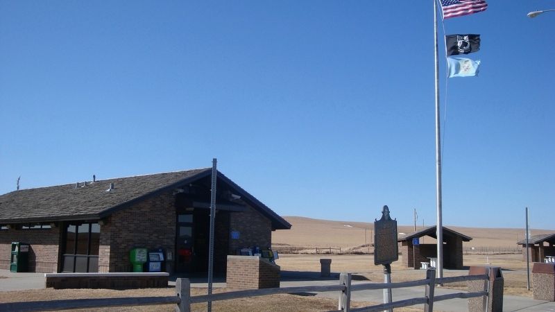
Location. 43° 54.698′ N, 100° 11.989′ W. Marker is near Vivian, South Dakota, in Lyman County. Marker can be reached from I-90 (Interstate I-90) 5.6 miles US 83 (U.S. 83), on the right when traveling east. Located in the Vivian Eastbound Rest Area on Interstate 90. Touch for map. Marker is in this post office area: Vivian SD 57576, United States of America. Touch for directions.
Other nearby markers. At least 6 other markers are within 8 miles of this marker, measured as the crow flies. Purple Heart Memorial Highway (here, next to this marker); Medicine Creek Rest Area (here, next to this marker); World's Only Corn Palace - Mitchell (a few steps from this marker); a different marker also named Medicine Creek Rest Area (approx. 2.8 miles away); How Come They Called it Presho (approx. 7.2 miles away); Lyman County, South Dakota Veterans Memorial (approx. 7.2 miles away).
Credits. This page was last revised on October 26, 2021. It was originally submitted on May 11, 2020, by Roger Dean Meyer of Yankton, South Dakota. This page has been viewed 138 times since then and 18 times this year. Last updated on October 25, 2021. Photos: 1, 2. submitted on May 11, 2020, by Roger Dean Meyer of Yankton, South Dakota. • J. Makali Bruton was the editor who published this page.

