Mayfield in Sanpete County, Utah — The American Mountains (Southwest)
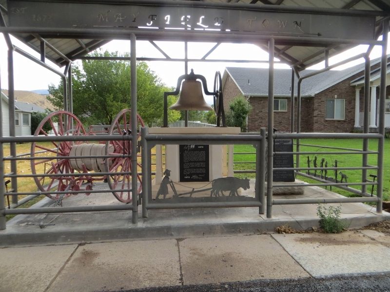
Mayfield Centennial
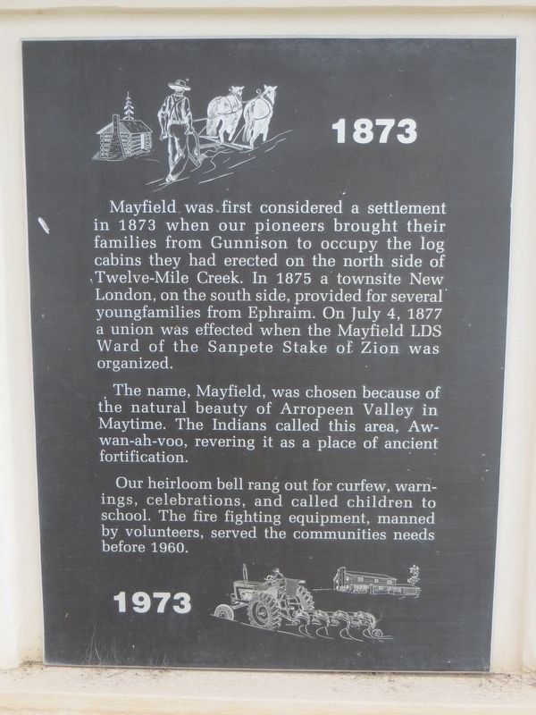
1873 - 1973
The name, Mayfield, was chosen because of the natural beauty of Arropeen Valley in Maytime. The Indians called this area, Aw-wan-ah-voo, revering it as a place of ancient fortification.
Our heirloom bell rang out for curfew, warnings, celebrations, and called children to school. The fire fighting equipment, manned by volunteers, served the communities needs before 1960.
Topics. This historical marker is listed in this topic list: Settlements & Settlers. A significant historical date for this entry is July 4, 1877.
Location. 39° 6.916′ N, 111° 42.516′ W. Marker is in Mayfield, Utah, in Sanpete County. Marker is on North Main Street, on the right when traveling north. Touch for map. Marker is at or near this postal address: 52 North Main Street, Mayfield UT 84643, United States of America. Touch for directions.
Other nearby markers. At least 8 other markers are within 7 miles of this marker, measured as the crow flies. Funk's Lake (approx. 5.4 miles away); Sterling (approx. 5˝ miles away); Pettyville Pioneers (approx. 5.6 miles away); Centerfield (approx. 6 miles away); First Public Buildings (approx. 6 miles away); “Back to the Soil” (approx. 6˝ miles away); The Colonists of Clarion (approx. 6˝ miles away); Life on the Land (approx. 6˝ miles away).
Credits. This page was last revised on May 18, 2020. It was originally submitted on May 18, 2020, by Bill Kirchner of Tucson, Arizona. This page has been viewed 147 times since then and 19 times this year. Photos: 1, 2. submitted on May 18, 2020, by Bill Kirchner of Tucson, Arizona.

