Gatineau in Communauté-Urbaine-de-l'Outaouais, Québec — Central Canada (French-Canadian)
Le Parlement du Canada / Canada's Parliament
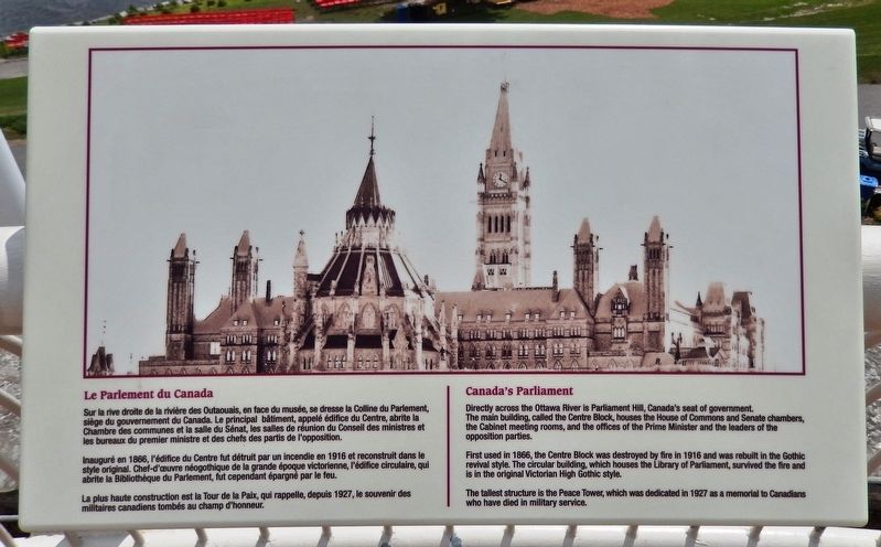
Inscription.
Sur la rive droite de la rivière des Outaouais, en face du musée, se dresse la Colline du Parlement, siège du gouvernement du Canada. Le principal bâtiment, appelé édifice du Centre, abrite la Chambre des communes et la salle du Sénat, les salles de réunion du Conseil des ministres et les bureaux du premier ministre et des chefs des partis de l'opposition.
Inauguré en 1866, l'édifice du Centre fut détruit par un incendie en 1916 et reconstruit dans le style original. Chef-d'œuvre néogothique de la grande époque victorienne, l'édifice circulaire, qui abrite la Bibliothèque du Parlement, fut cependant épargné par le feu.
La plus haute construction est la Tour de la Paix, qui rappelle, depuis 1927, le souvenir des militaires canadiens tombés au champ d'honneur.
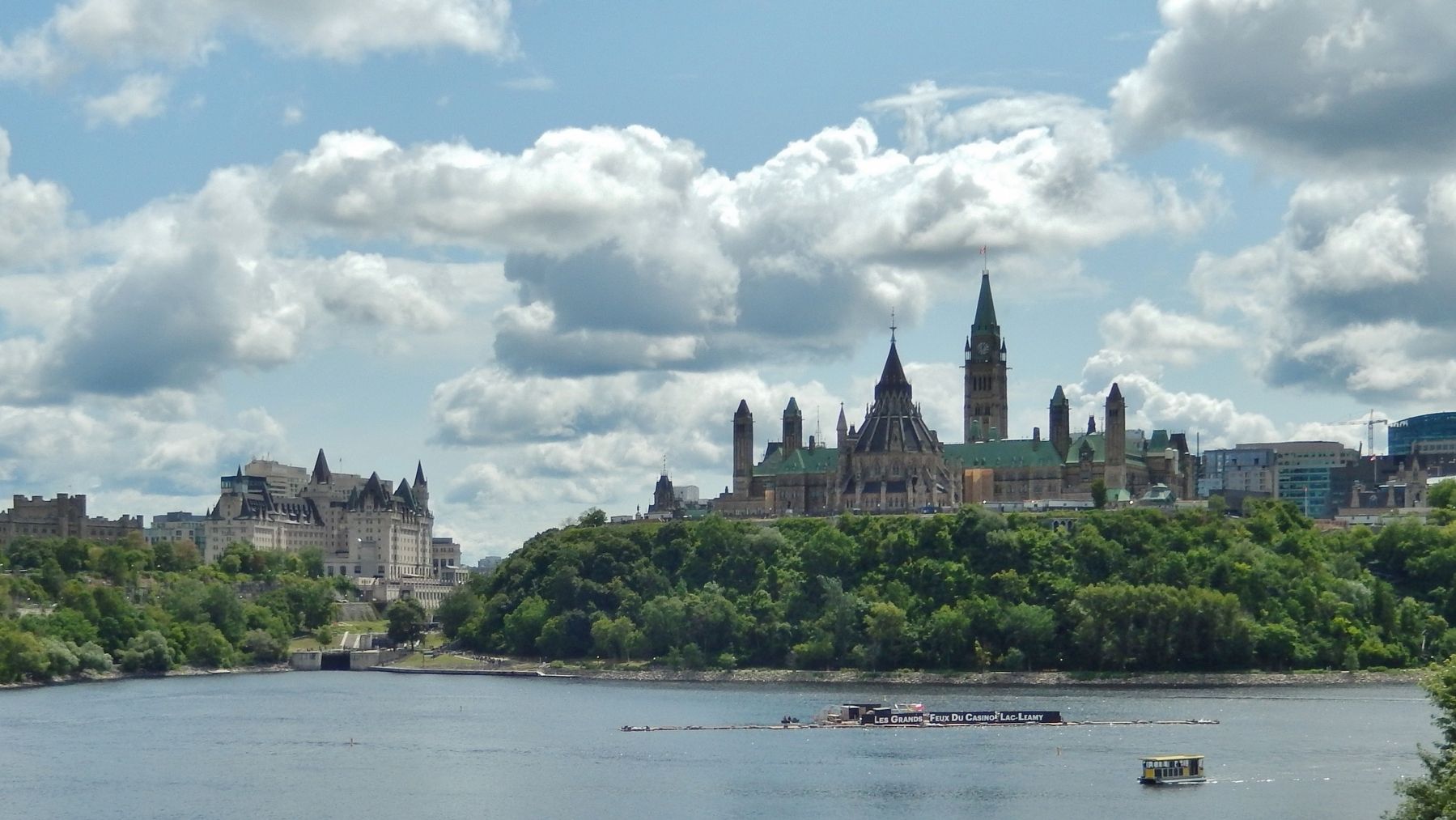
Directly across the Ottawa River is Parliament Hill, Canada's seat of government. The main building, called the Centre Block, houses the House of Commons and Senate chambers, the Cabinet meeting rooms, and the offices of the Prime Minister and the leaders of the opposition parties.
First used in 1866, the Centre Block was destroyed by fire in 1916 and was rebuilt in the Gothic revival style. The circular building, which houses the Library of Parliament, survived the fire and is in the original Victorian High Gothic style.
The tallest structure is the Peace Tower, which was dedicated in 1927 as a memorial to Canadians who have died in military service.
Topics. This historical marker is listed in this topic list: Architecture. A significant historical year for this entry is 1866.
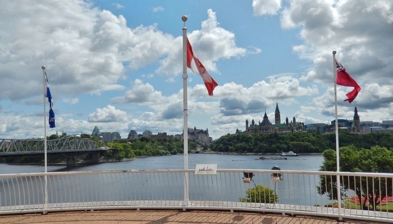
Location. 45° 25.789′ N, 75° 42.47′ W. Marker is in Gatineau, Québec, in Communauté-Urbaine-de-l'Outaouais. Marker can be reached from the intersection of Laurier Street and Rue Papineau, on the right when traveling north. Marker is located adjacent to the Canadian Museum of History grounds, overlooking the Ottawa River, downtown Ottawa and Parliament Hill. Touch for map. Marker is at or near this postal address: 100 Laurier Street, Gatineau QC K1A 0M8, Canada. Touch for directions.
Other nearby markers. At least 8 other markers are within walking distance of this marker. Deux cents ans d'essor / 200 Years in the Making (about 240 meters away, measured in a direct line); La Tour de Lessivage / The Digester Tower (about 240 meters away); Alexandra (Interprovincial) Bridge / Pont Alexandra (Interprovincial) (approx. 0.4 kilometers away in Ontario); Alexandra Bridge (Interprovincial) / Pont Alexandra (Interprovincial) (approx. 0.4
kilometers away in Ontario); People at an Ancient Crossroads / Un ancien point de jonction (approx. half a kilometer away in Ontario); Wilderness Highway / Une route au beau milieu de la nature (approx. half a kilometer away in Ontario); Building for a New Canada / Construire un nouveau Canada (approx. half a kilometer away in Ontario); The Royal Canadian Mint / La Monnaie Royale Canadienne (approx. 0.7 kilometers away in Ontario). Touch for a list and map of all markers in Gatineau.
Also see . . . Parliament Hill (Wikipedia). Originally the site of a military base in the 18th and early 19th centuries, development of the area into a governmental precinct began in 1859, after Queen Victoria chose Ottawa as the capital of the Province of Canada. Following a number of extensions to the parliament and departmental buildings and a fire in 1916 that destroyed the Centre Block, Parliament Hill took on its present form with the completion of the Peace Tower in 1927. (Submitted on June 4, 2020, by Cosmos Mariner of Cape Canaveral, Florida.)
Credits. This page was last revised on January 23, 2022. It was originally submitted on June 3, 2020, by Cosmos Mariner of Cape Canaveral, Florida. This page has been viewed 144 times since then and 25 times this year. Photos: 1, 2, 3. submitted on June 4, 2020, by Cosmos Mariner of Cape Canaveral, Florida.


