Near Esopus in Ulster County, New York — The American Northeast (Mid-Atlantic)
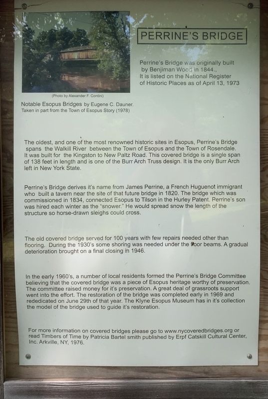
Perrine’s Bridge
Perrine's Bridge was originally built by Benjiman Wood in 1844. It is listed on the National Register of Historic Places as of April 13, 1973
Notable Esopus Bridges by Eugene C. Dauner.
Taken in part from the Town of Esopus Story (1978)
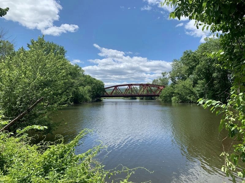
The oldest, and one of the most renowned historic sites in Esopus, Perrine's Bridge spans the Walkill River between the Town of Esopus and the Town of Rosendale. It was built for the Kingston to New Paltz Road. This covered bridge is a single span of 138 feet in length and is one of the Burr Arch Truss design. It is the only Burr Arch left in New York State.
Perrine's Bridge derives its name from James Perrine, a French Huguenot immigrant who built a tavern near the site of that future bridge in 1820. The bridge which was commissioned in 1834, connected Esopus to Tilson in the Hurley Patent. Perrine's son was hired each winter as the "snower.” He would spread snow the length of the structure so horse-drawn sleighs could cross.
The old covered bridge served for 100 years with few repairs needed other than flooring. During the 1930's some shoring was needed under the floor beams. A gradual deterioration brought on a final closing in 1946.
In the early 1960's, a number of local residents formed the Perrine's Bridge Committee believing that the covered bridge was a piece of Esopus heritage worthy of preservation. The committee raised money for its preservation. A great deal of grassroots support went into the effort. The restoration of the bridge was completed early in 1969 and rededicated on June 29th of that year. The Klyne Esopus Museum has in its collection the model of the bridge used to guide its restoration.
For more information on covered bridges please go to www.nycoveredbridges.org or read Timbers of Time by Patricia Bartel Smith published by Erpf Catskill Cultural Center, Inc. Arkville, NY, 1976.
Photo by Alexander F. Contini
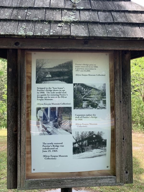
Second Panel: Reconstruction Photo captions (from top to bottom)
Perrine's Bridge prior to major renovations in 1968. A previous renovation in 1917 cost $3,000. (Klyne Esopus Museum Collection)
Stripped to the "bare bones", Perrine's Bridge shows its age in 1968. The scale model used as a guide for restoring Perrine's Bridge can be seen at the Klyne Esopus Museum. (Klyne Esopus Museum Collection)
Carpenters replace the deck of Perrine's Bridge in 1968. (Klyne Esopus Museum Collection)
The newly restored Perrine's Bridge was rededicated on June 29, 1969. (Klyne Esopus Museum Collection)
Topics. This historical marker is listed in this topic list: Bridges & Viaducts. A significant historical date for this entry is April 13, 1973.
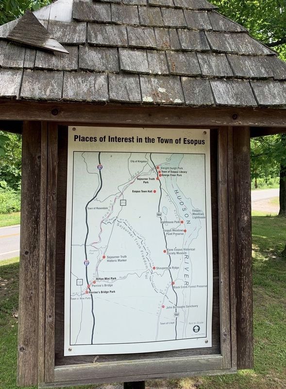
Location. 41° 48.958′ N, 74° 3.414′ W. Marker is near Esopus, New York, in Ulster County. Marker is on Main Street (New York State Route 213) 0.1 miles east of New York State Route 32, on the left when traveling east. Touch for map. Marker is in this post office area: Rosendale NY 12472, United States of America. Touch for directions.
Other nearby markers. At least 8 other markers are within 3 miles of this marker, measured as the crow flies. A different marker also named Perrine’s Bridge (about 700 feet away, measured in a direct line); Meeting House (approx. 1.1 miles away); Tillson House (approx. 1.1 miles away); Tawaeri Taqui (approx. 1.4 miles away); Fording Place (approx. 2.2 miles away); Rosendale Tourist Info (approx. 2.3 miles away); Rosendale Library (approx. 2.3 miles away); D&H Canal (approx. 2½ miles away).
Also see . . . NY Covered Bridge Society. (Submitted on June 8, 2020, by Steve Stoessel of Niskayuna, New York.)
Credits. This page was last revised on June 11, 2020. It was originally submitted on June 8, 2020, by Steve Stoessel of Niskayuna, New York. This page has been viewed 202 times since then and 12 times this year. Last updated on June 10, 2020, by Steve Stoessel of Niskayuna, New York. Photos: 1, 2, 3, 4, 5, 6. submitted on June 8, 2020, by Steve Stoessel of Niskayuna, New York. • Bill Pfingsten was the editor who published this page.
