Near Red Mountain in Kern County, California — The American West (Pacific Coastal)
The Baltic Mine
Photographed by Craig Baker, June 27, 2020
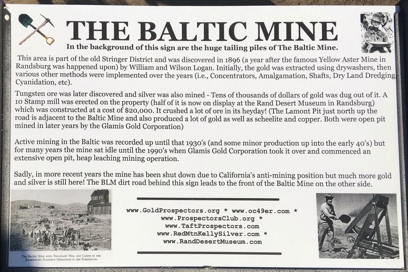
1. Baltic Mine Marker
In the background of this sign are the huge tailing piles of The Baltic Mine.
This area is part of the old Stringer District and was discovered in 1896 (a year after the famous Yellow Aster Mine in Randsburg was happened upon) by William and Wilson Logan. Initially, the gold was extracted using drywashers, then various other methods were implemented over the years (i.e., Concentrators, Amalgamation, Shafts, Dry Land Dredging Cyanidation, etc).
Tungsten ore was later discovered and silver was also mined - Tens of thousands of dollars of gold was dug out of it. A 10 Stamp mill was erected on the property (half of it is now on display at the Rand Desert Museum in Randsburg) which was constructed at a cost of $20,000. It crushed a lot of ore in its heyday! (The Lamont Pit just north up the road is adjacent to the Baltic Mine and also produced a lot of gold as well as scheelite and copper. Both were open pit mined in later years by the Glamis Gold Corporation)
Active mining in the Baltic was recorded up until that 1930's (and some minor production up into the early 40's) but for many years the mine sat
this page online
Sadly, in more recent years the mine has been shut down due to California's anti-mining position but much more gold and silver is still here! The BLM dirt road behind this sign leads to the front of the Baltic Mine on the other side.
Topics. This historical marker is listed in these topic lists: Industry & Commerce • Natural Resources. A significant historical year for this entry is 1896.
Location. 35° 21.054′ N, 117° 37.907′ W. Marker is near Red Mountain, California, in Kern County. It is on Red Mountain Road 0.8 miles west of U.S. 395, on the left when traveling west. Located at the end of an unmarked dirt road, at the top of a hill. Touch for map. Marker is in this post office area: Randsburg CA 93554, United States of America. Touch for directions.

Regionally, this marker is in California’s San Joaquin Valley, specifically in the Central Valley, and in the Sierra Nevada. It is also on the American Pacific Coast. Globally, it is in North America, on the Ring of Fire, on the
Photographed by Craig Baker, June 27, 2020
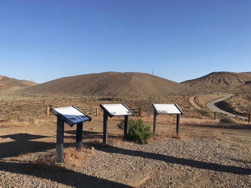
2. Baltic Mine Marker
The marker is in the middle. The nearby hill is a huge tailing pile of The Baltic Mine.
Other nearby markers. At least 8 other markers are within 2 miles of this marker, measured as the crow flies: Yellow Aster Gold Mine (here, next to this marker); The Kelly Silver Mine (here, next to this marker); a different marker also named The Baltic Mine (approx. 0.6 miles away); a different marker also named Kelly Silver Mine (approx. 0.7 miles away); The Owl Hotel (approx. 0.7 miles away); Silver Dollar Saloon (approx. 0.8 miles away); The King Solomon Mine (approx. 1.2 miles away); Rand District Cemetery (approx. 1.2 miles away). Touch for a list and map of all markers in Red Mountain.
Other markers no longer nearby. The Baltic Mine Project (was here, next to this marker but has been reported to have been replaced with another marker now near it); Historic Randsburg (was here, next to this marker but has been reported to have been replaced with another marker now near it); Red Mountain (was approx. 0.8 miles away but has been confirmed
Photographed by Craig Baker, April 7, 2025
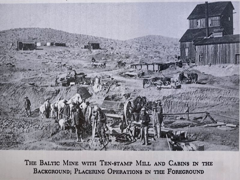
3. Marker Detail - The Baltic Mine
Stamp-mill building at top right.
More about this marker. An identical marker is located on the other side of the tailings pile, next to the paved road.
Also see . . . RedMtnKellySilver.com. Local mining history. (Submitted on July 18, 2020.)
Photographed by Craig Baker, April 7, 2025
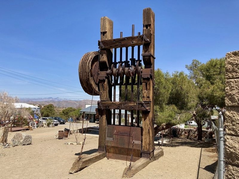
4. Baltic Mine Stamp Mill
On display in the park next to the Rand Desert Museum. Originally a ten-stamp mill.
Credits. This page was last revised on February 8, 2026. It was originally submitted on July 18, 2020, by Craig Baker of Sylmar, California. This page has been viewed 521 times since then and 36 times this year. Photos: 1, 2. submitted on July 18, 2020, by Craig Baker of Sylmar, California. 3, 4. submitted on April 11, 2025, by Craig Baker of Sylmar, California. • J. Makali Bruton was the editor who published this page.
