Cañon City in Fremont County, Colorado — The American Mountains (Southwest)
Lt. Zebulon Pike's Southwestern Expedition
1806-7
Inscription.
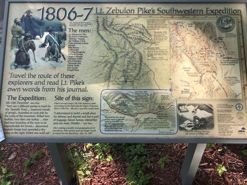
Travel the route of these explorers and read Lt. Pike's own words from his journal
U.S. Army Expedition to explore the United States' new southwest boundary with New Spain
The men
Lt. Zebulon M. Pike • Dr. John H. Robinson • "Baroney" Vasquez • Sgt. William Meek • Corp. Jeremiah Jackson • Privates: John Brown, Jacob Carter, Thomas Dougherty, William Gordon, Hugh Menaugh, Theodore Miller, John Mountjoy, Alexander Roy, Patrick Smith, John Sparks, Freegift Stout
The Expedition:
6th-10th December 1806 (Pike)
"Sent out 3 different parties to hunt for the 'Spanish Trace',...(explored mouth of gorge)...bounded on each side by the rocks of the mountain. Killed two buffalo, two deer, one turkey. ... men find two branches of the river to be impracticable for horses,...discovered Spanish troops had ascended a dry valley to the right. Killed one wild cat".
Site of this sign:
Pike's second camp (5th-14th January) after ascending South Park and the Upper Arkansas River (10th Dec. - 4th Jan.) was also made here:
"I determined to build a small place for defense and deposit and leave part of baggage , (lame) horses, interpreter, and one man, (Smith)..." 1807 (Pike)
After making scientific and geographical observations, Pike started west up Grape Creek to search for the Red River. Jan. 14, 1807
Map, top center: From the careful logbooks of early explorers like Lewis & Clark and Zebulon Pike, the mapmakers of Washington were kept busy creating new images of the mostly unknown Rocky Mountains. This original map was published in 1807.
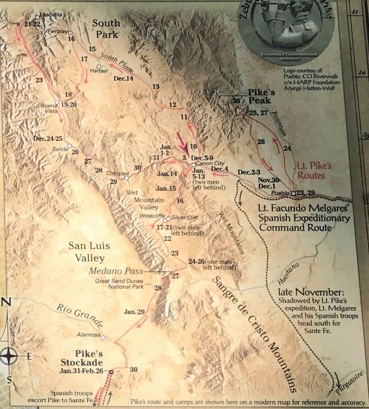
November 27th: "The unbounded prairie was overhung with clouds, which appeared like the ocean in a storm...the thermometer...here fell to 4° below 0." 1806 (Pike)
December 25th: "800 miles from the frontiers of our country, in the most inclement season of the year, not one person clothed for the winter, many without blankets..." 1806 (Pike)
Map, bottom center: Pike and his men stayed at this camp to rest and stock up first from the 5th-9th December then from 4th-13th January when they built their blockhouse/stockade.
December 10th: Having lost the trail of Lt. Melgares' troops, Pike falsely identifies heavy seasonal Indian trails to the north as the 'Spanish Trace'. On 10th of December he sets out to find the headwaters of the Arkansas River.
January 7th, 1807 (Pike): "The whole party was once more joined together. I now felt at considerable loss how to proceed, as any idea of services at that time from my horses* were entirely preposterous..." (* severely injured traveling
through the ragged Arkansas River canyon.)
Caption: Lower right: Log book, compass, telescope and sextant on buffalo robe.
Topics. This historical marker is listed in this topic list: Exploration. A significant historical date for this entry is December 6, 1806.
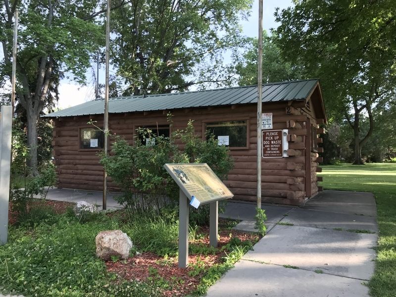
Location. 38° 26.214′ N, 105° 14.673′ W. Marker is in Cañon City, Colorado, in Fremont County. Marker is on Royal Gorge Boulevard (U.S. 50) east of South 1st Street, on the right when traveling east. Marker is located in Veterans Park near the Cañon City Visitor's Center cabin. Touch for map. Marker is at or near this postal address: 200 Royal Gorge Boulevard, Canon City CO 81212, United States of America. Touch for directions.
Other nearby markers. At least 8 other markers are within walking distance of this marker. Bustling Center for Trade, Transportation, and Tourism (here, next to this marker); The Gold Belt Tour National Scenic Byway (here, next to this marker); Colorado Territorial Prison (approx. 0.2 miles away); Raynolds Bank (approx. ¼ mile away); 405 Main Street (approx. ¼ mile away); First People, Explorers & Settlers (approx. ¼ mile away); The Banana Belt of Colorado (approx. 0.3 miles away); Rudd Cabin (approx. 0.4 miles away). Touch for a list and map of all markers in Cañon City.
More about this marker. Similar marker located in Florence, Colorado.
Credits. This page was last revised on September 5, 2023. It was originally submitted on July 21, 2020, by Duane and Tracy Marsteller of Murfreesboro, Tennessee. This page has been viewed 283 times since then and 28 times this year. Photos: 1, 2, 3. submitted on July 21, 2020, by Duane and Tracy Marsteller of Murfreesboro, Tennessee. 4. submitted on November 16, 2020, by Allen C. Browne of Silver Spring, Maryland. • Andrew Ruppenstein was the editor who published this page.


