South Fork in Rio Grande County, Colorado — The American Mountains (Southwest)
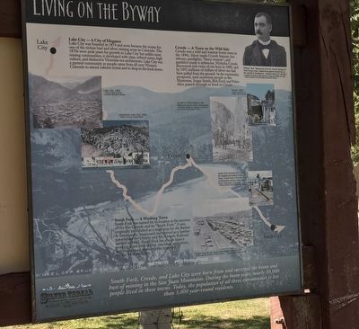
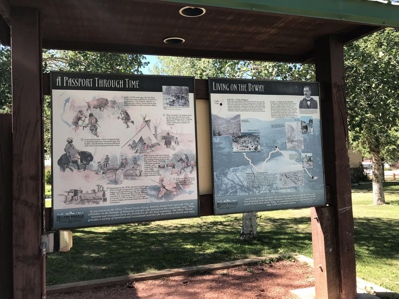
Living on the Byway
Lake City was founded in 1874 and soon became the center for one of the richest lead and silver mining areas in Colorado. The 1870s were peak years for growth in Lake City but unlike most mining communities, it developed with class, refined tastes, high culture, and distinctive Victorian-era architecture. Lake City was a genteel community as people came from all over Western Colorado to attend cultural events and to shop in the local stores.
Creede — A Town on the Wild Side
Creede was a wild and wanton boom town in the 1890s. Silver made Creede famous, but saloons, gunfights, "fancy women", and gamblers made it infamous. Nicholas Creede discovered rich veins of ore here in 1889, and by 1892 millions of dollars of silver ore had been pulled from the ground. As the community prospered, such notorious people as Bat Masterson, Soapy Smith, Bob Ford, and Poker Alice passed through or lived in Creede.
South Fork — A Working Town
South Fork was named for its location at the junction of the Rio Grande and its "South Fork.” It was originally established as a stage stop for the Barlow & Sanderson's Stagecoach but thrived as a lumber town when the Denver and Rio Grande Railroad arrived in 1882. South Fork has always been a working town with timber, ranching, agriculture, and the railroad providing the mainstay for the local economy.
South Fork, Creede, and Lake City were born from and survived the boom and bust of mining in the San Juan Mountains. During the boom years, nearly 30,000 people lived in these towns. Today, the population of all three communities is less than 3,000 year-round residents.
Captions [Clockwise from top right]
• Willam "Bat” Masterson lived in Creede during its early boom years. Masterson gained notoriety as the sheriff in Tombstone, Arizona where he carried a small wooden club used to keep rowdies in line. Photo courtesy of the Colorado Historical Society
• Creede, 1999. Photo courtesy of G. Collins, Gilmer Design
• Creede in 1892 before a fire destroyed much of the community. Photo by William H. Jackson, courtesy of the Colorado Historical Society
• South Fork developed to service the logging and mining industries. Today, South Fork celebrates the communities history with Logger Days festivities each July. Photo courtesy of South Fork Visitor Center
• Freight train in the South Fork lumber yard in 1930. Photo courtesy of Denver Public Library — Western History Department
• Downtown Lake City, 1990.
Photo courtesy of Bob Stigall
• Lake City, 1882. Photo courtesy of the Colorado Historical Society
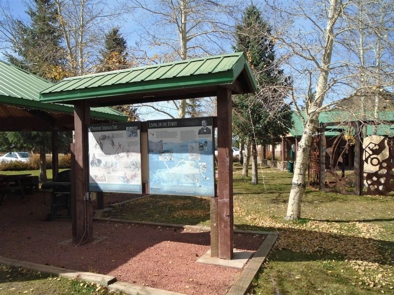
Erected by Silver Thread Scenic and Historic Byway.
Topics. This historical marker is listed in this topic list: Settlements & Settlers. A significant historical year for this entry is 1874.
Location. 37° 40.151′ N, 106° 38.493′ W. Marker is in South Fork, Colorado, in Rio Grande County. Marker is on Silver Thread Lane. Marker is located on grounds of South Fork Visitor Center. Touch for map. Marker is at or near this postal address: 28 Silver Thread Lane, South Fork CO 81154, United States of America. Touch for directions.
Other nearby markers. At least 6 other markers are within 16 miles of this marker, measured as the crow flies. A Passport Through Time (here, next to this marker); Watchable Wildlife (a few steps from this marker); Rio Grande — A River of Life (a few steps from this marker); Continental Divide Trail (approx. 15.6 miles away); The Great Divide (approx. 15.6 miles away); History of a Road (approx. 15.6 miles away).
Credits. This page was last revised on November 21, 2020. It was originally submitted on July 21, 2020, by Duane and Tracy Marsteller of Murfreesboro, Tennessee. This page has been viewed 143 times since then and 12 times this year. Photos: 1, 2. submitted on July 21, 2020, by Duane and Tracy Marsteller of Murfreesboro, Tennessee. 3. submitted on November 21, 2020, by William Fischer, Jr. of Scranton, Pennsylvania. • Andrew Ruppenstein was the editor who published this page.


