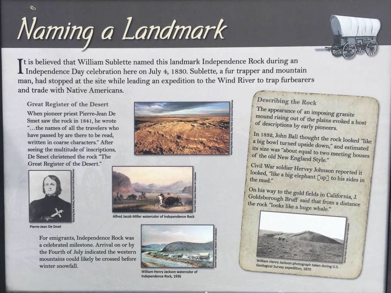
Naming a Landmark
Great Register of the Desert.
When pioneer priest Pierre-Jean De Smet saw the rock in 1841, he wrote “...the names of all the travelers who have passed by are there to be read, written in coarse characters. After seeing the multitude of inscriptions, De Smet christened the rock “The Great Register of the Desert.”
For emigrants, Independence Rock was a celebrated milestone. Arrival on or by the Fourth of July indicated the western mountains could likely be crossed before winter snowfall.
Describing the Rock
The appearance of an imposing granite mound rising out of the plains evoked a host of descriptions by early pioneers
In 1832, John Ball thought the Rock looked “like a big bowl turned upside down,” and estimated it’s size was “about equal to two meeting houses of old New England Style.”
Civil War soldier Harvey Johnson reported it looked, “like a big elephant [up] to its sides in the mud.”
On his way to the gold fields in
California, J. Goldborough Bruff said that from a distance the rock “looks like a huge whale.”
Photo captions
Left center: Pierre-Jean De Smet
Middle center: Alfred Jacob Miller watercolor of Independence Rock
Lower center: William Henry Jackson watercolor of Independence Rock, 1936
Lower right: William Henry Jackson photograph taken during U.S. Geological Survey expedition, 1870
Erected by Wyoming State Parks and Cultural Resources.
Topics. This historical marker is listed in these topic lists: Exploration • Settlements & Settlers. A significant historical date for this entry is July 4, 1830.
Location. 42° 29.588′ N, 107° 8.09′ W. Marker is in Alcova, Wyoming, in Natrona County. Marker can be reached from State Highway 220. Touch for map. Marker is in this post office area: Alcova WY 82620, United States of America. Touch for directions.
Other nearby markers. At least 8 other markers are within 6 miles of this marker, measured as the crow flies. Geologic Story (about 400 feet away, measured in a direct line); The Ox-Team Monument Expedition (about 400 feet away); Independence Rock (about 600 feet away); Oregon Trail (about 800 feet away); a different marker also named Independence Rock (approx. 0.2 miles away); The Preservation of Independence Rock
Credits. This page was last revised on January 17, 2021. It was originally submitted on August 2, 2020, by Connor Olson of Kewaskum, Wisconsin. This page has been viewed 144 times since then and 22 times this year. Photos: 1. submitted on August 2, 2020, by Connor Olson of Kewaskum, Wisconsin. 2. submitted on January 16, 2021, by Craig Baker of Sylmar, California. • Andrew Ruppenstein was the editor who published this page.

