Republic in Marquette County, Michigan — The American Midwest (Great Lakes)
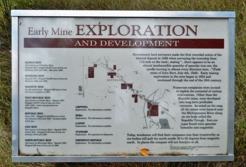
Early Mine Exploration and Development
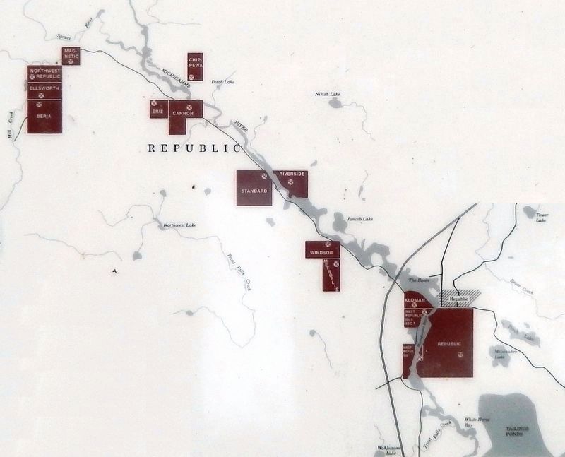
Numerous companies were formed to exploit the potential of various explorations. Other than the Republic mine, none developed into long term profitable ventures. As noted on the map, all the mines were located near the Michigammee River along an ore body called the Republic Trough. Iron ore types found were specular hematite and magnetite.
Today, woodsmen will find their compasses less than trustworthy as ore bodies will pull the north needle 30 to 60 degrees from magnetic north. In places the compass will not function at all.
Kloman Mine
Also known as Columbia Mine. Opened 1873, shipped 94,813 tons of iron ore between 1873 and 1883. Idle since 1883.
Riverside Mine
Opened 1887. Shipped 16,160 tons of iron ore Between 1888 and 1893.
Magnetic Mine
An old exploration. Shipped 292 tons of iron ore from stockpile in 1906.
West Republic Mine
Also known as Toledo Mine. Opened 1881. Shipped 133,077 tons of iron ore from 1881-1889. Later incorporated into Republic Mine.
Republic Mine
Open 1871. Shipped 8,430,093 tons of iron ore between 1872 and 1926. Greatest depth 2,910 feet.
Erie Mine
Also known as Fremont Mine. Opened 1876, closed 1885. Shipped 9,194 tons of iron ore between 1876 and 1883.
North Republic Mine
Also known as Metropole Mine. Opened 1888. Shipped 289 tons of iron ore in 1888.
Chippewa — Exploration. No information available.
Beria — Exploration. No information available.
Cannon — Exploration. No information available.
Standard — Exploration. No reported ore shipments.
Northwest Republic — Exploration. No information available.
Erected by Republic Area Historical Society and Cleveland-Cliffs Iron Incorporated.
Topics. This historical marker is listed in this topic list: Industry & Commerce. A significant historical year for this entry is 1846.
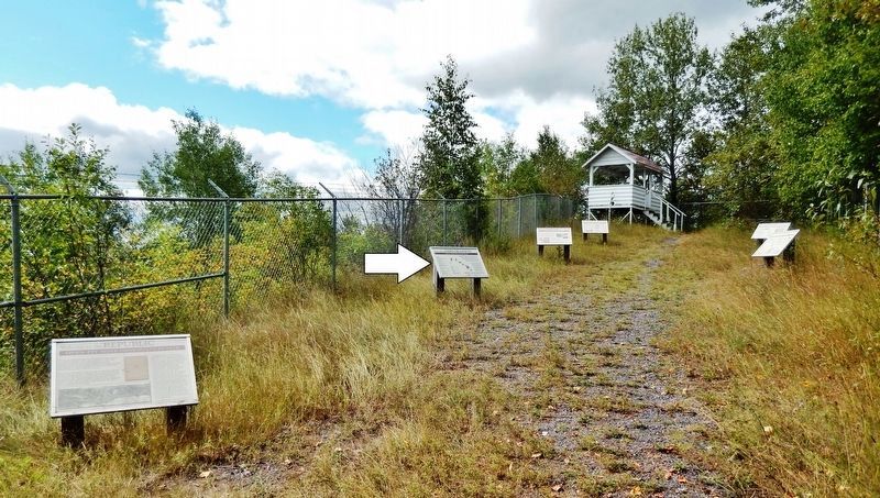
Location. 46° 24.21′ N, 87° 58.905′ W. Marker is in Republic, Michigan, in Marquette County. Marker can be reached from Park City Road, 0.2 miles south of River Road (County Road 601), on the right when traveling south. This is one of several interpretive markers at observation site overlooking the former Republic Open Pit Mine. Site access is from a parking area on the west side of Park City Road. Touch for map. Marker is in this post office area: Republic MI 49879, United States of America. Touch for directions.
Other nearby markers. At least 8 other markers are within walking distance of this marker. The Life of a Miner (here, next to this marker); Welcome to the Republic Open Pit Mine Observation Site (here, next to this marker); Community History and Other Industries (here, next to this marker); The Republic Open Pit Mine (a few steps from this marker); Reopening the Mine and Moving Republic (a few steps from this marker); The Republic Iron Company (approx. 0.2 miles away); Cecil E. Munson Memorial (approx. 0.2 miles away); In Memory of the Men Who Lost Their Lives (approx. 0.2 miles away). Touch for a list and map of all markers in Republic.
Related markers. Click here for a list of markers that are related to this marker. The Republic Iron Mine, Republic, Michigan
Also see . . . Michigan Iron Mines. (This link presents numerous vintage Michigan iron mine photos, including some from the Republic Mine at this location.) William A. Burt, a United States Deputy Surveyor, in attempting to establish the east-west line between townships 47 North and 48 North, noted strange variations in his magnetic compass needle. Searching for the cause of this disturbance, the surveying
party discovered deposits of iron ore, or hematite. The first major discovery was made near the present site of Negaunee. The men of the search party formed the Jackson Mining Company on July 23, 1845, and iron mining in Michigan officially began. (Submitted on August 7, 2020, by Cosmos Mariner of Cape Canaveral, Florida.)
Credits. This page was last revised on August 8, 2020. It was originally submitted on August 7, 2020, by Cosmos Mariner of Cape Canaveral, Florida. This page has been viewed 165 times since then and 12 times this year. Photos: 1, 2, 3. submitted on August 7, 2020, by Cosmos Mariner of Cape Canaveral, Florida.


