Howard in Knox County, Ohio — The American Midwest (Great Lakes)
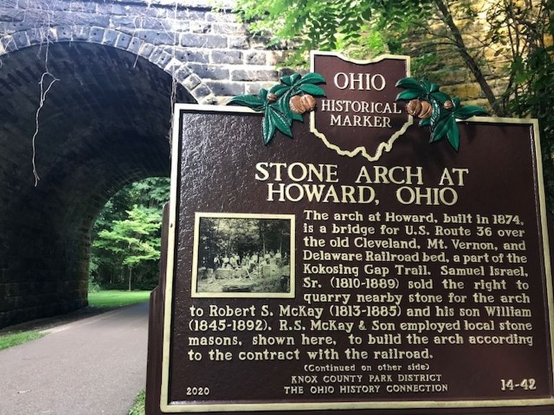
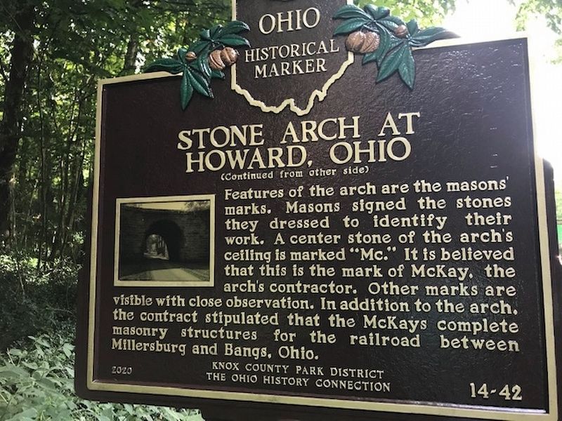
Stone Arch at Howard, Ohio
Features of the arch are the masons’ marks. Masons signed the stones they dressed to identify their work. A center stone of the arch's ceiling is marked "Mc." It is believed that this is the mark of McKay, the arch's contractor. Other marks are visible with close observation. In addition to the arch, the contract stipulated that the McKays complete masonry structures for the railroad between Millersburg and Bangs, Ohio.
Erected 2020 by Knox County Park District and The Ohio History Connection. (Marker Number 14-42.)
Topics and series. This historical marker is listed in this topic list: Railroads & Streetcars. In addition, it is included in the Ohio Historical Society / The Ohio History Connection series list. A significant historical year for this entry is 1874.
Location. 40° 24.44′ N, 82° 19.565′ W. Marker is in Howard, Ohio, in Knox County. Marker can be reached from Station Road south of Coshocton Avenue (U.S. 36). Marker is on the Kokosing Gap Trail (the former railroad bed of Pennsylvania Railroad) that runs through the stone arch. Touch for map. Marker is at or near this postal address: 23424 Coshocton Ave, Howard OH 43028, United States of America. Touch for directions.
Other nearby markers. At least 8 other markers are within 5 miles of this marker, measured as the crow flies. Christ Church at the Quarry (approx. 2.7 miles away); C & O caboose (approx. 4.3 miles away); Kenyon College (approx. 4.3 miles away); 0-6-0 Steam Locomotive (approx. 4.3 miles away); George Wharton Marriott (approx. 4.3 miles away); David Bates Douglass (approx. 4.3 miles away); Gambier (approx. 4.4 miles away); John Crowe Ransom & The Kenyon Review (approx. 4.4 miles away).
Also see . . . Kokosing Gap Trail.
The Kokosing Gap Trail is a paved, 14-mile recreational trail built on a former Pennsylvania Railroad line with endpoints in Mount Vernon and Danville, Ohio. Visitors will traverse the Kokosing River twice on railroad bridges more than 250 feet long with forests, wetlands, agriculture and villages along the way.(Submitted on August 8, 2020.)
Additional commentary.
1. Passenger Service At Howard
The Cleveland, Mt. Vernon, and Delaware Railroad was renamed the Cleveland, Akron and Columbus Railway in 1885 and the Pennsylvania Railroad acquired control of it in 1899 to create a through line between Cleveland and Cincinnati. Today the rails are gone and this portion of the old Pennsylvania Railroad line is now the Kokosing Gap Trail for hikers and bikers.
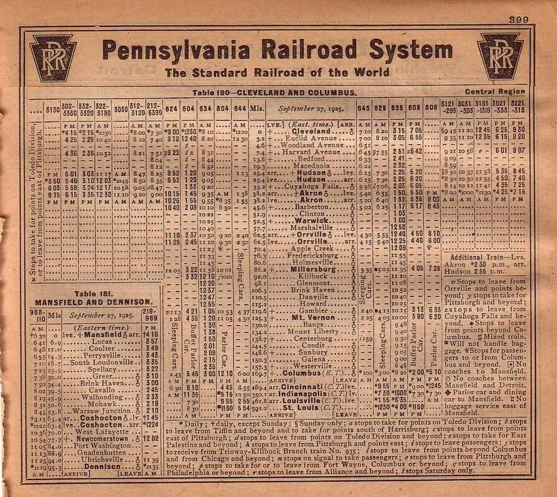
In 1925, ten Pennsylvania Railroad passenger trains, five southbound and five northbound, passed under this arch every day, but only two stopped at Howard. The trains that did not stop were express trains between Cleveland and Cincinnati, between Cleveland and Indianapolis via Columbus, between Cleveland and Louisville via Cincinnati, and between Cleveland and St. Louis via Cincinnati.
Train 635, the morning local from Columbus to Cleveland stopped here at 10:25 AM. It would get to Cleveland at 3:15 PM. Train 634 the morning local from Cleveland to Columbus stopped here at 12:55 PM. It would get to Columbus at 3 PM. These two trains would stop at every station on the line. At Columbus or Cleveland, you could change to long-distance trains to get you to most any other town in North America.
— Submitted August 8, 2020, by J. J. Prats of Powell, Ohio.
Credits. This page was last revised on August 8, 2020. It was originally submitted on August 8, 2020, by J. J. Prats of Powell, Ohio. This page has been viewed 748 times since then and 48 times this year. Photos: 1, 2, 3. submitted on August 8, 2020, by J. J. Prats of Powell, Ohio.
Editor’s want-list for this marker. A wide shot showing the marker and its surroundings • A photo of the other side of the arch • Can you help?


