Leaning On The Land
Nicodemus National Historic Site
— National Park Service, U.S. Department of the Interior —
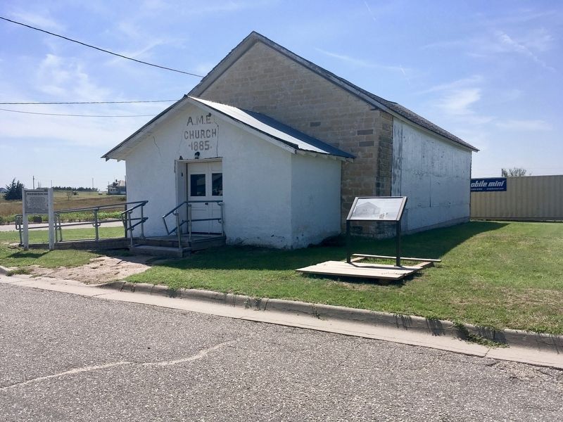
The harsh Kansas prairie inspired the Nicodemus AME (African Methodist Episcopal) congregation even more to their faith. Rev. Jerry Meyers and five others organized the church in 1879.
Members first met in dugouts and then in the First Baptist Church. Community leader, Rev. Meyers led the organization of the first school. In 1885, Rev Charles H. Brown and the forty-member congregation raised funds for their own wood-frame building, St. Paul's AME Church.
Fire destroyed the original church building in 1896. The congregation persevered and in 1910, purchased the Mt. Pleasant Baptist's building here at this location. hey added the front foyer to the building at that time, and date "1885" was set over the door to commemorate Rev. Brown and the congregation's first church structure.
[Captions:]
Reverend Joe Wilson was pastor here in the 1950s. He also pastored at First Baptist Church after the AME Church closed.
Nicodemus AME, 1920s As Nicodemus' population declined so did the AME congregation. After the 1960s, members worshiped with the First Baptist Church, a block northwest of here.
Erected by National Park Service, U.S. Department of the Interior.
Topics and series. This historical marker is listed in these topic lists:
Location. 39° 23.535′ N, 99° 36.955′ W. Marker is in Nicodemus, Kansas, in Graham County. Marker is on Third Street just north of Adams Avenue, on the right when traveling south. Touch for map. Marker is at or near this postal address: 517 Adams Ave, Bogue KS 67625, United States of America. Touch for directions.
Other nearby markers. At least 8 other markers are within walking distance of this marker. Mail From Back Home (about 300 feet away, measured in a direct line); St. Francis Hotel (about 300 feet away); We've Come This Far By Faith (about 400 feet away); Together We Gather (about 500 feet away); Main Street Boom and Beyond (about 500 feet away); First Baptist Church (about 500 feet away); Nicodemus (about 700 feet away); Nicodemus Baseball History (about 700 feet away). Touch for a list and map of all markers in Nicodemus.
Also see . . . Nicodemus Nat'l Hist. Site. (Submitted on August 15, 2020, by Connor Olson of Kewaskum, Wisconsin.)
Credits. This page was last revised on August 15, 2020. It was originally submitted on August 15, 2020, by Connor Olson of Kewaskum, Wisconsin. This page has been viewed 124 times since then and 16 times this year. Photos: 1, 2. submitted on August 15, 2020, by Connor Olson of Kewaskum, Wisconsin. • Devry Becker Jones was the editor who published this page.

