Marker Logo HMdb.org THE HISTORICAL
MARKER DATABASE
“Bite-Size Bits of Local, National, and Global History”
Capitol Heights in Prince George's County, Maryland — The American Northeast (Mid-Atlantic)
 

Original Federal Boundary Stone, District of Columbia, Southeast 1


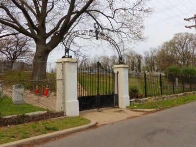
Original Federal Boundary Stone SE 1 Marker image. Click for full size.
Photographed By Allen C. Browne, April 15, 2015
1. Original Federal Boundary Stone SE 1 Marker
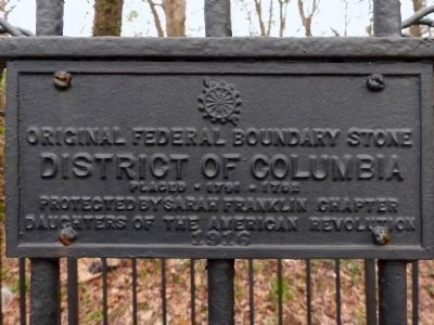
Inscription.  
Original Federal Boundary Stone
District of Columbia
Placed 1791-1792
Protected by Sarah Franklin Chapter
Daughters of the American Revolution
1916

 
Erected 1916 by The Sarah Franklin Chapter, Daughters of the American Revolution.
 
Topics and series. This historical marker is listed in this topic list: Political Subdivisions. In addition, it is included in the Daughters of the American Revolution (DAR), and the Original Federal Boundary Stones series lists. A significant historical year for this entry is 1916.
 
Location. 38° 52.96′ N, 76° 55.339′ W. Marker is in Capitol Heights, Maryland, in Prince George's County. Marker is on Thrift Road south of D Street Southeast, on the right when traveling north. Near the corner of the wall around the National Capitol Hebrew Cemetery. Touch for map. Marker is at or near this postal address: 5629 Southern Avennue Southeast, Clinton MD 20735, United States of America. Touch for directions.
 
Other nearby markers. At least 8 other markers are within one mile of this marker, measured as the crow flies. Woodlawn Cemetery (approx. 0.8 miles away in District of Columbia); Original Federal Boundary Stone, District of Columbia, East Cornerstone
Paid Advertisement
Click on the ad for more information.
Please report objectionable advertising to the Editor.
Click or scan to see
this page online
(approx. one mile away in District of Columbia); Original Federal Boundary Stone, District of Columbia, Southeast 2 (approx. one mile away); Watts Going On (approx. one mile away in District of Columbia); Fort Chaplin (approx. one mile away in District of Columbia); The William Sidney Pittman House (approx. one mile away); William Sidney Pittman and Portia Washington Pittman House Site (approx. one mile away); Howard D. Woodson Residence (approx. 1.1 miles away in District of Columbia).
 
Original Federal Boundary Stone SE 1 Marker image. Click for full size.
Photographed By Allen C. Browne, April 15, 2015
2. Original Federal Boundary Stone SE 1 Marker
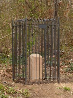
Original Federal Boundary Stone SE 1 image. Click for full size.
Photographed By Allen C. Browne, April 15, 2015
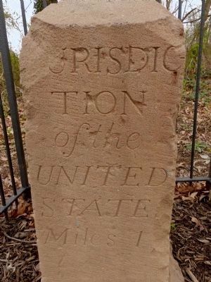
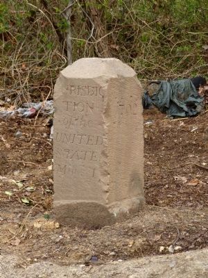
3. Original Federal Boundary Stone SE 1
Jurisdiction of the United States, Miles 1
Original Federal Boundary Stone SE 1 image. Click for full size.
Photographed By Allen C. Browne, April 15, 2015
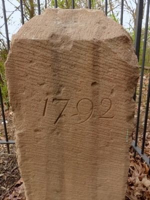
4. Original Federal Boundary Stone SE 1
1792
Original Federal Boundary Stone SE 1 image. Click for full size.
Photographed By Allen C. Browne, April 15, 2015
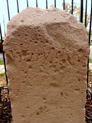
5. Original Federal Boundary Stone SE 1
Maryland
Original Federal Boundary Stone SE 1 image. Click for full size.
Photographed By Allen C. Browne, April 15, 2015
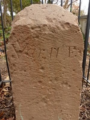
6. Original Federal Boundary Stone SE 1
Var 11' E
Original Federal Boundary Stone SE 1 image. Click for full size.
Photographed By Allen C. Browne, April 19, 2014
7. Original Federal Boundary Stone SE 1
In 2014 The DAR fence and plaque were missing
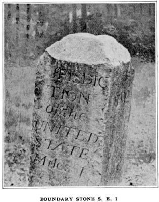
Boundary Stone S. E. 1 image. Click for full size.
Photographed By Marcus Baker, 1897
8. Boundary Stone S. E. 1
Marcus Baker published this photo in his 1897 essay, The Boundary Mounuments of The District of Columbia:
“This monument is one mile S. E. from the E. corner of the District of Columbia”
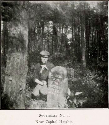
Southeast No. 1.<br>Near Capitol Heights image. Click for full size.
9. Southeast No. 1.
Near Capitol Heights
Fred Woodward posed with this boundary marker on his 1906 "Ramble."
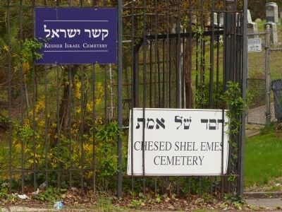
Kesher Israel / Chesed Shel Emes Cemetery image. Click for full size.
Photographed By Allen C. Browne, April 15, 2015
10. Kesher Israel / Chesed Shel Emes Cemetery
National Capitol Hebrew Cemetery image. Click for full size.
Photographed By Allen C. Browne, April 15, 2015
11. National Capitol Hebrew Cemetery
 
 
Credits. This page was last revised on September 29, 2020. It was originally submitted on April 17, 2015, by Allen C. Browne of Silver Spring, Maryland. This page has been viewed 486 times since then and 85 times this year. Last updated on August 15, 2020, by Roberto Bernate of Arlington, Virginia. Photos:   1, 2, 3, 4, 5, 6, 7, 8, 9, 10, 11. submitted on April 17, 2015, by Allen C. Browne of Silver Spring, Maryland. • Devry Becker Jones was the editor who published this page.
Share this page.  
Share on Tumblr
m=154788

CeraNet Cloud Computing sponsors the Historical Marker Database.
Paid Advertisements


Jun. 8, 2023